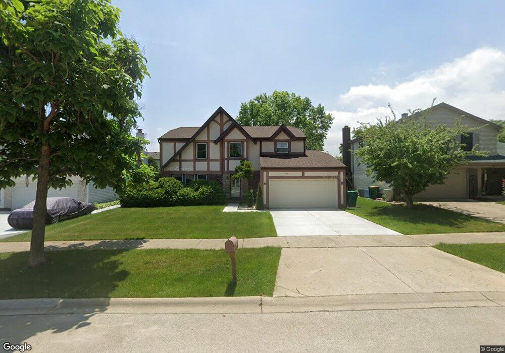
1316 Devonshire Rd Buffalo Grove, IL 60089
Prairie Park-Lake County NeighborhoodEstimated Value: $527,718 - $627,000
4
Beds
3
Baths
2,199
Sq Ft
$260/Sq Ft
Est. Value
About This Home
This home is located at 1316 Devonshire Rd, Buffalo Grove, IL 60089 and is currently estimated at $572,180, approximately $260 per square foot. 1316 Devonshire Rd is a home located in Lake County with nearby schools including Prairie Elementary School, Twin Groves Middle School, and Adlai E Stevenson High School.
Ownership History
Date
Name
Owned For
Owner Type
Purchase Details
Closed on
Feb 24, 2006
Sold by
Spivak Alex and Spivak Larisa
Bought by
Bromberg Igor and Danilova Maria
Current Estimated Value
Home Financials for this Owner
Home Financials are based on the most recent Mortgage that was taken out on this home.
Original Mortgage
$372,000
Outstanding Balance
$212,221
Interest Rate
6.33%
Mortgage Type
Fannie Mae Freddie Mac
Estimated Equity
$359,959
Purchase Details
Closed on
Jun 3, 1999
Sold by
Iklov Gary and Iklov Liya
Bought by
Spivak Alex and Spivak Larisa
Home Financials for this Owner
Home Financials are based on the most recent Mortgage that was taken out on this home.
Original Mortgage
$221,600
Interest Rate
7.15%
Create a Home Valuation Report for This Property
The Home Valuation Report is an in-depth analysis detailing your home's value as well as a comparison with similar homes in the area
Home Values in the Area
Average Home Value in this Area
Purchase History
| Date | Buyer | Sale Price | Title Company |
|---|---|---|---|
| Bromberg Igor | $465,000 | Fidelity National Title Insu | |
| Spivak Alex | $277,000 | -- |
Source: Public Records
Mortgage History
| Date | Status | Borrower | Loan Amount |
|---|---|---|---|
| Open | Bromberg Igor | $372,000 | |
| Previous Owner | Spivak Alex | $221,600 |
Source: Public Records
Tax History
| Year | Tax Paid | Tax Assessment Tax Assessment Total Assessment is a certain percentage of the fair market value that is determined by local assessors to be the total taxable value of land and additions on the property. | Land | Improvement |
|---|---|---|---|---|
| 2024 | $14,677 | $160,122 | $33,162 | $126,960 |
| 2023 | $13,905 | $151,087 | $31,291 | $119,796 |
| 2022 | $13,905 | $139,352 | $28,860 | $110,492 |
| 2021 | $13,378 | $137,850 | $28,549 | $109,301 |
| 2020 | $13,063 | $138,320 | $28,646 | $109,674 |
| 2019 | $12,883 | $137,810 | $28,540 | $109,270 |
| 2018 | $12,472 | $137,660 | $28,208 | $109,452 |
| 2017 | $12,236 | $134,447 | $27,550 | $106,897 |
| 2016 | $11,918 | $128,743 | $26,381 | $102,362 |
| 2015 | $11,604 | $120,399 | $24,671 | $95,728 |
| 2014 | $10,605 | $109,041 | $26,496 | $82,545 |
| 2012 | $10,529 | $109,259 | $26,549 | $82,710 |
Source: Public Records
Map
Nearby Homes
- 1234 Devonshire Rd
- 1265 Devonshire Rd
- 962 Thompson Blvd
- 1120 Courtland Dr
- 1135 Thompson Blvd
- 1150 Thompson Blvd
- 1318 Gail Dr Unit 4
- 5107 N Arlington Heights Rd
- 327 Lasalle Ln
- 5152 Bridlewood Ln
- 5176 Aptakisic Rd
- 600 Thompson Blvd
- 1217 Franklin Ln Unit G5
- 810 Silver Rock Ln
- 5135 Bridlewood Ct
- 525 Lasalle Ln
- 736 Clohesey Dr
- 1480 Fairfax Ln
- 1602 Brittany Ln
- 711 Woodhollow Ln
- 1314 Devonshire Rd
- 1320 Devonshire Rd
- 1330 Devonshire Rd
- 900 Dannet Rd
- 1312 Devonshire Rd
- 910 Dannet Rd
- 824 Dannet Rd
- 1317 Devonshire Rd
- 1319 Devonshire Rd
- 1315 Devonshire Rd
- 1310 Devonshire Rd
- 1313 Devonshire Rd
- 1321 Devonshire Rd
- 820 Dannet Rd
- 1311 Devonshire Rd
- 1308 Devonshire Rd
- 1323 Devonshire Rd
- 816 Dannet Rd
- 1212 Dannet Ct
- 1329 Devonshire Rd
Your Personal Tour Guide
Ask me questions while you tour the home.