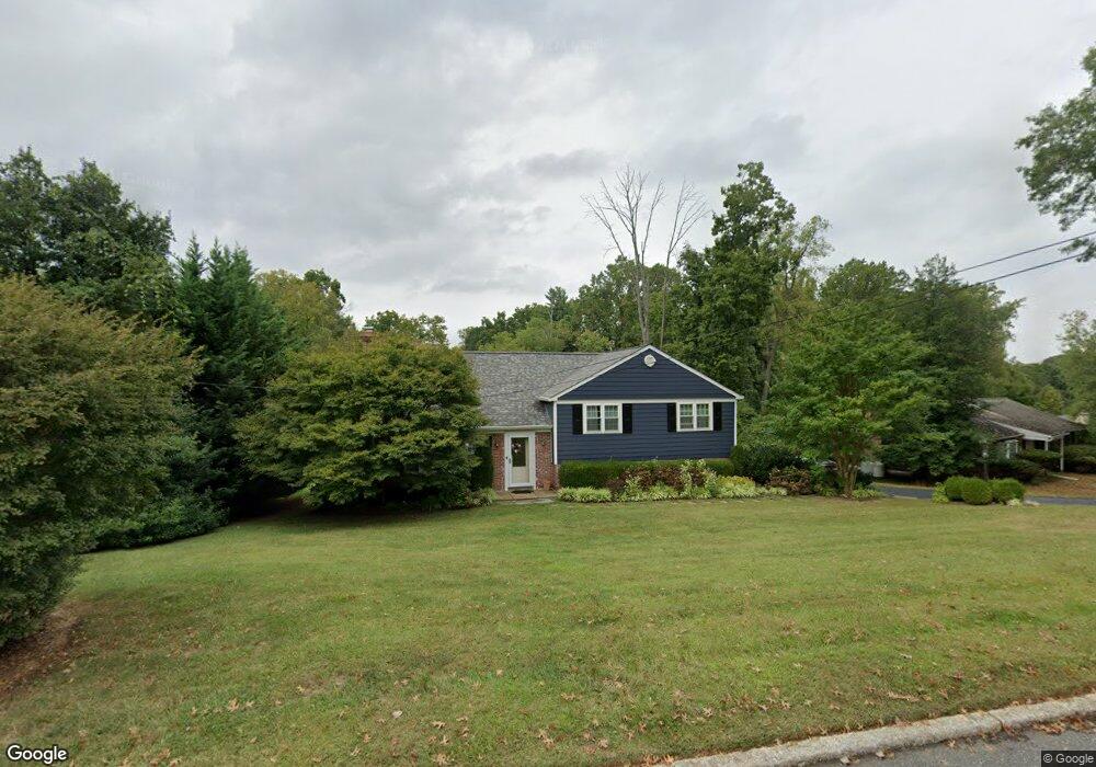
132 Brookside Rd Newtown Square, PA 19073
Estimated Value: $609,823 - $747,000
4
Beds
3
Baths
2,098
Sq Ft
$320/Sq Ft
Est. Value
About This Home
This home is located at 132 Brookside Rd, Newtown Square, PA 19073 and is currently estimated at $671,206, approximately $319 per square foot. 132 Brookside Rd is a home located in Delaware County with nearby schools including Culbertson Elementary School, Paxon Hollow Middle School, and Marple Newtown Senior High School.
Ownership History
Date
Name
Owned For
Owner Type
Purchase Details
Closed on
Feb 14, 2013
Sold by
Keffer Joseph and Keffer Annamaria
Bought by
Keffer Joseph
Current Estimated Value
Purchase Details
Closed on
Jul 2, 2004
Sold by
Yearsley Doris S
Bought by
Keffer Joseph and Keffer Annamaria
Home Financials for this Owner
Home Financials are based on the most recent Mortgage that was taken out on this home.
Original Mortgage
$188,000
Outstanding Balance
$50,612
Interest Rate
6.25%
Mortgage Type
Fannie Mae Freddie Mac
Estimated Equity
$620,594
Create a Home Valuation Report for This Property
The Home Valuation Report is an in-depth analysis detailing your home's value as well as a comparison with similar homes in the area
Home Values in the Area
Average Home Value in this Area
Purchase History
| Date | Buyer | Sale Price | Title Company |
|---|---|---|---|
| Keffer Joseph | -- | None Available | |
| Keffer Joseph | $310,000 | -- |
Source: Public Records
Mortgage History
| Date | Status | Borrower | Loan Amount |
|---|---|---|---|
| Open | Keffer Joseph | $188,000 |
Source: Public Records
Tax History
| Year | Tax Paid | Tax Assessment Tax Assessment Total Assessment is a certain percentage of the fair market value that is determined by local assessors to be the total taxable value of land and additions on the property. | Land | Improvement |
|---|---|---|---|---|
| 2025 | $6,887 | $413,830 | $139,460 | $274,370 |
| 2024 | $6,887 | $413,830 | $139,460 | $274,370 |
| 2023 | $6,670 | $413,830 | $139,460 | $274,370 |
| 2022 | $6,524 | $413,830 | $139,460 | $274,370 |
| 2021 | $9,973 | $413,830 | $139,460 | $274,370 |
| 2020 | $5,015 | $182,810 | $72,260 | $110,550 |
| 2019 | $4,935 | $182,810 | $72,260 | $110,550 |
| 2018 | $4,881 | $182,810 | $0 | $0 |
| 2017 | $4,865 | $182,810 | $0 | $0 |
| 2016 | $1,003 | $182,810 | $0 | $0 |
| 2015 | $1,003 | $182,810 | $0 | $0 |
| 2014 | $1,003 | $182,810 | $0 | $0 |
Source: Public Records
Map
Nearby Homes
- 3408B Goshen Rd
- 106 Barren Rd
- 1 Radnor Dr Unit F4
- 1 Radnor Dr Unit E4
- 204 3rd Ave
- 118 N Line Rd
- 3088 Dorman Cir
- 334 Foxtail Ln Unit 22D
- 204 Media Line Rd
- 34 Mary Jane Ln
- 326 Squire Dr Unit 21C
- 312 Belpaire Ct Unit 312
- 147 W Kenilworth Cir Unit 147
- 150 Poplar Rd
- 197 E Chelsea Cir Unit 197
- 202 E Chelsea Cir
- 2899 Pennview Ave
- 711 Elgin Rd
- 3718 Parris Blvd
- 3518 Muirwood Dr
- 130 Brookside Rd
- 134 Brookside Rd
- 136 Brookside Rd
- 128 Brookside Rd
- 135 Brookside Rd
- 131 Brookside Rd
- 137 Brookside Rd
- 129 Brookside Rd
- 127 Brookside Rd
- 139 Brookside Rd
- 147 Ashley Rd
- 138 Brookside Rd
- 126 Brookside Rd
- 145 Ashley Rd
- 143 Ashley Rd
- 141 Brookside Rd
- 125 Brookside Rd
- 149 Ashley Rd
- 107 Furlong Ave
- 124 Brookside Rd
Your Personal Tour Guide
Ask me questions while you tour the home.