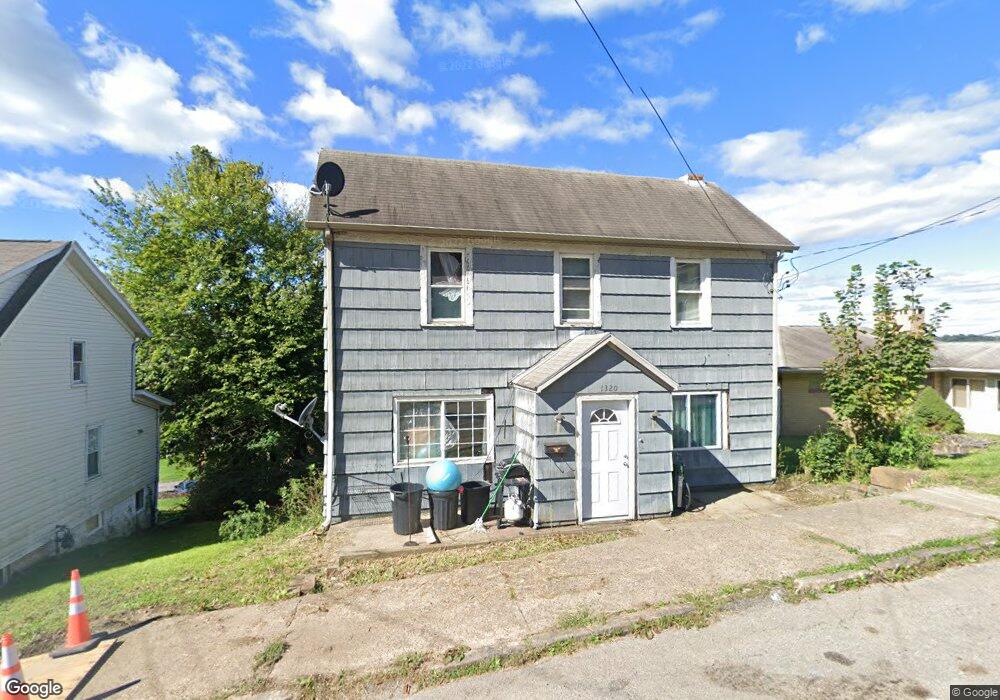
1320 4th Ave Conway, PA 15027
Estimated Value: $88,282 - $161,000
3
Beds
1
Bath
1,200
Sq Ft
$94/Sq Ft
Est. Value
About This Home
This home is located at 1320 4th Ave, Conway, PA 15027 and is currently estimated at $112,821, approximately $94 per square foot. 1320 4th Ave is a home located in Beaver County with nearby schools including Freedom Area Elementary School, Freedom Area Middle School, and Freedom Area Senior High School.
Ownership History
Date
Name
Owned For
Owner Type
Purchase Details
Closed on
Jun 2, 2023
Sold by
Popowich Peter and Popowich Joyce E
Bought by
Shriver Joseph and Shriver Jeanette
Current Estimated Value
Purchase Details
Closed on
Jan 27, 2006
Sold by
Grp Loan Llc
Bought by
Popowich Peter
Purchase Details
Closed on
Feb 13, 2001
Sold by
Est Of Lena Ruskin
Bought by
Healey Agnes P
Home Financials for this Owner
Home Financials are based on the most recent Mortgage that was taken out on this home.
Original Mortgage
$18,900
Interest Rate
6.89%
Create a Home Valuation Report for This Property
The Home Valuation Report is an in-depth analysis detailing your home's value as well as a comparison with similar homes in the area
Home Values in the Area
Average Home Value in this Area
Purchase History
| Date | Buyer | Sale Price | Title Company |
|---|---|---|---|
| Shriver Joseph | $16,000 | Everest Settlement Services | |
| Popowich Peter | $23,500 | -- | |
| Healey Agnes P | $21,000 | -- |
Source: Public Records
Mortgage History
| Date | Status | Borrower | Loan Amount |
|---|---|---|---|
| Previous Owner | Healey Agnes P | $18,900 |
Source: Public Records
Tax History
| Year | Tax Paid | Tax Assessment Tax Assessment Total Assessment is a certain percentage of the fair market value that is determined by local assessors to be the total taxable value of land and additions on the property. | Land | Improvement |
|---|---|---|---|---|
| 2025 | $150 | $20,450 | $10,950 | $9,500 |
| 2024 | $701 | $20,450 | $10,950 | $9,500 |
| 2023 | $1,610 | $13,100 | $2,200 | $10,900 |
| 2022 | $1,564 | $13,100 | $2,200 | $10,900 |
| 2021 | $1,564 | $13,100 | $2,200 | $10,900 |
| 2020 | $1,458 | $13,100 | $2,200 | $10,900 |
| 2019 | $1,458 | $13,100 | $2,200 | $10,900 |
| 2018 | $1,402 | $13,100 | $2,200 | $10,900 |
| 2017 | $1,402 | $13,100 | $2,200 | $10,900 |
| 2016 | $1,279 | $13,100 | $2,200 | $10,900 |
| 2015 | $291 | $13,100 | $2,200 | $10,900 |
| 2014 | $291 | $13,100 | $2,200 | $10,900 |
Source: Public Records
Map
Nearby Homes
- 1001 2nd Ave
- 1508 Dupont St
- 1227 Porter St
- 744 N Gross St
- 1025 Catherine Dr
- 1079 Catherine Dr
- 149 Shady River Blvd Unit 40 B
- 245 Conway Wallrose Rd
- 150 Shady River Blvd Unit 56A
- 154 Shady River Blvd
- 300 River Ridge Ct
- 328 River Ridge Ct Unit 47B
- 450 Knollwood Cir
- 500 Conway Wallrose Rd
- 155 Sproat Ave
- 1010 4th St
- 969 4th St
- 1530 6th Ave
- 996 Monaca Rd
- 580 Tevebaugh Hollow Rd
- 1320 4th Ave
- 1324 4th Ave
- 1325 3rd Ave
- 1316 4th Ave
- 1312 4th Ave
- 1321 3rd Ave
- 1329 3rd Ave
- 1333 3rd Ave
- 00000 Route 65
- Lots 50-55 Roosevelt St
- Lots 48/49 Roosevelt St
- Lots 42/43 Roosevelt St
- Lots 46/47 Roosevelt St
- Lot 30 Birchwood Falls
- 1308 4th Ave
- 1400 4th Ave
- 1325 4th Ave
- 1317 3rd Ave
- 1321 4th Ave
- 1317 4th Ave
Your Personal Tour Guide
Ask me questions while you tour the home.