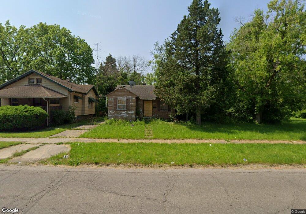
1321 Mackin Rd Flint, MI 48503
Downtown Flint NeighborhoodEstimated Value: $27,000 - $46,000
2
Beds
1
Bath
694
Sq Ft
$58/Sq Ft
Est. Value
About This Home
This home is located at 1321 Mackin Rd, Flint, MI 48503 and is currently estimated at $40,325, approximately $58 per square foot. 1321 Mackin Rd is a home located in Genesee County with nearby schools including Doyle/Ryder School, WAY Academy of Flint, and St John Vianney Catholic School.
Ownership History
Date
Name
Owned For
Owner Type
Purchase Details
Closed on
Oct 16, 2024
Sold by
Genesee County Land Bank Authority
Bought by
James Investment Group Llc
Current Estimated Value
Purchase Details
Closed on
Dec 22, 2014
Sold by
Genesee County Treasurer
Bought by
Genesee County Land Bank
Purchase Details
Closed on
Mar 28, 2014
Sold by
Waters Harold
Bought by
Mclemore Jaquandre and Morgan Nicklas
Purchase Details
Closed on
Nov 1, 2012
Sold by
Umphryes Jerome
Bought by
Waters Harold
Purchase Details
Closed on
Jan 18, 2010
Sold by
Wothke Matthew J and Wothke Staci
Bought by
Umphryes Jerome
Purchase Details
Closed on
Oct 24, 2002
Sold by
Smith Marjorie G and Mccann Carol J
Bought by
Wothke Matthew J
Create a Home Valuation Report for This Property
The Home Valuation Report is an in-depth analysis detailing your home's value as well as a comparison with similar homes in the area
Home Values in the Area
Average Home Value in this Area
Purchase History
We collect this data history from publicly available records. To have your information removed, we recommend requesting removal directly through your county’s website.
| Date | Buyer | Sale Price | Title Company |
|---|---|---|---|
| James Investment Group Llc | $225 | None Listed On Document | |
| James Investment Group Llc | $225 | None Listed On Document | |
| James Investment Group Llc | $225 | None Listed On Document | |
| Genesee County Land Bank | -- | None Available | |
| Mclemore Jaquandre | -- | None Available | |
| Waters Harold | -- | None Available | |
| Umphryes Jerome | -- | None Available | |
| Wothke Matthew J | $5,000 | Sargents Title Company |
Source: Public Records
Tax History
| Year | Tax Paid | Tax Assessment Tax Assessment Total Assessment is a certain percentage of the fair market value that is determined by local assessors to be the total taxable value of land and additions on the property. | Land | Improvement |
|---|---|---|---|---|
| 2025 | -- | $14,000 | $0 | $0 |
| 2024 | -- | $0 | $0 | $0 |
| 2023 | -- | $0 | $0 | $0 |
| 2022 | $0 | $0 | $0 | $0 |
| 2021 | $0 | $0 | $0 | $0 |
| 2020 | $0 | $0 | $0 | $0 |
| 2019 | $0 | $0 | $0 | $0 |
| 2018 | $0 | $0 | $0 | $0 |
| 2017 | $0 | $0 | $0 | $0 |
| 2016 | $0 | $0 | $0 | $0 |
| 2015 | -- | $0 | $0 | $0 |
| 2014 | -- | $0 | $0 | $0 |
| 2012 | -- | $5,800 | $0 | $0 |
Source: Public Records
Map
Nearby Homes
- 1717 Wolcott St
- 1717 Stevenson St
- 1908 Raskob St
- 2001 Mackin Rd
- 1016 Dupont St
- 1008 Dupont St
- 1620 Mason St
- 1645 Seminole St
- 1644 Mason St
- 772 N Chevrolet Ave
- 2410 Sloan St
- 1606 Garland St
- 2309 Barth St
- 1545 Martin Luther King Ave
- 2302 Mallery St
- 800 Martin Luther King Ave
- 2134 Martin Luther King Ave
- 1651 N Chevrolet Ave
- 606 Stockdale St
- 416 W 2nd Ave Unit 4
- 1317 Mackin Rd
- 1329 Mackin Rd
- 1318 Prospect St
- 1322 Prospect St
- 1309 Mackin Rd
- 1401 Mackin Rd
- 1310 Prospect St
- 1326 Prospect St
- 1326 Prospect St
- 1306 Prospect St
- 1409 Mackin Rd
- 1405 Mackin Rd
- 1326 Mackin Rd
- 1400 Prospect St
- 1220 Niagara St
- 1320 Mackin Rd
- 1222 Niagara St
- 1302 Prospect St
- 1316 Mackin Rd
- 1301 Mackin Rd
Your Personal Tour Guide
Ask me questions while you tour the home.