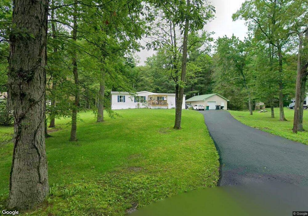
1323 Deer Path Dr Walnutport, PA 18088
Estimated Value: $292,000 - $356,032
3
Beds
2
Baths
1,620
Sq Ft
$206/Sq Ft
Est. Value
About This Home
This home is located at 1323 Deer Path Dr, Walnutport, PA 18088 and is currently estimated at $334,508, approximately $206 per square foot. 1323 Deer Path Dr is a home located in Northampton County with nearby schools including Lehigh Elementary School, Northampton Area Middle School, and Northampton Area High School.
Ownership History
Date
Name
Owned For
Owner Type
Purchase Details
Closed on
May 31, 2011
Sold by
Dreisbach Todd and Dreisbach Antoinette
Bought by
Dreisbach Todd
Current Estimated Value
Purchase Details
Closed on
Mar 8, 2004
Sold by
Speach Nicholas
Bought by
Dreisbach Todd
Create a Home Valuation Report for This Property
The Home Valuation Report is an in-depth analysis detailing your home's value as well as a comparison with similar homes in the area
Home Values in the Area
Average Home Value in this Area
Purchase History
| Date | Buyer | Sale Price | Title Company |
|---|---|---|---|
| Dreisbach Todd | -- | None Available | |
| Dreisbach Todd | $33,000 | -- |
Source: Public Records
Tax History
| Year | Tax Paid | Tax Assessment Tax Assessment Total Assessment is a certain percentage of the fair market value that is determined by local assessors to be the total taxable value of land and additions on the property. | Land | Improvement |
|---|---|---|---|---|
| 2026 | $600 | $55,600 | $17,300 | $38,300 |
| 2025 | $600 | $55,600 | $17,300 | $38,300 |
| 2024 | $4,087 | $55,600 | $17,300 | $38,300 |
| 2023 | $1,249 | $17,300 | $17,300 | $0 |
| 2022 | $2,701 | $37,400 | $17,300 | $20,100 |
| 2021 | $2,707 | $37,400 | $17,300 | $20,100 |
| 2020 | $2,707 | $37,400 | $17,300 | $20,100 |
| 2019 | $2,668 | $37,400 | $17,300 | $20,100 |
| 2018 | $2,628 | $37,400 | $17,300 | $20,100 |
| 2017 | $2,571 | $37,400 | $17,300 | $20,100 |
| 2016 | -- | $37,400 | $17,300 | $20,100 |
| 2015 | -- | $37,400 | $17,300 | $20,100 |
| 2014 | -- | $37,400 | $17,300 | $20,100 |
Source: Public Records
Map
Nearby Homes
- 0 Deer Path Dr Unit 773551
- 1412 Heytesbury Rd
- 1410 Heytesbury Rd
- 3983 Hastings Rd
- 4234 Independence Ln
- 4185 Independence Ln
- 4165 Bunker Hill Ln W
- 4162 Bunker Hill Ln W
- 10 E Zimmer Dr
- 161 Windsor St
- 4083 W Mountain View Dr
- 127 Zimmer Dr W Unit 127
- 4119 Butternut Dr
- 32 De Rose St Unit 32A
- 1225 Quince Rd
- 0 Olive Rd
- 4586 W Mountain View Dr
- 1089 Walnut Dr
- 3749 Mountain View Dr
- 172 1 2 Windsor St Unit 172A
- 1315 Deer Path Dr
- 1331 Deer Path Dr
- 1320 Deer Path Dr
- 1306 Deer Path Dr
- 1334 Deer Path Dr
- 1311 Spring Dr
- 0 Deer Path Dr Unit 767888
- 0 Deer Path Dr Unit PM-73391
- 0 Deer Path Dr Unit PANH105488
- 0 Deer Path Dr Unit 626791
- 0 Deer Path Dr Unit 335285
- 0 Deer Path Dr Unit 347387
- 0 Deer Path Dr Unit 475467
- 0 Deer Path Dr Unit 478469
- 0 Deer Path Dr Unit 507246
- 1315 Spring Dr
- 1323 Spring Dr
- 1335 Spring Dr
- 1341 Spring Dr
- 1348 Deer Path Dr
Your Personal Tour Guide
Ask me questions while you tour the home.