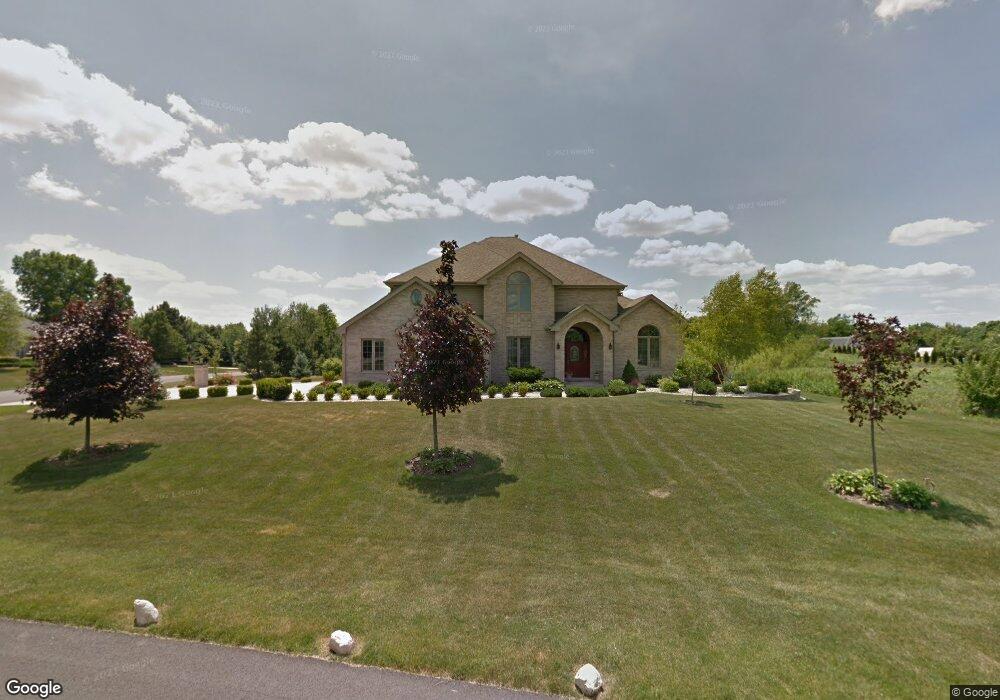
13232 Briar Patch Ln Lemont, IL 60439
Southeast Lemont NeighborhoodEstimated Value: $786,000 - $935,000
About This Home
This home is located at 13232 Briar Patch Ln, Lemont, IL 60439 and is currently estimated at $855,462, approximately $261 per square foot. 13232 Briar Patch Ln is a home located in Cook County with nearby schools including Oakwood School, River Valley School, and Old Quarry Middle School.
Ownership History
We collect this data history from publicly available records. To have your information removed, we recommend requesting removal directly through your county’s website.
Purchase Details
Home Financials for this Owner
Home Financials are based on the most recent Mortgage that was taken out on this home.Home Values in the Area
Average Home Value in this Area
Purchase History
We collect this data history from publicly available records. To have your information removed, we recommend requesting removal directly through your county’s website.
| Date | Buyer | Sale Price | Title Company |
|---|---|---|---|
| $680,000 | Atgf Inc |
Mortgage History
We collect this data history from publicly available records. To have your information removed, we recommend requesting removal directly through your county’s website.
| Date | Status | Borrower | Loan Amount |
|---|---|---|---|
| Open | $350,000 | ||
| Closed | $201,000 |
Tax History
We collect this data history from publicly available records. To have your information removed, we recommend requesting removal directly through your county’s website.
| Year | Tax Paid | Tax Assessment Tax Assessment Total Assessment is a certain percentage of the fair market value that is determined by local assessors to be the total taxable value of land and additions on the property. | Land | Improvement |
|---|---|---|---|---|
| 2025 | $12,152 | $66,000 | $18,121 | $47,879 |
| 2024 | $12,152 | $66,000 | $18,121 | $47,879 |
| 2023 | $9,728 | $66,000 | $18,121 | $47,879 |
| 2022 | $9,728 | $46,604 | $16,030 | $30,574 |
| 2021 | $9,470 | $46,603 | $16,029 | $30,574 |
| 2020 | $9,656 | $46,603 | $16,029 | $30,574 |
| 2019 | $9,967 | $49,648 | $16,029 | $33,619 |
| 2018 | $10,197 | $51,470 | $16,029 | $35,441 |
| 2017 | $10,074 | $51,470 | $16,029 | $35,441 |
| 2016 | $8,571 | $41,470 | $13,242 | $28,228 |
| 2015 | $9,037 | $43,008 | $13,242 | $29,766 |
| 2014 | $9,986 | $46,678 | $13,242 | $33,436 |
| 2013 | $8,451 | $42,344 | $4,878 | $37,466 |
Map
- 13423 Hunt Master Ln
- 13161 Eliza Ct
- 13050 Silver Fox Dr
- 13201 Meadow Hill Ln Unit 2
- 12903 Waterford Dr
- 13616 Lost Boy Ln
- 13340 Bond Cir
- 13836 Amelia Dr
- 13657 S Parker Rd
- 13849 Anne Dr
- 12902 W Beaver Lake Dr
- 12750 Corbett Ct
- 12758 Corbett Ct
- 12766 Corbett Ct
- 13829 S Teakwood Dr
- 12570 Eileen St
- 12810 W Beaver Lake Dr
- 12538 Eileen St
- 13021 W Creekside Dr
- 12560 Derry Dr
- 13242 Briar Patch Ln
- 13308 E Red Coat Dr
- 13252 Briar Patch Ln
- 13222 Briar Patch Ln
- 13289 E Red Coat Dr
- 13237 Briar Patch Ln
- 13309 E Red Coat Dr
- 13247 Briar Patch Ln
- 13199 E Red Coat Dr
- 13262 Briar Patch Ln
- 13318 E Red Coat Dr
- 13257 Briar Patch Ln
- 13187 E Red Coat Dr
- 13319 E Red Coat Dr
- 13272 Briar Patch Ln
- 13267 Briar Patch Ln
- 13250 Fox Hill Dr
- 13230 Fox Hill Dr
- 13100 Moorefield Ct
- 13328 E Red Coat Dr
Ask me questions while you tour the home.