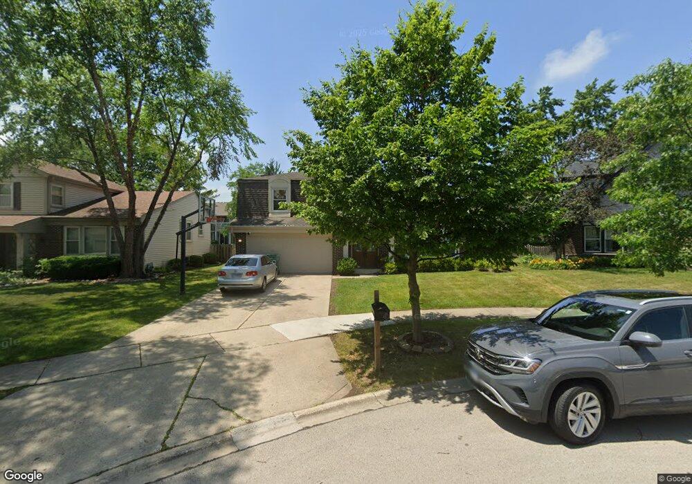
1327 Devonshire Rd Buffalo Grove, IL 60089
Prairie Park-Lake County NeighborhoodEstimated Value: $464,000 - $575,000
Studio
3
Baths
1,485
Sq Ft
$348/Sq Ft
Est. Value
About This Home
This home is located at 1327 Devonshire Rd, Buffalo Grove, IL 60089 and is currently estimated at $516,292, approximately $347 per square foot. 1327 Devonshire Rd is a home located in Lake County with nearby schools including Prairie Elementary School, Twin Groves Middle School, and Adlai E Stevenson High School.
Ownership History
Date
Name
Owned For
Owner Type
Purchase Details
Closed on
Jul 21, 2003
Sold by
Green Boris and Green Polina
Bought by
Adler Josh and Adler Lisa
Current Estimated Value
Home Financials for this Owner
Home Financials are based on the most recent Mortgage that was taken out on this home.
Original Mortgage
$280,000
Outstanding Balance
$117,934
Interest Rate
5.97%
Mortgage Type
Purchase Money Mortgage
Estimated Equity
$398,358
Create a Home Valuation Report for This Property
The Home Valuation Report is an in-depth analysis detailing your home's value as well as a comparison with similar homes in the area
Home Values in the Area
Average Home Value in this Area
Purchase History
We collect this data history from publicly available records. To have your information removed, we recommend requesting removal directly through your county’s website.
| Date | Buyer | Sale Price | Title Company |
|---|---|---|---|
| Adler Josh | $350,000 | Multiple |
Source: Public Records
Mortgage History
We collect this data history from publicly available records. To have your information removed, we recommend requesting removal directly through your county’s website.
| Date | Status | Borrower | Loan Amount |
|---|---|---|---|
| Open | Adler Josh | $280,000 |
Source: Public Records
Tax History
| Year | Tax Paid | Tax Assessment Tax Assessment Total Assessment is a certain percentage of the fair market value that is determined by local assessors to be the total taxable value of land and additions on the property. | Land | Improvement |
|---|---|---|---|---|
| 2025 | $14,885 | $167,104 | $35,649 | $131,455 |
| 2024 | $14,426 | $157,527 | $33,606 | $123,921 |
| 2023 | $13,670 | $148,639 | $31,710 | $116,929 |
| 2022 | $13,670 | $137,094 | $29,247 | $107,847 |
| 2021 | $13,152 | $135,616 | $28,932 | $106,684 |
| 2020 | $12,842 | $136,079 | $29,031 | $107,048 |
| 2019 | $12,665 | $135,577 | $28,924 | $106,653 |
| 2018 | $11,047 | $122,624 | $28,585 | $94,039 |
| 2017 | $10,837 | $119,762 | $27,918 | $91,844 |
| 2016 | $10,552 | $114,682 | $26,734 | $87,948 |
| 2015 | $10,270 | $107,249 | $25,001 | $82,248 |
| 2014 | $7,772 | $81,514 | $26,851 | $54,663 |
| 2012 | $7,704 | $81,678 | $26,905 | $54,773 |
Source: Public Records
Map
Nearby Homes
- 1275 Ranchview Ct
- 958 Chaucer Way
- 1120 Thompson Blvd
- 1150 Thompson Blvd
- 5107 N Arlington Heights Rd
- 1124 Brandywyn Ct
- 701 Thompson Blvd
- 5152 Bridlewood Ln
- 1058 Providence Ln
- 1145 Bristol Ln
- 5176 Aptakisic Rd
- 1336 Fairfax Ln Unit B62
- 879 Saybrook Ln
- 421 Thompson Blvd
- 1602 Brittany Ln
- 1005 Cooper Ct
- 1516 Anderson Ln Unit I7
- 405 Caren Dr
- 711 Woodhollow Ln
- 917 Shambliss Ln
- 1329 Devonshire Rd
- 1325 Devonshire Rd
- 1267 Ranch View Ct Unit 1267
- 1265 Ranch View Ct Unit 4
- 1331 Devonshire Rd
- 1267 Ranchview Ct
- 1263 Ranch View Ct Unit 4
- 1263 Ranchview Ct Unit 1263
- 1263 Ranch View Ct Unit 1263
- 1263 Ranch View Ct Unit 2
- 1265 Ranchview Ct
- 1261 Ranch View Ct Unit 4
- 1323 Devonshire Rd
- 1271 Ranchview Ct
- 1271 Ranch View Ct Unit 5
- 1257 Ranch View Ct Unit 4
- 1255 Ranch View Ct
- 1273 Ranch View Ct Unit 52R
- 1253 Ranch View Ct Unit 4
- 1275 Ranch View Ct Unit 5
Your Personal Tour Guide
Ask me questions while you tour the home.