Estimated Value: $128,000 - $146,590
About This Home
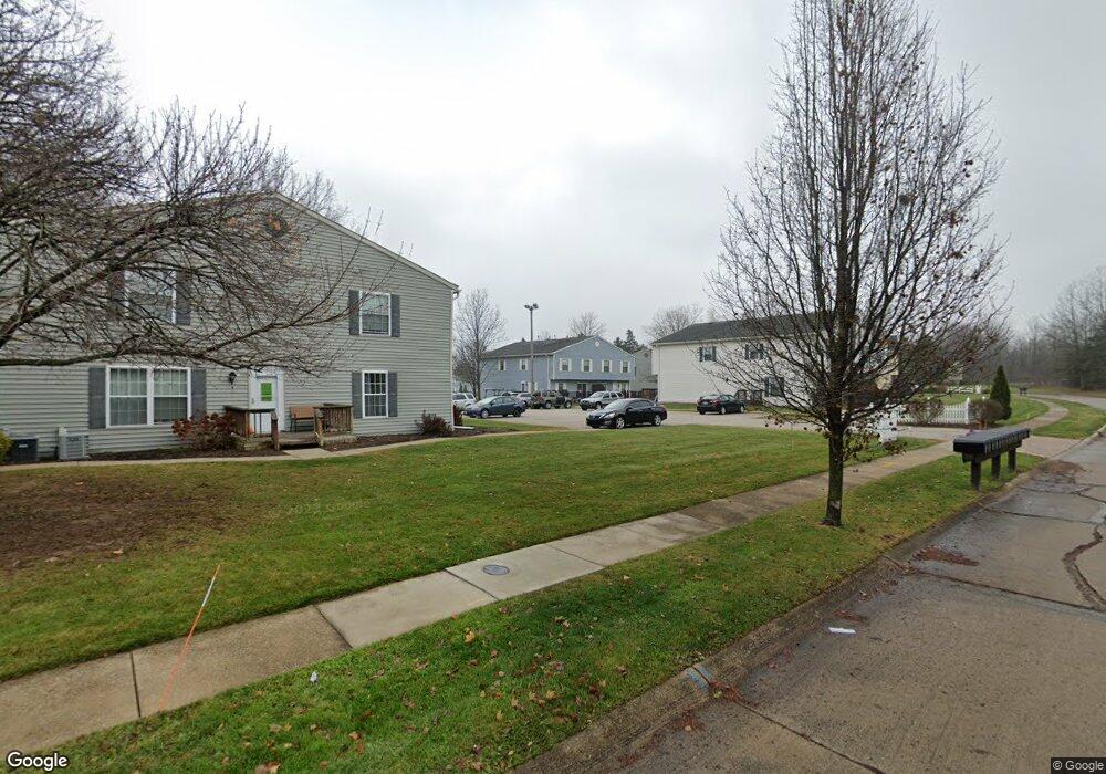
This home is located at 1329 Apache Trail Unit L4, Stow, OH 44224 and is currently estimated at $137,898, approximately $205 per square foot. 1329 Apache Trail Unit L4 is a home located in Summit County with nearby schools including Stow-Munroe Falls High School, Primrose School of Hudson, and Cuyahoga Valley Christian Academy.
Ownership History
We collect this data history from publicly available records. To have your information removed, we recommend requesting removal directly through your county’s website.
Purchase Details
Home Financials for this Owner
Home Financials are based on the most recent Mortgage that was taken out on this home.Purchase Details
Home Financials for this Owner
Home Financials are based on the most recent Mortgage that was taken out on this home.Home Values in the Area
Average Home Value in this Area
Purchase History
We collect this data history from publicly available records. To have your information removed, we recommend requesting removal directly through your county’s website.
| Date | Buyer | Sale Price | Title Company |
|---|---|---|---|
| $75,000 | Title First Agency Inc | ||
| $109,900 | Attorney |
Mortgage History
We collect this data history from publicly available records. To have your information removed, we recommend requesting removal directly through your county’s website.
| Date | Status | Borrower | Loan Amount |
|---|---|---|---|
| Open | $60,000 | ||
| Previous Owner | $98,910 |
Tax History
We collect this data history from publicly available records. To have your information removed, we recommend requesting removal directly through your county’s website.
| Year | Tax Paid | Tax Assessment Tax Assessment Total Assessment is a certain percentage of the fair market value that is determined by local assessors to be the total taxable value of land and additions on the property. | Land | Improvement |
|---|---|---|---|---|
| 2026 | $2,938 | $36,719 | $4,078 | $32,641 |
| 2024 | $2,155 | $36,719 | $4,078 | $32,641 |
| 2023 | $2,263 | $36,719 | $4,078 | $32,641 |
| 2022 | $1,980 | $29,750 | $3,290 | $26,460 |
| 2021 | $1,782 | $29,750 | $3,290 | $26,460 |
| 2020 | $1,752 | $29,750 | $3,290 | $26,460 |
| 2019 | $1,310 | $20,540 | $3,290 | $17,250 |
| 2018 | $1,290 | $20,540 | $3,290 | $17,250 |
| 2017 | $1,283 | $20,540 | $3,290 | $17,250 |
| 2016 | $1,318 | $19,840 | $3,290 | $16,550 |
| 2015 | $1,283 | $19,840 | $3,290 | $16,550 |
| 2014 | $1,284 | $19,840 | $3,290 | $16,550 |
| 2013 | $1,642 | $26,560 | $3,290 | $23,270 |
Map
- 4994 Comanche Trail
- 4748 Sunnyside Dr
- 4760 Sunnyside Dr
- 1259 Meadowbrook Blvd
- V/L Housley Rd
- 1480 Meadowbrook Blvd
- 1403 Whippoorwill Trail
- 4281 Meadowlark Trail
- 1946 Leisure Ln
- 1826 Arndale Rd
- 4092 Hummingbird Trail
- 4102 Leewood Rd
- 1969 Willowdale Dr
- 1545 Woodlake Blvd
- 1484 Woodlake Blvd
- 1979 Sandy Hook
- 1528 Spruce Hill Dr
- V/L Diplomat Dr
- 5005 Bar Harbor Ln Unit 5005
- 4436 Forest Lake Ct
- 1329 Apache Trail Unit L3
- 1329 Apache Trail Unit L2
- 1329 Apache Trail Unit L1
- 1329 Apache Trail Unit A
- 1329 Apache Trail
- 1329 Apache Trail Unit D
- 1329 Apache Trail Unit B
- 1341 Apache Trail Unit D
- 1341 Apache Trail Unit N3
- 1341 Apache Trail Unit N2
- 1341 Apache Trail Unit N1
- 1341 Apache Trail Unit N4
- 1341 Apache Trail Unit C
- 1341 Apache Trail Unit A
- 1341 Apache Trail Unit B
- 1325 Apache Trail Unit K3
- 1325 Apache Trail
- 1325 Apache Trail Unit K1
- 1325 Apache Trail
- 1325 Apache Trail Unit D
Ask me questions while you tour the home.