133 Baker Ave Cincinnati, OH 45217
Estimated Value: $185,000 - $223,000
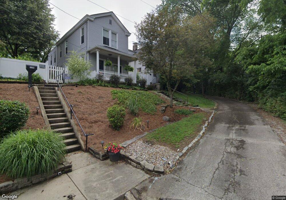
About This Home
This home is located at 133 Baker Ave, Cincinnati, OH 45217 and is currently estimated at $195,863, approximately $157 per square foot. 133 Baker Ave is a home located in Hamilton County with nearby schools including St Bernard Elementary School, St Bernard-Elmwood Place High School, and The New School Montessori.
Ownership History
We collect this data history from publicly available records. To have your information removed, we recommend requesting removal directly through your county’s website.
Purchase Details
Purchase Details
Purchase Details
Home Values in the Area
Average Home Value in this Area
Purchase History
We collect this data history from publicly available records. To have your information removed, we recommend requesting removal directly through your county’s website.
| Date | Buyer | Sale Price | Title Company |
|---|---|---|---|
| $60,555 | None Listed On Document | ||
| -- | Attorney | ||
| -- | -- |
Tax History
We collect this data history from publicly available records. To have your information removed, we recommend requesting removal directly through your county’s website.
| Year | Tax Paid | Tax Assessment Tax Assessment Total Assessment is a certain percentage of the fair market value that is determined by local assessors to be the total taxable value of land and additions on the property. | Land | Improvement |
|---|---|---|---|---|
| 2025 | $2,513 | $39,659 | $8,911 | $30,748 |
| 2024 | $2,484 | $39,659 | $8,911 | $30,748 |
| 2023 | $2,536 | $39,659 | $8,911 | $30,748 |
| 2022 | $1,707 | $20,791 | $6,955 | $13,836 |
| 2021 | $1,700 | $20,791 | $6,955 | $13,836 |
| 2020 | $1,638 | $20,791 | $6,955 | $13,836 |
| 2019 | $1,530 | $17,770 | $5,943 | $11,827 |
| 2018 | $1,553 | $17,770 | $5,943 | $11,827 |
| 2017 | $1,459 | $17,770 | $5,943 | $11,827 |
| 2016 | $1,482 | $17,868 | $7,000 | $10,868 |
| 2015 | $1,378 | $17,868 | $7,000 | $10,868 |
| 2014 | $1,375 | $17,868 | $7,000 | $10,868 |
| 2013 | $1,480 | $19,779 | $7,368 | $12,411 |
Map
- 4546 Leo St
- 27 Phillips Ave
- 4504 Park Place
- 4500 Park Place
- 311 E Ross Ave
- 208 Bank Ave
- 37 Orchard St
- 27 Kessler Place
- 4238 Leonard Ave
- 4259 Vine St
- 4237 Vine St
- 4235 Vine St
- 218 Washington Ave
- 54 E Mitchell Ave
- 64 E Mitchell Ave
- 4616 Sullivan Ave
- 313 Washington Ave
- 4315 Sullivan Ave
- 130 Mary Ln
- 4910 Greenlee Ave
Ask me questions while you tour the home.