Estimated Value: $463,578 - $693,000
4
Beds
2
Baths
1,872
Sq Ft
$297/Sq Ft
Est. Value
About This Home
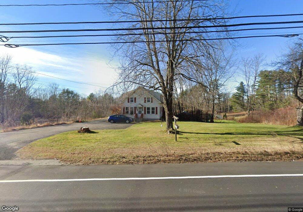
This home is located at 133 Lewiston Rd, Gray, ME 04039 and is currently estimated at $556,895, approximately $297 per square foot. 133 Lewiston Rd is a home located in Cumberland County with nearby schools including Gray-New Gloucester High School and Fiddlehead School of Arts & Science.
Ownership History
Date
Name
Owned For
Owner Type
Purchase Details
Closed on
Jan 6, 2015
Sold by
Watts Gregory E
Bought by
Rajpold Ann M
Current Estimated Value
Purchase Details
Closed on
Sep 5, 2007
Sold by
Humphrey Gene D
Bought by
Rajpolo Ann M and Watts Gregory E
Home Financials for this Owner
Home Financials are based on the most recent Mortgage that was taken out on this home.
Original Mortgage
$235,100
Interest Rate
6.74%
Mortgage Type
Unknown
Create a Home Valuation Report for This Property
The Home Valuation Report is an in-depth analysis detailing your home's value as well as a comparison with similar homes in the area
Home Values in the Area
Average Home Value in this Area
Purchase History
We collect this data history from publicly available records. To have your information removed, we recommend requesting removal directly through your county’s website.
| Date | Buyer | Sale Price | Title Company |
|---|---|---|---|
| Rajpold Ann M | -- | -- | |
| Rajpolo Ann M | -- | -- |
Source: Public Records
Mortgage History
We collect this data history from publicly available records. To have your information removed, we recommend requesting removal directly through your county’s website.
| Date | Status | Borrower | Loan Amount |
|---|---|---|---|
| Previous Owner | Rajpolo Ann M | $234,300 | |
| Previous Owner | Rajpolo Ann M | $235,100 |
Source: Public Records
Tax History
| Year | Tax Paid | Tax Assessment Tax Assessment Total Assessment is a certain percentage of the fair market value that is determined by local assessors to be the total taxable value of land and additions on the property. | Land | Improvement |
|---|---|---|---|---|
| 2025 | $4,290 | $443,200 | $125,000 | $318,200 |
| 2024 | $4,299 | $443,200 | $125,000 | $318,200 |
| 2023 | $3,809 | $250,900 | $50,000 | $200,900 |
| 2022 | $3,500 | $250,900 | $50,000 | $200,900 |
| 2021 | $3,295 | $225,500 | $50,000 | $175,500 |
| 2020 | $3,326 | $225,500 | $50,000 | $175,500 |
| 2019 | $3,326 | $225,500 | $50,000 | $175,500 |
| 2018 | $3,157 | $225,500 | $50,000 | $175,500 |
| 2017 | $2,944 | $163,100 | $46,200 | $116,900 |
| 2016 | $2,985 | $163,100 | $46,200 | $116,900 |
| 2015 | $2,958 | $162,500 | $46,200 | $116,300 |
| 2014 | $2,958 | $162,500 | $46,200 | $116,300 |
| 2012 | $2,575 | $162,455 | $46,200 | $116,255 |
Source: Public Records
Map
Nearby Homes
- 22 Weymouth Rd
- 270 Mayall Rd
- 4 Divot Dr
- Lot 21-29 Weymouth Rd
- 52 Colley Hill Rd
- 49 Megquier Rd
- 7 Roman Woods Way
- 0 Colley Hill Rd
- 1 Colley Hill Rd Unit A
- M20/21/311 Shaw Brook Ln
- 224 Shaker Rd
- 521 Mayall Rd
- 7 Sunset View St
- 91 Merrill Rd
- 9 Brown St
- 56 Yarmouth Rd
- 0 Gore Unit 1655428
- 21 Woodcock Dr
- 52 Woodcock Dr
- 22 Woodcock Dr
Your Personal Tour Guide
Ask me questions while you tour the home.