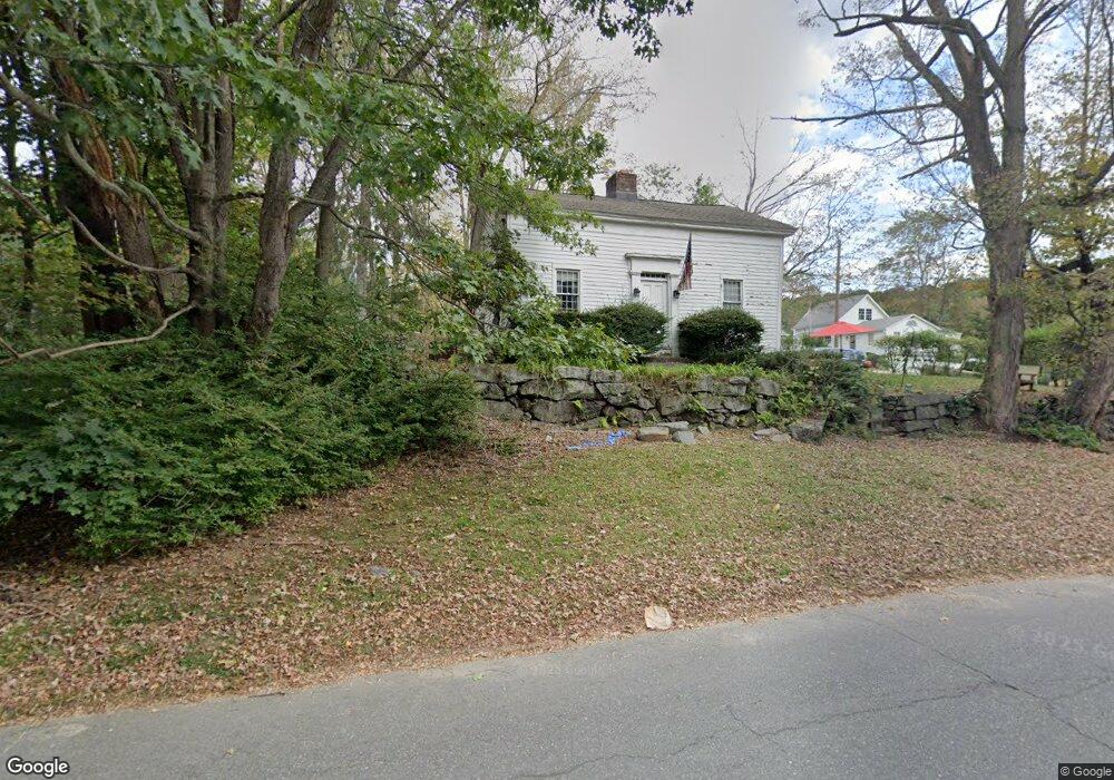
133 Platts Mill Rd Naugatuck, CT 06770
Naugatuck AreaEstimated Value: $319,000 - $361,000
About This Home
This home is located at 133 Platts Mill Rd, Naugatuck, CT 06770 and is currently estimated at $345,801, approximately $212 per square foot. 133 Platts Mill Rd is a home located in New Haven County with nearby schools including City Hill Middle School, Naugatuck High School, and Our Lady Of Mount Carmel School.
Ownership History
We collect this data history from publicly available records. To have your information removed, we recommend requesting removal directly through your county’s website.
Purchase Details
Home Values in the Area
Average Home Value in this Area
Purchase History
We collect this data history from publicly available records. To have your information removed, we recommend requesting removal directly through your county’s website.
| Date | Buyer | Sale Price | Title Company |
|---|---|---|---|
| $99,900 | -- |
Mortgage History
We collect this data history from publicly available records. To have your information removed, we recommend requesting removal directly through your county’s website.
| Date | Status | Borrower | Loan Amount |
|---|---|---|---|
| Open | $198,000 | ||
| Closed | $115,000 | ||
| Previous Owner | $104,000 |
Tax History
We collect this data history from publicly available records. To have your information removed, we recommend requesting removal directly through your county’s website.
| Year | Tax Paid | Tax Assessment Tax Assessment Total Assessment is a certain percentage of the fair market value that is determined by local assessors to be the total taxable value of land and additions on the property. | Land | Improvement |
|---|---|---|---|---|
| 2025 | $5,760 | $144,760 | $32,340 | $112,420 |
| 2024 | $6,050 | $144,760 | $32,340 | $112,420 |
| 2023 | $6,478 | $144,760 | $32,340 | $112,420 |
| 2022 | $4,594 | $96,210 | $34,600 | $61,610 |
| 2021 | $4,594 | $96,210 | $34,600 | $61,610 |
| 2020 | $4,594 | $96,210 | $34,600 | $61,610 |
| 2019 | $4,546 | $96,210 | $34,600 | $61,610 |
| 2018 | $4,817 | $99,620 | $41,640 | $57,980 |
| 2017 | $4,837 | $99,620 | $41,640 | $57,980 |
| 2016 | $4,749 | $99,620 | $41,640 | $57,980 |
| 2015 | $4,540 | $99,620 | $41,640 | $57,980 |
| 2014 | $4,489 | $99,620 | $41,640 | $57,980 |
| 2012 | $4,823 | $143,750 | $52,570 | $91,180 |
Map
- 82 Sande Ave
- 126 Thunderbird Dr
- 461 Spring St Unit 4F
- 1385 Highland Ave Unit 1B
- 55 Porter Ave Unit 6E
- 82 Greenwood St
- 0 Field St Unit 170385250
- 68 Round Tree Dr Unit 3
- 101 Ridge Rd Unit 5
- 124 Spring St
- 925 Oronoke Rd Unit 27F
- 925 Oronoke Rd Unit 32G
- 925 Oronoke Rd Unit 25G
- 925 Oronoke Rd Unit 13J
- 925 Oronoke Rd Unit 31C
- 925 Oronoke Rd Unit 25D
- 925 Oronoke Rd Unit 41D
- 99 Ridge Rd Unit 7
- 2 Michelle Ln
- 465 N Main St
- 137 Platts Mill Rd
- 76 Radnor Ave
- 96 Radnor Ave
- 145 Platts Mill Rd
- 11 Sande Ave
- 113 Platts Mill Rd
- 5 Sande Ave
- 3 Sande Ave Unit 3
- 3 Sande Ave
- 1 Sande Ave Unit 1
- 1 Sande Ave
- 68 Radnor Ave
- 98 Radnor Ave
- 62 Radnor Ave
- 107 Platts Mill Rd
- 104 Radnor Ave
- 56 Radnor Ave
- 2 Sande Ave
- 79 Radnor Ave
- 87 Radnor Ave
Ask me questions while you tour the home.