Estimated Value: $219,000 - $316,000
Studio
--
Bath
2,670
Sq Ft
$107/Sq Ft
Est. Value
About This Home
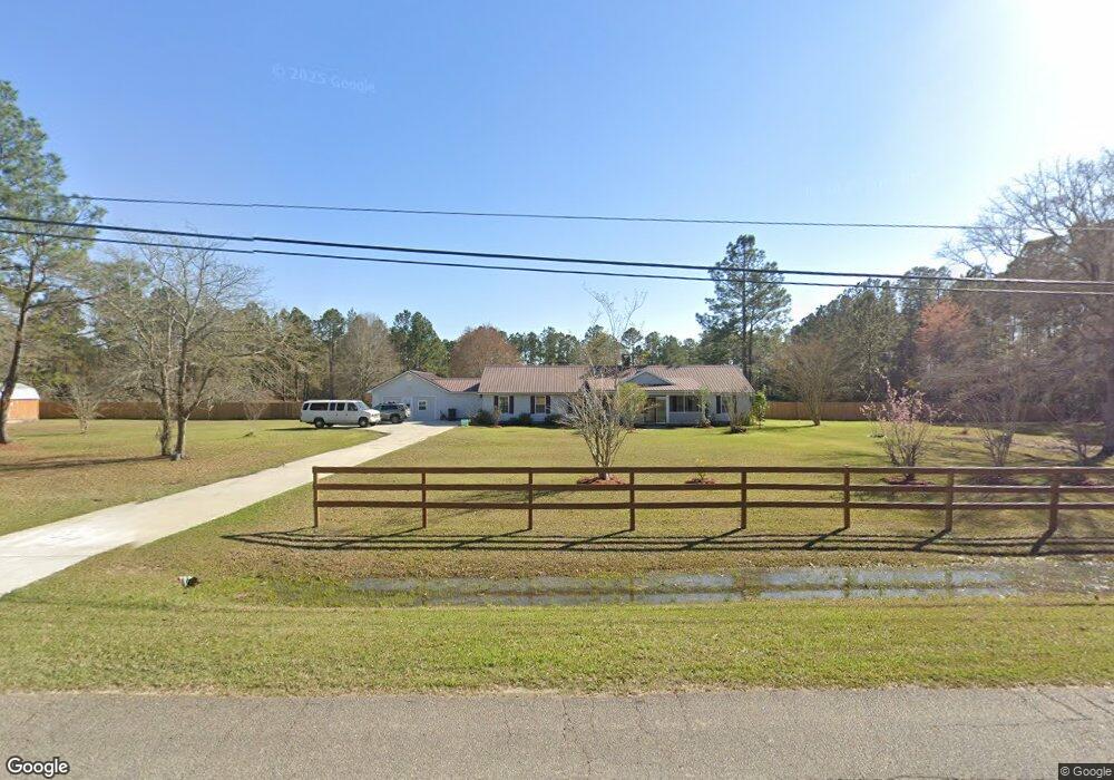
This home is located at 1336 Patterson St, Adel, GA 31620 and is currently estimated at $284,872, approximately $106 per square foot. 1336 Patterson St is a home located in Cook County with nearby schools including Cook Primary School, Cook Elementary School, and Cook County Middle School.
Ownership History
Date
Name
Owned For
Owner Type
Purchase Details
Closed on
Jun 13, 2024
Sold by
S7a Llc
Bought by
Mamacocha Ancestral Memory Institute Inc
Current Estimated Value
Purchase Details
Closed on
Jan 20, 2023
Sold by
Ellison Ritchey Tamrya
Bought by
S7a Llc
Purchase Details
Closed on
Apr 25, 2006
Sold by
Ellison Thomas L
Bought by
The Ellison Fam Trust
Purchase Details
Closed on
Mar 15, 2006
Sold by
Lee Gerald Lewis
Bought by
Ellison Thomas L and Ellison Helen Y
Create a Home Valuation Report for This Property
The Home Valuation Report is an in-depth analysis detailing your home's value as well as a comparison with similar homes in the area
Home Values in the Area
Average Home Value in this Area
Purchase History
| Date | Buyer | Sale Price | Title Company |
|---|---|---|---|
| Mamacocha Ancestral Memory Institute Inc | -- | -- | |
| S7a Llc | $65,651 | -- | |
| The Ellison Fam Trust | -- | -- | |
| Ellison Thomas L | $159,000 | -- |
Source: Public Records
Tax History
| Year | Tax Paid | Tax Assessment Tax Assessment Total Assessment is a certain percentage of the fair market value that is determined by local assessors to be the total taxable value of land and additions on the property. | Land | Improvement |
|---|---|---|---|---|
| 2025 | $3,490 | $113,097 | $35,323 | $77,774 |
| 2024 | $865 | $93,272 | $27,924 | $65,348 |
| 2023 | $2,557 | $79,260 | $24,932 | $54,328 |
| 2022 | $2,557 | $79,260 | $24,932 | $54,328 |
| 2021 | $2,495 | $72,344 | $24,932 | $47,412 |
| 2020 | $2,495 | $72,344 | $24,932 | $47,412 |
| 2019 | $2,497 | $72,344 | $24,932 | $47,412 |
| 2018 | $2,555 | $72,344 | $24,932 | $47,412 |
| 2017 | $2,499 | $72,344 | $24,932 | $47,412 |
| 2016 | $2,503 | $72,344 | $24,932 | $47,412 |
| 2015 | $2,506 | $72,344 | $24,932 | $47,412 |
| 2014 | $2,510 | $72,344 | $24,932 | $47,412 |
| 2013 | -- | $72,343 | $24,931 | $47,412 |
Source: Public Records
Map
Nearby Homes
- 2696 Woodland Dr
- 2603 Dianne St
- 2304 Thomas St
- 284 Barrett Rd
- 1702 Jimmy St
- 1607 Jimmy St
- 1405 Pebblewood Dr
- 1402 Bear Creek Rd
- 1002 Bear Creek Rd
- 526 E Mitchell St
- 509 E Mitchell St
- 625 Coxstill Rd
- 309 Wayne St
- 106 S Goodman St
- 814 N Cleveland Ave
- 103 Bryan St
- 315 Newton Dr
- 708 Town And Country Dr
- 609 E 4th St
- 111 Brookside Dr
- 0 Dottie St
- Lot 105 Dottie St
- 2709 Dottie St
- 1600 Patterson St
- Lot 102 Dottie St
- 1415 Patterson St
- 1301 Patterson St
- 1255 Patterson St
- 2703 Dottie St
- 1234 Patterson St
- 714 Pebblewood N Unit 6
- 2701 Dottie St
- 1235 Patterson St
- Lot 107 Dottie St
- 1460 Patterson St
- 1606 Patterson St
- 2802 Robinhood Dr
- Lot 106 Dottie St
- 1903 Pebblewood E
- 1910 Pebblewood E
Your Personal Tour Guide
Ask me questions while you tour the home.