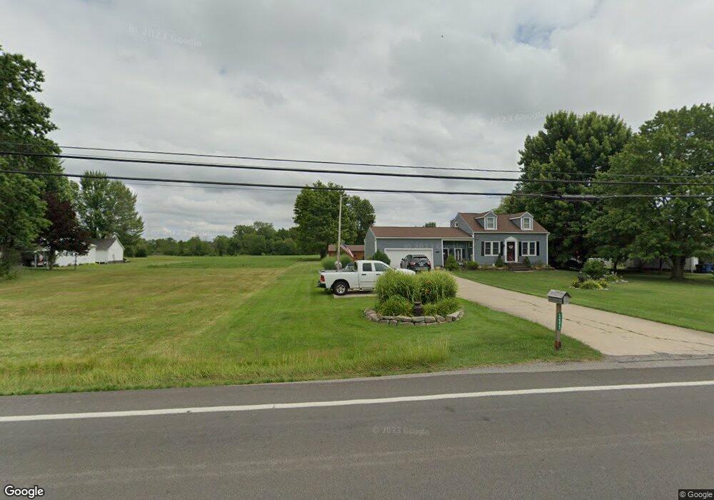
13373 State Route 301 Lagrange, OH 44050
Estimated Value: $319,145 - $379,000
4
Beds
2
Baths
1,682
Sq Ft
$205/Sq Ft
Est. Value
About This Home
This home is located at 13373 State Route 301, Lagrange, OH 44050 and is currently estimated at $345,286, approximately $205 per square foot. 13373 State Route 301 is a home located in Lorain County with nearby schools including Keystone Elementary School, Keystone Middle School, and Keystone High School.
Ownership History
Date
Name
Owned For
Owner Type
Purchase Details
Closed on
Dec 6, 2023
Sold by
Townsley Michael A and Townsley Ilia E
Bought by
Townsley Michael A
Current Estimated Value
Purchase Details
Closed on
Jul 18, 2013
Sold by
Rogers Steven M and Rogers Judith A
Bought by
Townsley Michael A and Townsley Ilia E
Home Financials for this Owner
Home Financials are based on the most recent Mortgage that was taken out on this home.
Original Mortgage
$164,957
Interest Rate
4.5%
Mortgage Type
FHA
Create a Home Valuation Report for This Property
The Home Valuation Report is an in-depth analysis detailing your home's value as well as a comparison with similar homes in the area
Purchase History
We collect this data history from publicly available records. To have your information removed, we recommend requesting removal directly through your county’s website.
| Date | Buyer | Sale Price | Title Company |
|---|---|---|---|
| Townsley Michael A | -- | None Listed On Document | |
| Townsley Michael A | $168,000 | None Available |
Source: Public Records
Mortgage History
We collect this data history from publicly available records. To have your information removed, we recommend requesting removal directly through your county’s website.
| Date | Status | Borrower | Loan Amount |
|---|---|---|---|
| Previous Owner | Townsley Michael A | $164,957 |
Source: Public Records
Tax History
| Year | Tax Paid | Tax Assessment Tax Assessment Total Assessment is a certain percentage of the fair market value that is determined by local assessors to be the total taxable value of land and additions on the property. | Land | Improvement |
|---|---|---|---|---|
| 2024 | $3,521 | $76,969 | $16,268 | $60,701 |
| 2023 | $2,995 | $52,658 | $15,810 | $36,848 |
| 2022 | $2,975 | $52,658 | $15,810 | $36,848 |
| 2021 | $2,975 | $52,658 | $15,810 | $36,848 |
| 2020 | $3,040 | $48,930 | $14,690 | $34,240 |
| 2019 | $3,022 | $48,930 | $14,690 | $34,240 |
| 2018 | $3,010 | $48,930 | $14,690 | $34,240 |
| 2017 | $2,986 | $44,910 | $14,690 | $30,220 |
| 2016 | $2,967 | $44,910 | $14,690 | $30,220 |
| 2015 | $2,924 | $44,910 | $14,690 | $30,220 |
| 2014 | $1,925 | $44,910 | $14,690 | $30,220 |
| 2013 | $1,925 | $44,910 | $14,690 | $30,220 |
Source: Public Records
Map
Nearby Homes
- 112 Mallard Creek Run
- 180 Mallard Creek Run
- 40163 Banks Rd
- 40175 Banks Rd
- 39738 Banks Rd
- 14002 Diagonal Rd
- 1167 Fox Run
- 1009 Glendalough Dr
- 10924 Libby Ave
- 1025 Parsons Rd
- 336 Granger Dr
- 147 Granger Dr
- 808 Buckingham Dr
- 800 Buckingham Dr
- 1157 Novak Rd
- 613 U s Grant St
- 801 Willich Ct
- 551 N Main St
- 13242 Timber Trail
- 1141 Novak Rd
- 13395 State Route 301
- 13373 Lagrange Rd
- 13333 State Route 301
- 13435 State Route 301
- 13303 State Route 301
- 13453 State Route 301
- 13273 State Route 301
- 13457 State Route 301
- 13428 State Route 301
- 45 Mills Unit 45
- 13333 Lagrange Rd
- 41098 Mills Cir
- 41114 Mills Cir
- 41097 Mills Cir
- 41202 Mills Cir
- 41113 Mills Cir
- 13657 State Route 301
- 41115 Mills Cir
- 41208 Mills Cir
- 41208 Mills Cir
Your Personal Tour Guide
Ask me questions while you tour the home.