1339 Pilot Westfield Rd Pilot Mountain, NC 27041
Estimated Value: $252,000 - $377,237
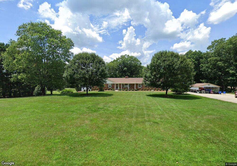
About This Home
This home is located at 1339 Pilot Westfield Rd, Pilot Mountain, NC 27041 and is currently estimated at $319,309, approximately $138 per square foot. 1339 Pilot Westfield Rd is a home located in Stokes County with nearby schools including Nancy Reynolds Elementary School, Piney Grove Middle, and North Stokes High.
Ownership History
We collect this data history from publicly available records. To have your information removed, we recommend requesting removal directly through your county’s website.
Purchase Details
Purchase Details
Purchase History
We collect this data history from publicly available records. To have your information removed, we recommend requesting removal directly through your county’s website.
| Date | Buyer | Sale Price | Title Company |
|---|---|---|---|
| -- | None Listed On Document | ||
| -- | Attorney |
Tax History
We collect this data history from publicly available records. To have your information removed, we recommend requesting removal directly through your county’s website.
| Year | Tax Paid | Tax Assessment Tax Assessment Total Assessment is a certain percentage of the fair market value that is determined by local assessors to be the total taxable value of land and additions on the property. | Land | Improvement |
|---|---|---|---|---|
| 2025 | $2,294 | $320,900 | $38,100 | $282,800 |
| 2024 | $2,294 | $210,800 | $29,600 | $181,200 |
| 2023 | $1,707 | $210,800 | $29,600 | $181,200 |
| 2022 | $1,560 | $210,800 | $29,600 | $181,200 |
| 2021 | $1,560 | $210,800 | $29,600 | $181,200 |
| 2020 | $1,353 | $182,900 | $32,300 | $150,600 |
| 2019 | $125 | $182,900 | $32,300 | $150,600 |
| 2018 | $1,353 | $182,900 | $32,300 | $150,600 |
| 2017 | $1,344 | $182,900 | $32,300 | $150,600 |
| 2016 | $1,311 | $178,400 | $32,300 | $146,100 |
| 2015 | $1,302 | $178,400 | $32,300 | $146,100 |
| 2014 | $1,338 | $178,400 | $32,300 | $146,100 |
Map
- 4075 E Nc Highway 268
- 1369 Brims Grove Rd
- 1709 Bud Tilley Rd
- 1202 Farm Rd
- 2513 Nc 268 Hwy
- 1075 Atkins Ln
- 1661 King Rd
- 2007 Old Mill Rd
- 3-4 Old Mill Rd
- 2008 Old Mill Rd
- 6 Old Mill Rd
- 482 Carson Rd
- 1072 Grassy Knob Rd
- 624 E 52 Bypass
- 00 Jackson Rd
- 1119 Brown Mountain Rd
- 528 E Main St
- 103 Howard St
- 0 Dearmin Rd Unit 1210255
- 213 Old Westfield Rd
- 1371 Pilot Westfield Rd
- 1321 Pilot Westfield Rd
- 1309 Pilot Westfield Rd
- 1324 Pilot Westfield Rd
- 1381 Pilot Westfield Rd
- 1340 Pilot Westfield Rd
- 1277 Pilot Westfield Rd
- 1036 Mitchell Rd
- 1030 Linville Dr
- 1334 Pilot Westfield Rd
- 1292 Pilot Westfield Rd
- 1280 Pilot Westfield Rd
- 1010 Chuck Dr
- 1253 Pilot Westfield Rd
- 1253 Pilot-Westfield Rd
- 1055 Walker Ln
- 1040 Chuck Dr
- 1030 Chuck Dr
- 1065 Chuck Dr
- 1482 Pilot Westfield Rd
Ask me questions while you tour the home.