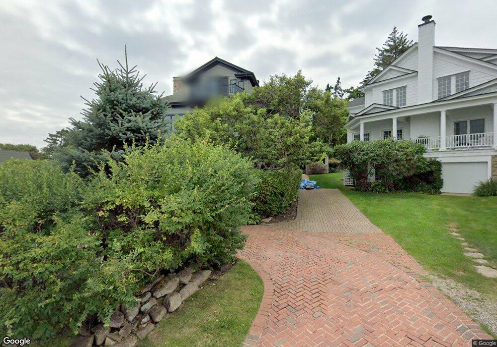
134 Israel Head Rd Ogunquit, ME 03907
Ogunquit NeighborhoodEstimated Value: $2,456,000 - $3,780,000
4
Beds
4
Baths
3,356
Sq Ft
$896/Sq Ft
Est. Value
About This Home
This home is located at 134 Israel Head Rd, Ogunquit, ME 03907 and is currently estimated at $3,007,121, approximately $896 per square foot. 134 Israel Head Rd is a home located in York County with nearby schools including Wells Junior High School, Wells Elementary School, and Wells High School.
Ownership History
Date
Name
Owned For
Owner Type
Purchase Details
Closed on
Sep 19, 2024
Sold by
Bresnahan Nancy E
Bought by
Coburn Melissa B and Coburn Thomas I
Current Estimated Value
Purchase Details
Closed on
Sep 8, 2008
Sold by
Bresnahan Nancy E
Bought by
Bresnahan Thomas J and Bresnahan Nancy E
Create a Home Valuation Report for This Property
The Home Valuation Report is an in-depth analysis detailing your home's value as well as a comparison with similar homes in the area
Home Values in the Area
Average Home Value in this Area
Purchase History
| Date | Buyer | Sale Price | Title Company |
|---|---|---|---|
| Coburn Melissa B | -- | None Available | |
| Coburn Melissa B | -- | None Available | |
| Bresnahan Thomas J | -- | -- | |
| Bresnahan Thomas J | -- | -- |
Source: Public Records
Tax History
| Year | Tax Paid | Tax Assessment Tax Assessment Total Assessment is a certain percentage of the fair market value that is determined by local assessors to be the total taxable value of land and additions on the property. | Land | Improvement |
|---|---|---|---|---|
| 2024 | $21,760 | $3,368,400 | $2,754,500 | $613,900 |
| 2023 | $21,760 | $3,368,400 | $2,754,500 | $613,900 |
| 2022 | $21,288 | $3,368,400 | $2,754,500 | $613,900 |
| 2021 | $19,788 | $2,499,800 | $1,967,400 | $532,400 |
| 2020 | $19,350 | $2,499,800 | $1,967,400 | $532,400 |
| 2019 | $19,998 | $2,499,800 | $1,967,400 | $532,400 |
| 2018 | $19,762 | $2,498,300 | $1,967,400 | $530,900 |
| 2017 | $16,583 | $2,187,700 | $1,656,800 | $530,900 |
| 2016 | $17,317 | $2,140,500 | $1,656,800 | $483,700 |
| 2015 | $17,274 | $2,140,500 | $1,656,800 | $483,700 |
| 2014 | $16,563 | $2,134,400 | $1,656,800 | $477,600 |
Source: Public Records
Map
Nearby Homes
- 55 Israel Head Rd Unit 203
- 67 Cherry Ln
- 15 Cooley Ln
- 0 Cooley Ln
- 200 Shore Rd
- 50 Shore Rd Unit 2
- 50 Shore Rd Unit 1
- 413 Shore Rd
- 25 Shore Rd Unit A
- 20 Shore Rd Unit 2A,B,C,D
- 35 Main St Unit 9
- 14 Valleybrook Rd Unit 14
- 444 Main St Unit 112
- 488 Main St Unit 7
- 14 Maple St
- 350 Pine Hill Rd
- 1 Ruby Rd
- 718 Main St Unit A3
- 20 Zoe's Way
- 22 Adams Ln
- 122 Israel Head Rd
- 159 Stearns Rd
- 116 Israel Head Rd
- 155 Stearns Rd
- 166 Stearns Rd
- 119 Israel Head Rd
- 112 Israel Head Rd
- 111 Israel Head Rd
- 11 Lighthouse View
- 108 Israel Head Rd
- 18 Briar Bank Rd
- 123 Ledge Rd
- 105 Israel Head Rd
- 20 Briar Bank Rd
- 15 Lighthouse View
- 139 Stearns Rd
- 104 Israel Head Rd
- 140 Stearns Rd
- 96 Israel Head Rd
- 15 Atlantic Ln
Your Personal Tour Guide
Ask me questions while you tour the home.