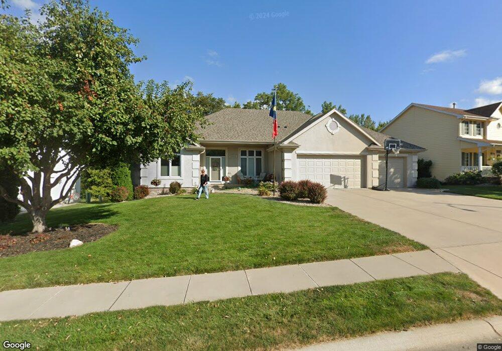
13411 S 20th St Bellevue, NE 68123
Estimated Value: $434,000 - $583,000
1
Bed
4
Baths
2,104
Sq Ft
$242/Sq Ft
Est. Value
About This Home
This home is located at 13411 S 20th St, Bellevue, NE 68123 and is currently estimated at $508,642, approximately $241 per square foot. 13411 S 20th St is a home located in Sarpy County with nearby schools including Fairview Elementary School, Bellevue Mission Middle School, and Bellevue West High School.
Ownership History
Date
Name
Owned For
Owner Type
Purchase Details
Closed on
Dec 9, 2020
Sold by
Giles Steven E and Giles Debra M
Bought by
Debra M Giles Living Trust and Giles
Current Estimated Value
Purchase Details
Closed on
Jun 23, 2000
Sold by
Giles Debra M
Bought by
Giles Steven E and Giles Debra M
Home Financials for this Owner
Home Financials are based on the most recent Mortgage that was taken out on this home.
Original Mortgage
$180,000
Interest Rate
8.5%
Purchase Details
Closed on
May 20, 1999
Sold by
R S Land Inc
Bought by
Giles Debra M and Debra M Giles Living Trust
Create a Home Valuation Report for This Property
The Home Valuation Report is an in-depth analysis detailing your home's value as well as a comparison with similar homes in the area
Home Values in the Area
Average Home Value in this Area
Purchase History
| Date | Buyer | Sale Price | Title Company |
|---|---|---|---|
| Debra M Giles Living Trust | -- | None Listed On Document | |
| Giles Steven E | -- | -- | |
| Giles Debra M | $41,000 | -- |
Source: Public Records
Mortgage History
| Date | Status | Borrower | Loan Amount |
|---|---|---|---|
| Previous Owner | Giles Steven E | $180,000 |
Source: Public Records
Tax History
| Year | Tax Paid | Tax Assessment Tax Assessment Total Assessment is a certain percentage of the fair market value that is determined by local assessors to be the total taxable value of land and additions on the property. | Land | Improvement |
|---|---|---|---|---|
| 2025 | $8,673 | $521,665 | $72,000 | $449,665 |
| 2024 | $9,327 | $495,032 | $72,000 | $423,032 |
| 2023 | $9,327 | $441,719 | $67,000 | $374,719 |
| 2022 | $8,475 | $393,826 | $62,000 | $331,826 |
| 2021 | $8,010 | $368,235 | $62,000 | $306,235 |
| 2020 | $7,780 | $356,540 | $62,000 | $294,540 |
| 2019 | $7,737 | $344,633 | $52,000 | $292,633 |
| 2018 | $7,361 | $336,489 | $52,000 | $284,489 |
| 2017 | $7,351 | $333,228 | $52,000 | $281,228 |
| 2016 | $7,098 | $328,435 | $52,000 | $276,435 |
| 2015 | $6,810 | $321,731 | $52,000 | $269,731 |
| 2014 | $6,567 | $302,606 | $47,000 | $255,606 |
| 2012 | -- | $305,861 | $47,000 | $258,861 |
Source: Public Records
Map
Nearby Homes
- 2205 Whitted Dr
- 13801 S 22nd Cir
- 2303 Coventry Dr
- 13702 Leona Ln
- 0000 Cedar Island Road East of Old 36th St
- 13613 S 14th St
- 14106 S 21st St
- 2705 Arrowhead Ln
- 14106 S 18th St
- 14204 S 18th St
- 14002 Tregaron Ridge Ave Unit B
- 2711 Lynnwood Dr
- 13805 Kelly Dr
- 13910 Kelly Dr
- 14313 S 20th St
- 2924 Blackhawk Cir
- 12901 S 29th St
- 2915 Daniell Cir
- 2917 Daniell Cir
- 3004 Lone Tree Rd
- 13409 S 20th St
- 13501 S 20th St
- 13407 S 20th St
- 13503 S 20th St
- 13410 S 20th St
- 13408 S 20th St
- 13502 S 20th St
- 13406 S 20th St
- 13504 S 20th St
- 13405 S 20th St
- 13505 S 20th St
- 13506 S 20th St
- 2105 Greenwald St
- 13409 S 22nd St
- 13403 S 20th St
- 13501 S 22nd St
- 13507 S 20th St
- 13508 S 20th St
- 13503 S 22nd St
- 2006 Greenwald St
Your Personal Tour Guide
Ask me questions while you tour the home.