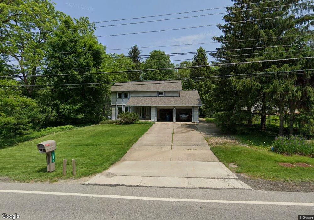
1343 Barlow Rd Hudson, OH 44236
Estimated Value: $390,849 - $446,000
4
Beds
3
Baths
2,146
Sq Ft
$195/Sq Ft
Est. Value
About This Home
This home is located at 1343 Barlow Rd, Hudson, OH 44236 and is currently estimated at $419,462, approximately $195 per square foot. 1343 Barlow Rd is a home located in Summit County with nearby schools including Ellsworth Hill Elementary School, East Woods Intermediate School, and Hudson Middle School.
Ownership History
Date
Name
Owned For
Owner Type
Purchase Details
Closed on
Aug 7, 2019
Sold by
Phillips Ronald L and Phillips Donna D
Bought by
Phillips Ronald L and Phillips Donna D
Current Estimated Value
Create a Home Valuation Report for This Property
The Home Valuation Report is an in-depth analysis detailing your home's value as well as a comparison with similar homes in the area
Home Values in the Area
Average Home Value in this Area
Purchase History
| Date | Buyer | Sale Price | Title Company |
|---|---|---|---|
| Phillips Ronald L | -- | None Available |
Source: Public Records
Tax History
| Year | Tax Paid | Tax Assessment Tax Assessment Total Assessment is a certain percentage of the fair market value that is determined by local assessors to be the total taxable value of land and additions on the property. | Land | Improvement |
|---|---|---|---|---|
| 2024 | $5,710 | $111,944 | $13,377 | $98,567 |
| 2023 | $5,710 | $111,944 | $13,377 | $98,567 |
| 2022 | $4,485 | $78,281 | $9,352 | $68,929 |
| 2021 | $4,492 | $78,281 | $9,352 | $68,929 |
| 2020 | $4,413 | $78,280 | $9,350 | $68,930 |
| 2019 | $4,009 | $65,740 | $16,810 | $48,930 |
| 2018 | $3,994 | $65,740 | $16,810 | $48,930 |
| 2017 | $4,107 | $65,740 | $16,810 | $48,930 |
| 2016 | $4,136 | $65,740 | $16,810 | $48,930 |
| 2015 | $4,107 | $65,740 | $16,810 | $48,930 |
| 2014 | $4,118 | $65,740 | $16,810 | $48,930 |
| 2013 | $4,230 | $65,980 | $16,810 | $49,170 |
Source: Public Records
Map
Nearby Homes
- 5782 Holland Dr
- 186 S Main St
- 5866 Ogilby Dr
- 54 E Case Dr
- 85 Maple Dr
- 6101 Independence Dr
- 3 Hudson Common Dr Unit 3
- 12 N Oviatt St
- 20 Stratford Rd
- 77 Atterbury Blvd Unit 308
- 77 Atterbury Blvd Unit 107
- 43 N Oviatt St
- 479 W Streetsboro St Unit B
- 213 E Streetsboro St
- 5123 Sodalite Dr
- 128 Hudson St
- V/L Norton Rd
- 5026 Portland Cove
- 5091 Ridge Meadow Dr
- 235 Bridgewater Cir
- 1329 Barlow Rd
- 5796 Holland Dr
- 1317 Barlow Rd
- 5781 Holland Dr
- 5806 Holland Dr
- 1342 Barlow Rd
- 1330 Barlow Rd
- 5795 Holland Dr
- 1360 Barlow Rd
- 1303 Barlow Rd
- 1379 Barlow Rd
- 1379 Barlow Rd Unit 4
- 1379 Barlow Rd Unit 1
- 1379 Barlow Rd Unit 2
- 1379 Barlow Rd Unit 3
- 5818 Holland Dr
- 1376 Faymont Dr
- 1370 Barlow Rd
- 5830 Holland Dr
- 1289 Barlow Rd
Your Personal Tour Guide
Ask me questions while you tour the home.