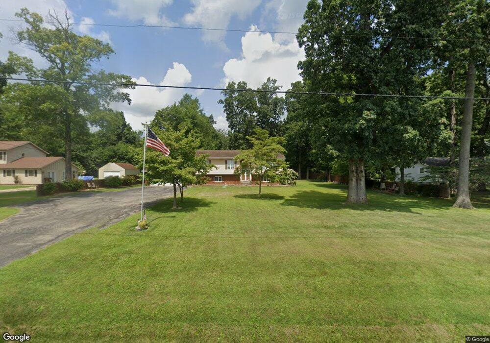
1346 E Gorman Rd Adrian, MI 49221
Estimated Value: $285,432 - $365,000
4
Beds
3
Baths
2,950
Sq Ft
$106/Sq Ft
Est. Value
About This Home
This home is located at 1346 E Gorman Rd, Adrian, MI 49221 and is currently estimated at $313,358, approximately $106 per square foot. 1346 E Gorman Rd is a home located in Lenawee County with nearby schools including Ruth McGregor Elementary School and Sand Creek High School.
Ownership History
Date
Name
Owned For
Owner Type
Purchase Details
Closed on
Feb 6, 2007
Sold by
Fannie Mae
Bought by
Carter Michael and Carter Dawn E
Current Estimated Value
Home Financials for this Owner
Home Financials are based on the most recent Mortgage that was taken out on this home.
Original Mortgage
$154,000
Outstanding Balance
$92,598
Interest Rate
6.23%
Mortgage Type
New Conventional
Estimated Equity
$220,760
Purchase Details
Closed on
Apr 20, 2006
Sold by
Royal Keith W
Bought by
Sky Bank
Create a Home Valuation Report for This Property
The Home Valuation Report is an in-depth analysis detailing your home's value as well as a comparison with similar homes in the area
Home Values in the Area
Average Home Value in this Area
Purchase History
| Date | Buyer | Sale Price | Title Company |
|---|---|---|---|
| Carter Michael | $154,000 | None Available | |
| Sky Bank | $305,156 | None Available |
Source: Public Records
Mortgage History
| Date | Status | Borrower | Loan Amount |
|---|---|---|---|
| Open | Carter Michael | $154,000 |
Source: Public Records
Tax History
| Year | Tax Paid | Tax Assessment Tax Assessment Total Assessment is a certain percentage of the fair market value that is determined by local assessors to be the total taxable value of land and additions on the property. | Land | Improvement |
|---|---|---|---|---|
| 2025 | $2,473 | $136,300 | $0 | $0 |
| 2024 | $10 | $118,800 | $0 | $0 |
| 2022 | $910 | $102,900 | $0 | $0 |
| 2021 | $2,172 | $99,800 | $0 | $0 |
| 2020 | $2,143 | $93,500 | $0 | $0 |
| 2019 | $218,252 | $81,400 | $0 | $0 |
| 2018 | $2,283 | $81,427 | $0 | $0 |
| 2017 | $3,551 | $77,744 | $0 | $0 |
| 2016 | $3,442 | $72,530 | $0 | $0 |
| 2014 | -- | $74,411 | $0 | $0 |
Source: Public Records
Map
Nearby Homes
- 1168 Seneca St
- 4703 Treat Hwy
- 8250 Treat Hwy
- 2329 Wood Ridge Dr
- 3822 Sharp Rd
- 324 Grand River Dr
- 1 Yukon River Ct
- 1883 Harold St
- 2171 Harold St
- 2048 Richards St
- 2090 Richards St
- 5000 BLK LOT B S Adrian Hwy
- 5000 BLK LOT C S Adrian Hwy
- 2303 Lakewood Dr
- 1702 Lakewood Dr Unit B
- 1639 Rivers Edge Ct
- 1637 Rivers Edge Ct
- 260 Storr
- 264 Storr
- 211 Tiffany
- 1320 E Gorman Rd
- 1372 E Gorman Rd
- 1200 BLK E Gorman Rd
- 1408 E Gorman Rd
- 1420 E Gorman Rd
- 1224 E Gorman Rd
- 1494 E Gorman Rd
- 1493 E Gorman Rd
- 1510 E Gorman Rd
- 1510 E Gorman Rd Unit FORREST VIEW
- 1510 E Gorman Rd Unit GORMAN
- 1174 E Gorman Rd
- 1327 Shumway Rd
- 1189 E Gorman Rd
- 1108 E Gorman Rd
- 1080 E Gorman Rd
- 6601 S Adrian Hwy
- 1331 Shumway Rd
- 1518 E Gorman Rd
- 6677 S Adrian Hwy
Your Personal Tour Guide
Ask me questions while you tour the home.