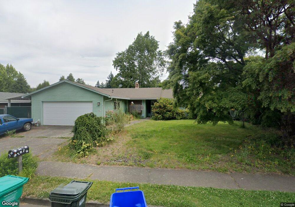
1356 NE Barnes Ct Gresham, OR 97030
Northeast Gresham NeighborhoodEstimated Value: $432,000 - $517,000
3
Beds
3
Baths
1,564
Sq Ft
$293/Sq Ft
Est. Value
About This Home
This home is located at 1356 NE Barnes Ct, Gresham, OR 97030 and is currently estimated at $458,683, approximately $293 per square foot. 1356 NE Barnes Ct is a home located in Multnomah County with nearby schools including Hall Elementary School, Gordon Russell Middle School, and Sam Barlow High School.
Ownership History
Date
Name
Owned For
Owner Type
Purchase Details
Closed on
May 17, 2021
Sold by
Green Larry Aimo and Green Marva Jean
Bought by
Cano Joel R and Tongren Michelle L
Current Estimated Value
Home Financials for this Owner
Home Financials are based on the most recent Mortgage that was taken out on this home.
Original Mortgage
$384,408
Outstanding Balance
$347,628
Interest Rate
3.1%
Mortgage Type
FHA
Estimated Equity
$111,055
Purchase Details
Closed on
Dec 14, 2016
Sold by
Green Marva
Bought by
Green Larry Aimo and Green Marva Jean
Purchase Details
Closed on
Jul 10, 2015
Sold by
Green Larry Aimo
Bought by
Kalinoski Marva Jean
Home Financials for this Owner
Home Financials are based on the most recent Mortgage that was taken out on this home.
Original Mortgage
$168,600
Interest Rate
3.83%
Mortgage Type
Seller Take Back
Purchase Details
Closed on
Sep 5, 2003
Sold by
Casey John G
Bought by
Green Larry Aimo and Green Janet Lynn
Home Financials for this Owner
Home Financials are based on the most recent Mortgage that was taken out on this home.
Original Mortgage
$160,630
Interest Rate
5.87%
Mortgage Type
FHA
Purchase Details
Closed on
May 30, 2000
Sold by
Casey John G
Bought by
Casey John G and Casey Karen E
Home Financials for this Owner
Home Financials are based on the most recent Mortgage that was taken out on this home.
Original Mortgage
$110,000
Interest Rate
8.18%
Mortgage Type
Purchase Money Mortgage
Purchase Details
Closed on
May 26, 2000
Sold by
Klopfenstein Gene A
Bought by
Casey John G
Home Financials for this Owner
Home Financials are based on the most recent Mortgage that was taken out on this home.
Original Mortgage
$110,000
Interest Rate
8.18%
Mortgage Type
Purchase Money Mortgage
Purchase Details
Closed on
Mar 15, 1996
Sold by
Robinson Gregory E
Bought by
Klopfenstein Gene A
Home Financials for this Owner
Home Financials are based on the most recent Mortgage that was taken out on this home.
Original Mortgage
$68,000
Interest Rate
7.01%
Mortgage Type
Purchase Money Mortgage
Create a Home Valuation Report for This Property
The Home Valuation Report is an in-depth analysis detailing your home's value as well as a comparison with similar homes in the area
Home Values in the Area
Average Home Value in this Area
Purchase History
| Date | Buyer | Sale Price | Title Company |
|---|---|---|---|
| Cano Joel R | $391,500 | First American | |
| Green Larry Aimo | -- | None Available | |
| Kalinoski Marva Jean | $243,600 | None Available | |
| Green Larry Aimo | $162,900 | Stewart Title | |
| Casey John G | -- | First American Title Co | |
| Casey John G | $150,000 | First American Title Co | |
| Klopfenstein Gene A | $126,250 | Fidelity National Title Co |
Source: Public Records
Mortgage History
| Date | Status | Borrower | Loan Amount |
|---|---|---|---|
| Open | Cano Joel R | $384,408 | |
| Previous Owner | Kalinoski Marva Jean | $168,600 | |
| Previous Owner | Green Larry Aimo | $160,630 | |
| Previous Owner | Casey John G | $110,000 | |
| Previous Owner | Klopfenstein Gene A | $68,000 | |
| Closed | Green Larry Aimo | $6,425 |
Source: Public Records
Tax History
| Year | Tax Paid | Tax Assessment Tax Assessment Total Assessment is a certain percentage of the fair market value that is determined by local assessors to be the total taxable value of land and additions on the property. | Land | Improvement |
|---|---|---|---|---|
| 2025 | $4,861 | $238,870 | -- | -- |
| 2024 | $4,653 | $231,920 | -- | -- |
| 2023 | $4,239 | $225,170 | $0 | $0 |
| 2022 | $4,121 | $218,620 | $0 | $0 |
| 2021 | $4,017 | $212,260 | $0 | $0 |
| 2020 | $3,780 | $206,080 | $0 | $0 |
| 2019 | $3,681 | $200,080 | $0 | $0 |
| 2018 | $3,510 | $194,260 | $0 | $0 |
| 2017 | $3,368 | $188,610 | $0 | $0 |
| 2016 | $2,969 | $183,120 | $0 | $0 |
| 2015 | $2,905 | $177,790 | $0 | $0 |
| 2014 | $2,834 | $172,620 | $0 | $0 |
Source: Public Records
Map
Nearby Homes
- 4055 NE 13th Terrace
- 4117 NE 8th St Unit 9
- 1480 NE Kane Dr
- 685 NE Paloma Ave
- 1465 NE Kane Dr Unit 4
- 1601 NE Hale Place Unit 2
- 1553 NE Hale Place Unit 1
- 2505 SE Troutdale Rd
- 2980 NE Division St Unit 31
- 2980 NE Division St Unit 13
- 2980 NE Division St Unit 43
- 2941 NE 13th St Unit 22
- 499 NE Williams Rd
- 3454 NE 5th Ct
- 4031 SE Knarr Cir
- 4111 NE 3rd St
- 845 SE 48th St
- 3825 NE 2nd St
- 1350 NE Cochran Dr
- 275 NE Scott Dr
- 1324 NE Barnes Ct
- 1368 NE Barnes Ct
- 1327 NE Paloma Ave
- 1367 NE Paloma Ave
- 1307 NE Paloma Ave
- 1353 NE Barnes Ct
- 1417 NE Paloma Ave
- 1288 NE Barnes Ct
- 1325 NE Barnes Ct
- 1438 NE Barnes Ct
- 1297 NE Paloma Ave
- 1475 NE Barnes Relisting
- 1326 NE Paloma Ave
- 1457 NE Paloma Ave
- 1475 NE Barnes Ct
- 1346 NE Paloma Ave
- 1278 NE Barnes Ct
- 1277 NE Paloma Ave
- 1291 NE Barnes Ct
Your Personal Tour Guide
Ask me questions while you tour the home.