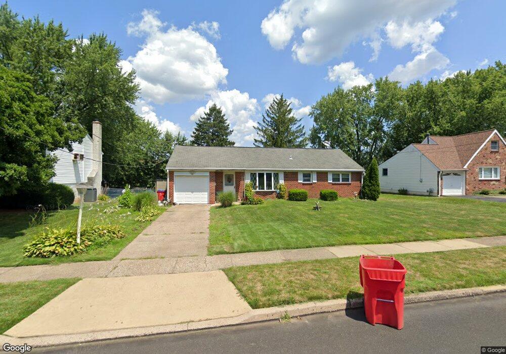
1357 Foster Rd Warminster, PA 18974
Estimated Value: $324,560 - $427,000
Studio
1
Bath
1,133
Sq Ft
$343/Sq Ft
Est. Value
About This Home
This home is located at 1357 Foster Rd, Warminster, PA 18974 and is currently estimated at $388,640, approximately $343 per square foot. 1357 Foster Rd is a home located in Bucks County with nearby schools including Willow Dale Elementary School, Log College Middle School, and William Tennent High School.
Ownership History
Date
Name
Owned For
Owner Type
Purchase Details
Closed on
Aug 25, 2008
Sold by
Manogue Evelyn L
Bought by
Manogue Evelyn L
Current Estimated Value
Home Financials for this Owner
Home Financials are based on the most recent Mortgage that was taken out on this home.
Original Mortgage
$382,500
Outstanding Balance
$217,493
Interest Rate
3.68%
Mortgage Type
Reverse Mortgage Home Equity Conversion Mortgage
Estimated Equity
$171,147
Purchase Details
Closed on
Dec 4, 1963
Bought by
Manogue Edgar W and Manogue Evelyn L
Create a Home Valuation Report for This Property
The Home Valuation Report is an in-depth analysis detailing your home's value as well as a comparison with similar homes in the area
Home Values in the Area
Average Home Value in this Area
Purchase History
| Date | Buyer | Sale Price | Title Company |
|---|---|---|---|
| Manogue Evelyn L | -- | None Available | |
| Manogue Edgar W | -- | -- |
Source: Public Records
Mortgage History
| Date | Status | Borrower | Loan Amount |
|---|---|---|---|
| Open | Manogue Evelyn L | $382,500 |
Source: Public Records
Tax History
| Year | Tax Paid | Tax Assessment Tax Assessment Total Assessment is a certain percentage of the fair market value that is determined by local assessors to be the total taxable value of land and additions on the property. | Land | Improvement |
|---|---|---|---|---|
| 2025 | $3,715 | $17,600 | $5,200 | $12,400 |
| 2024 | $3,715 | $17,600 | $5,200 | $12,400 |
| 2023 | $3,600 | $17,600 | $5,200 | $12,400 |
| 2022 | $3,523 | $17,600 | $5,200 | $12,400 |
| 2021 | $3,441 | $17,600 | $5,200 | $12,400 |
| 2020 | $3,393 | $17,600 | $5,200 | $12,400 |
| 2019 | $3,213 | $17,600 | $5,200 | $12,400 |
| 2018 | $3,136 | $17,600 | $5,200 | $12,400 |
| 2017 | $3,044 | $17,600 | $5,200 | $12,400 |
| 2016 | $3,044 | $17,600 | $5,200 | $12,400 |
| 2015 | $3,044 | $17,600 | $5,200 | $12,400 |
| 2014 | $3,044 | $17,600 | $5,200 | $12,400 |
Source: Public Records
Map
Nearby Homes
- 168 Fairway Dr Unit 178
- 299 Kent Rd
- 203 Fairway Dr Unit 113
- 1493 Bradley Ln
- 64 Villa Dr Unit 206
- 253 Kent Rd
- 1575 W Street Rd Unit 327
- 1575 W Street Rd Unit 537
- 1575 W Street Rd Unit 429
- L:26 Street Rd
- 1728 Beacon Ln
- 103 Basswood Ct
- 381 Redbud Ct Unit 381
- 848 Roger Rd
- 1708 Triumphe Way
- 605 America Dr
- 607 America Dr
- 1171 W County Line Rd
- 931 Cornell Dr
- 602 America Dr Unit FARADAY MODEL HOME
- 1349 Foster Rd
- 1365 Foster Rd
- 1341 Foster Rd
- 1373 Foster Rd
- 1350 Mallard Cir
- 1358 Mallard Cir
- 1342 Mallard Cir
- 1356 Foster Rd
- 1348 Foster Rd
- 1333 Foster Rd
- 1364 Foster Rd
- 1340 Foster Rd
- 1366 Mallard Cir
- 1372 Foster Rd
- 1385 Foster Rd
- 1332 Foster Rd
- 1327 Foster Rd
- 441 Cooper Dr
- 1357 Nevarc Rd
- 401 Cooper Dr
Your Personal Tour Guide
Ask me questions while you tour the home.