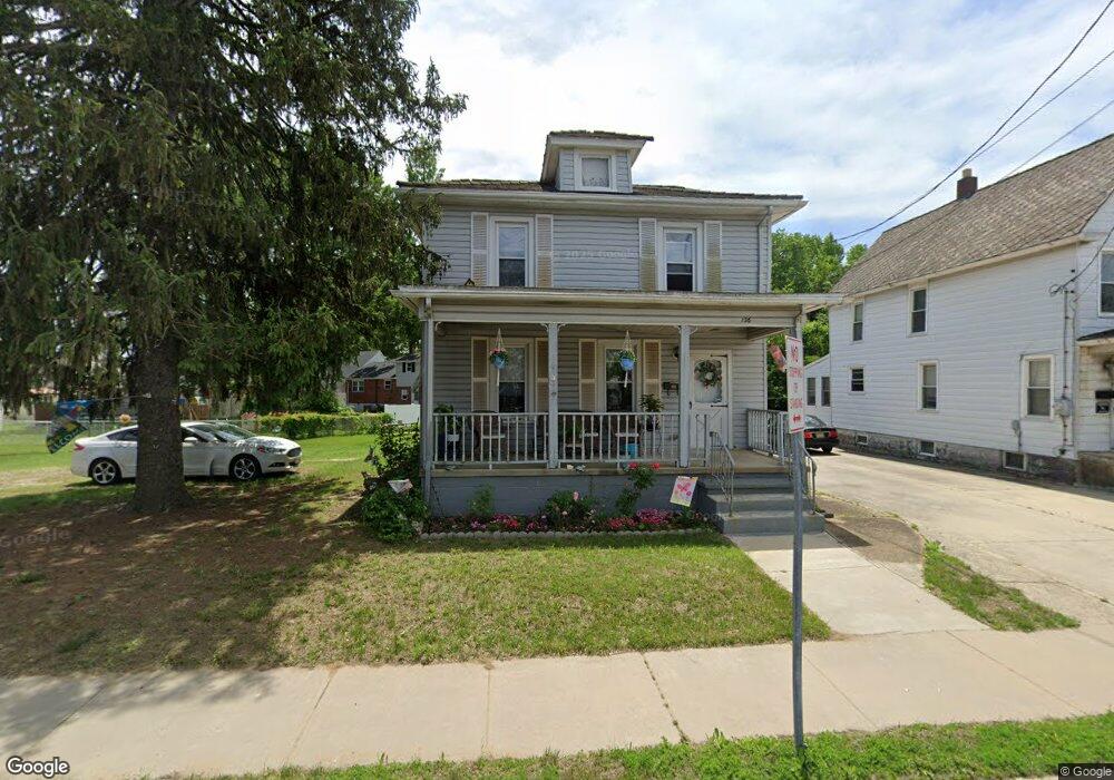
136 E Broad St Gibbstown, NJ 08027
Estimated Value: $297,000 - $336,000
4
Beds
2
Baths
1,551
Sq Ft
$203/Sq Ft
Est. Value
About This Home
This home is located at 136 E Broad St, Gibbstown, NJ 08027 and is currently estimated at $315,144, approximately $203 per square foot. 136 E Broad St is a home located in Gloucester County with nearby schools including Nehaunsey Middle School and Guardian Angels Regional School.
Ownership History
Date
Name
Owned For
Owner Type
Purchase Details
Closed on
Jan 13, 2026
Sold by
Anna Sands
Bought by
Sands Lisa
Current Estimated Value
Purchase Details
Closed on
Jan 6, 2010
Sold by
Tara Development & Investments Llc
Bought by
Sands Anna
Home Financials for this Owner
Home Financials are based on the most recent Mortgage that was taken out on this home.
Original Mortgage
$137,362
Interest Rate
4.5%
Mortgage Type
FHA
Purchase Details
Closed on
Aug 14, 2009
Sold by
Lytle Jane L and Estate Of Jane L Morris
Bought by
Tara Development & Investments Llc
Create a Home Valuation Report for This Property
The Home Valuation Report is an in-depth analysis detailing your home's value as well as a comparison with similar homes in the area
Home Values in the Area
Average Home Value in this Area
Purchase History
We collect this data history from publicly available records. To have your information removed, we recommend requesting removal directly through your county’s website.
| Date | Buyer | Sale Price | Title Company |
|---|---|---|---|
| Sands Lisa | -- | None Listed On Document | |
| Sands Anna | $140,000 | Homestead Title Agency Inc | |
| Tara Development & Investments Llc | $89,000 | Homestead Title Agency Inc |
Source: Public Records
Mortgage History
We collect this data history from publicly available records. To have your information removed, we recommend requesting removal directly through your county’s website.
| Date | Status | Borrower | Loan Amount |
|---|---|---|---|
| Previous Owner | Sands Anna | $137,362 |
Source: Public Records
Tax History
| Year | Tax Paid | Tax Assessment Tax Assessment Total Assessment is a certain percentage of the fair market value that is determined by local assessors to be the total taxable value of land and additions on the property. | Land | Improvement |
|---|---|---|---|---|
| 2025 | $4,803 | $139,500 | $25,200 | $114,300 |
| 2024 | $4,550 | $139,500 | $25,200 | $114,300 |
| 2023 | $4,550 | $139,500 | $25,200 | $114,300 |
| 2022 | $4,553 | $139,500 | $25,200 | $114,300 |
| 2021 | $4,238 | $139,500 | $25,200 | $114,300 |
| 2020 | $4,569 | $139,500 | $25,200 | $114,300 |
| 2019 | $4,571 | $139,500 | $25,200 | $114,300 |
| 2018 | $4,442 | $139,500 | $25,200 | $114,300 |
| 2017 | $4,334 | $139,500 | $25,200 | $114,300 |
| 2016 | $4,287 | $139,500 | $25,200 | $114,300 |
| 2015 | $4,149 | $139,500 | $25,200 | $114,300 |
| 2014 | $3,970 | $139,500 | $25,200 | $114,300 |
Source: Public Records
Map
Nearby Homes
- 50 E Vine St
- 44 S Market St
- 56 W Broad St
- 1479 Memorial Ave
- 438 Lock Ave
- 77 Harmony Rd
- 354 Memorial Ave
- 104 Patterson Ave
- 372 W Broad St
- 157 S Poplar St
- 452 W Broad St
- 622 W Broad St
- 126 Tomlin Station Rd
- 203 Tomlin Station Rd
- 351 Croce Ave
- 448 Thomson Ave
- 765 Willow Dr
- 400 Thomson Ave
- 403 W Broad St
- L18 20 W Broad St
- 146 E Broad St
- 150 E Broad St
- 313 Kirkbride Dr
- 307 Kirkbride Dr
- 132 E Broad St
- 154 E Broad St
- 301 Kirkbride Dr
- 143 E Broad St
- 133 E Broad St
- 149 E Broad St
- 126 E Broad St Unit 128
- 201 Ashton Dr
- 153 E Broad St
- 129 E Broad St
- 161 E Broad St
- 160 E Broad St
- 14 Bailey Ln
- 310 Kirkbride Dr
- 217 Ashton Dr
- 122 E Vine St
Your Personal Tour Guide
Ask me questions while you tour the home.