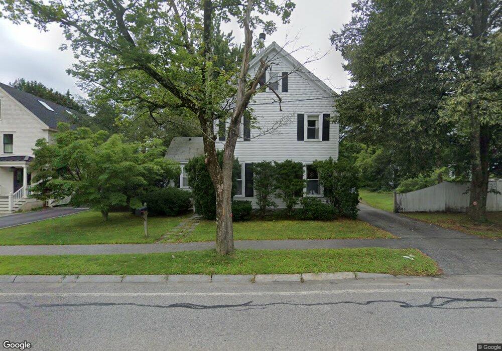
1369 Main St Concord, MA 01742
Estimated Value: $458,271 - $846,000
3
Beds
2
Baths
1,954
Sq Ft
$299/Sq Ft
Est. Value
About This Home
This home is located at 1369 Main St, Concord, MA 01742 and is currently estimated at $585,068, approximately $299 per square foot. 1369 Main St is a home located in Middlesex County with nearby schools including Thoreau Elementary School, Concord Middle School, and Concord Carlisle High School.
Ownership History
Date
Name
Owned For
Owner Type
Purchase Details
Closed on
Aug 27, 2001
Sold by
Kennedy Kevin E and Kennedy Elizabeth
Bought by
Desbecker Sharon D
Current Estimated Value
Home Financials for this Owner
Home Financials are based on the most recent Mortgage that was taken out on this home.
Original Mortgage
$152,000
Outstanding Balance
$60,221
Interest Rate
7.21%
Mortgage Type
Purchase Money Mortgage
Estimated Equity
$524,847
Purchase Details
Closed on
May 13, 1994
Sold by
King Maria
Bought by
Kennedy Kevin E and Kennedy Elizabeth
Create a Home Valuation Report for This Property
The Home Valuation Report is an in-depth analysis detailing your home's value as well as a comparison with similar homes in the area
Home Values in the Area
Average Home Value in this Area
Purchase History
We collect this data history from publicly available records. To have your information removed, we recommend requesting removal directly through your county’s website.
| Date | Buyer | Sale Price | Title Company |
|---|---|---|---|
| Desbecker Sharon D | $190,000 | -- | |
| Kennedy Kevin E | $92,600 | -- |
Source: Public Records
Mortgage History
We collect this data history from publicly available records. To have your information removed, we recommend requesting removal directly through your county’s website.
| Date | Status | Borrower | Loan Amount |
|---|---|---|---|
| Open | Kennedy Kevin E | $152,000 | |
| Previous Owner | Kennedy Kevin E | $90,000 | |
| Previous Owner | Kennedy Kevin E | $10,000 | |
| Previous Owner | Kennedy Kevin E | $91,400 |
Source: Public Records
Tax History
| Year | Tax Paid | Tax Assessment Tax Assessment Total Assessment is a certain percentage of the fair market value that is determined by local assessors to be the total taxable value of land and additions on the property. | Land | Improvement |
|---|---|---|---|---|
| 2025 | $53 | $399,800 | $0 | $399,800 |
| 2024 | $5,105 | $388,800 | $0 | $388,800 |
| 2023 | $4,885 | $376,900 | $0 | $376,900 |
| 2022 | $4,856 | $329,000 | $0 | $329,000 |
| 2021 | $4,069 | $276,400 | $0 | $276,400 |
| 2020 | $3,933 | $276,400 | $0 | $276,400 |
| 2019 | $3,885 | $273,800 | $0 | $273,800 |
| 2018 | $3,587 | $251,000 | $0 | $251,000 |
| 2017 | $3,532 | $251,000 | $0 | $251,000 |
| 2016 | $3,227 | $231,800 | $0 | $231,800 |
| 2015 | $3,100 | $216,900 | $0 | $216,900 |
Source: Public Records
Map
Nearby Homes
- 102 Highland St
- 70 McCallar Ln
- 54 Maple St
- 449 Old Marlboro Rd
- 42 Sunnyside Ln
- 37 Water St
- 1814 Main St
- 1844 Main St
- 1844 Main St Unit 1
- 56 Old Marlboro Rd
- 79-81 Assabet Ave
- 565 Elm St
- 1 Baker Ave
- 22 Hayward Mill Cir
- 696 Main St
- 127 Lee Dr
- 93 Nashoba Rd
- 497 Old Road to 9 Acre Corner
- 94 College Rd
- 244 Musterfield Rd
Your Personal Tour Guide
Ask me questions while you tour the home.