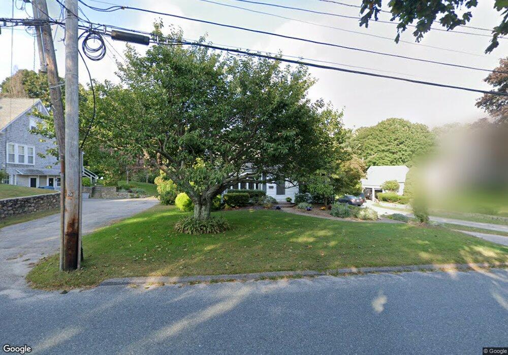
137 Kenyon Ave Wakefield, RI 02879
Estimated Value: $580,836 - $689,000
2
Beds
3
Baths
1,414
Sq Ft
$458/Sq Ft
Est. Value
About This Home
This home is located at 137 Kenyon Ave, Wakefield, RI 02879 and is currently estimated at $646,959, approximately $457 per square foot. 137 Kenyon Ave is a home located in Washington County with nearby schools including South Kingstown High School, Monsignor Matthew Clarke Catholic Regional School, and Bradley School-South.
Ownership History
Date
Name
Owned For
Owner Type
Purchase Details
Closed on
Aug 8, 1963
Bought by
Pouliot Joseph F and Pouliot Assunta G
Current Estimated Value
Create a Home Valuation Report for This Property
The Home Valuation Report is an in-depth analysis detailing your home's value as well as a comparison with similar homes in the area
Home Values in the Area
Average Home Value in this Area
Purchase History
We collect this data history from publicly available records. To have your information removed, we recommend requesting removal directly through your county’s website.
| Date | Buyer | Sale Price | Title Company |
|---|---|---|---|
| Pouliot Joseph F | -- | -- |
Source: Public Records
Mortgage History
We collect this data history from publicly available records. To have your information removed, we recommend requesting removal directly through your county’s website.
| Date | Status | Borrower | Loan Amount |
|---|---|---|---|
| Open | Pouliot Joseph F | $100,000 | |
| Closed | Pouliot Joseph F | $50,000 |
Source: Public Records
Tax History
| Year | Tax Paid | Tax Assessment Tax Assessment Total Assessment is a certain percentage of the fair market value that is determined by local assessors to be the total taxable value of land and additions on the property. | Land | Improvement |
|---|---|---|---|---|
| 2025 | $4,353 | $486,900 | $248,900 | $238,000 |
| 2024 | $4,327 | $391,600 | $191,600 | $200,000 |
| 2023 | $4,327 | $391,600 | $191,600 | $200,000 |
| 2022 | $4,288 | $391,600 | $191,600 | $200,000 |
| 2021 | $4,305 | $297,900 | $144,400 | $153,500 |
| 2020 | $4,305 | $297,900 | $144,400 | $153,500 |
| 2019 | $4,305 | $297,900 | $144,400 | $153,500 |
| 2018 | $4,086 | $260,600 | $133,300 | $127,300 |
| 2017 | $3,990 | $260,600 | $133,300 | $127,300 |
| 2016 | $3,932 | $260,600 | $133,300 | $127,300 |
| 2015 | $3,700 | $238,400 | $121,000 | $117,400 |
| 2014 | $3,690 | $238,400 | $121,000 | $117,400 |
Source: Public Records
Map
Nearby Homes
- 23 Hillcrest Rd
- 71 Kenyon Ave
- 302 Pond St
- 390 Woodruff Ave
- 50 Shadow Farm Way
- 16 Mechanic St
- 125 Woodruff Ave
- 35 Highland Ave
- 39 Hazard Ave
- 20 Cleveland St
- 10 Hendricks St
- 35 Abbey Rd
- 11 Billington Ave
- 40 Tern Rd
- 23 Rockland Dr
- 24 Tern Rd
- 37 Pleasant Ave
- 47 Tuckertown Rd
- 6 Lakewood Dr
- 16 Harrison Ave
- 145 Kenyon Ave
- 161 Kenyon Ave
- 131 Kenyon Ave
- 173 Kenyon Ave
- 154 Kenyon Ave
- 181 Kenyon Ave
- 123 Kenyon Ave
- 164 Kenyon Ave
- 79 Christopher St
- 187 Kenyon Ave
- 6 Hillcrest Rd
- 174 Kenyon Ave
- 184 Kenyon Ave
- 80 Silver Lake Ave
- 111 Kenyon Ave
- 90 Silver Lake Ave
- 69 Christopher St
- 195 Kenyon Ave
- 10 Hillcrest Rd
- 196 Kenyon Ave
Your Personal Tour Guide
Ask me questions while you tour the home.