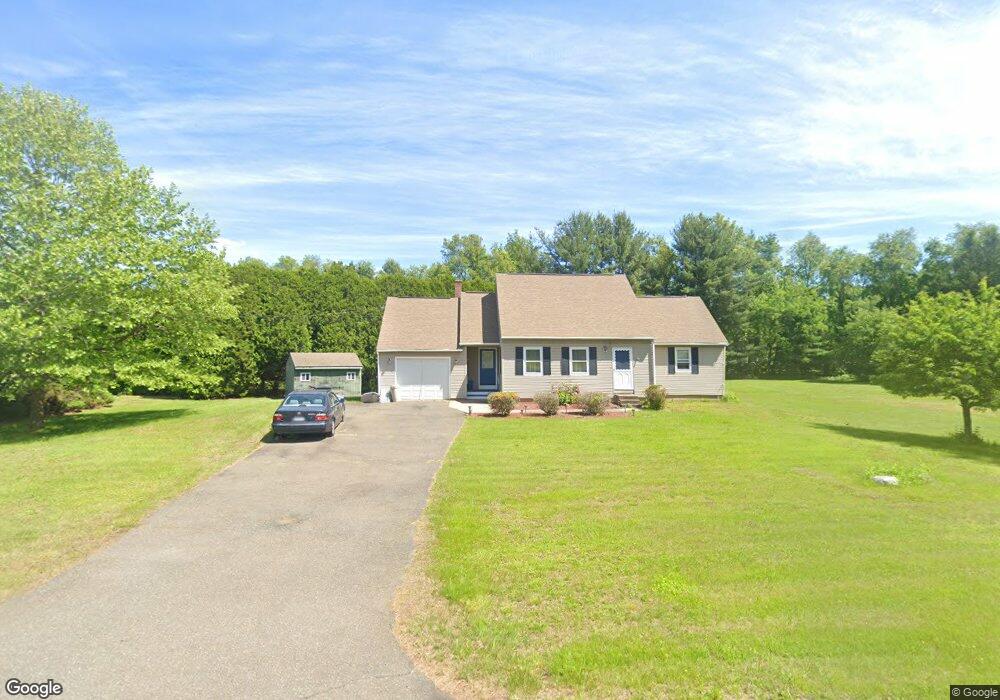
137 Whitaker Rd Westfield, MA 01085
Estimated Value: $391,000 - $530,000
3
Beds
2
Baths
1,600
Sq Ft
$286/Sq Ft
Est. Value
About This Home
This home is located at 137 Whitaker Rd, Westfield, MA 01085 and is currently estimated at $457,591, approximately $285 per square foot. 137 Whitaker Rd is a home located in Hampden County with nearby schools including Westfield High School and Saint Mary High School.
Ownership History
Date
Name
Owned For
Owner Type
Purchase Details
Closed on
Dec 16, 1993
Sold by
Sundor Brands Inc
Bought by
Cruz Jose and Cruz Loida J
Current Estimated Value
Home Financials for this Owner
Home Financials are based on the most recent Mortgage that was taken out on this home.
Original Mortgage
$121,500
Interest Rate
7.03%
Mortgage Type
Purchase Money Mortgage
Purchase Details
Closed on
Apr 20, 1993
Sold by
Aloise Elizabeth A
Bought by
Sundor Brands Inc
Purchase Details
Closed on
Mar 31, 1992
Sold by
Sperry William F and Sperry Sherrie L
Bought by
Aloise Elizabeth A
Home Financials for this Owner
Home Financials are based on the most recent Mortgage that was taken out on this home.
Original Mortgage
$130,000
Interest Rate
8.66%
Mortgage Type
Purchase Money Mortgage
Purchase Details
Closed on
Feb 22, 1989
Sold by
Forish Mitchell K
Bought by
Sperry William F
Home Financials for this Owner
Home Financials are based on the most recent Mortgage that was taken out on this home.
Original Mortgage
$111,200
Interest Rate
10.75%
Mortgage Type
Purchase Money Mortgage
Create a Home Valuation Report for This Property
The Home Valuation Report is an in-depth analysis detailing your home's value as well as a comparison with similar homes in the area
Home Values in the Area
Average Home Value in this Area
Purchase History
| Date | Buyer | Sale Price | Title Company |
|---|---|---|---|
| Cruz Jose | $122,500 | -- | |
| Sundor Brands Inc | $132,450 | -- | |
| Aloise Elizabeth A | $140,000 | -- | |
| Sperry William F | $139,000 | -- |
Source: Public Records
Mortgage History
| Date | Status | Borrower | Loan Amount |
|---|---|---|---|
| Closed | Sperry William F | $121,500 | |
| Previous Owner | Sperry William F | $130,000 | |
| Previous Owner | Sperry William F | $20,000 | |
| Previous Owner | Sperry William F | $111,200 |
Source: Public Records
Tax History
| Year | Tax Paid | Tax Assessment Tax Assessment Total Assessment is a certain percentage of the fair market value that is determined by local assessors to be the total taxable value of land and additions on the property. | Land | Improvement |
|---|---|---|---|---|
| 2025 | $5,284 | $348,100 | $139,000 | $209,100 |
| 2024 | $5,272 | $330,100 | $126,800 | $203,300 |
| 2023 | $4,996 | $306,500 | $120,700 | $185,800 |
| 2022 | $4,996 | $270,200 | $107,200 | $163,000 |
| 2021 | $4,835 | $256,100 | $101,100 | $155,000 |
| 2020 | $4,918 | $255,500 | $101,100 | $154,400 |
| 2019 | $4,803 | $244,200 | $96,300 | $147,900 |
| 2018 | $4,728 | $244,200 | $96,300 | $147,900 |
| 2017 | $4,641 | $239,000 | $97,600 | $141,400 |
| 2016 | $4,646 | $239,000 | $97,600 | $141,400 |
| 2015 | $4,485 | $241,900 | $97,600 | $144,300 |
| 2014 | $3,355 | $241,900 | $97,600 | $144,300 |
Source: Public Records
Map
Nearby Homes
- 0 Fox Hill Dr
- 150 City View Rd
- 12 Woodland Rd
- 324 Russell Rd Unit 204
- 324 Russell Rd Unit 109
- 44 Llewellyn Dr
- 26 Hayre St
- 180 Russell Rd
- 145 Honey Pot Rd
- 274 Prospect Street Extension
- 70 S Maple St
- 64 Brookline Ave
- 240 Hillside Rd
- 32 Allen Ave
- 40 Hawks Cir
- 16 Squawfield Rd
- 25 Tannery Rd Unit 6A
- 2 Sugar Maple Ln
- 42R Jefferson St
- 13 Hampden St
Your Personal Tour Guide
Ask me questions while you tour the home.