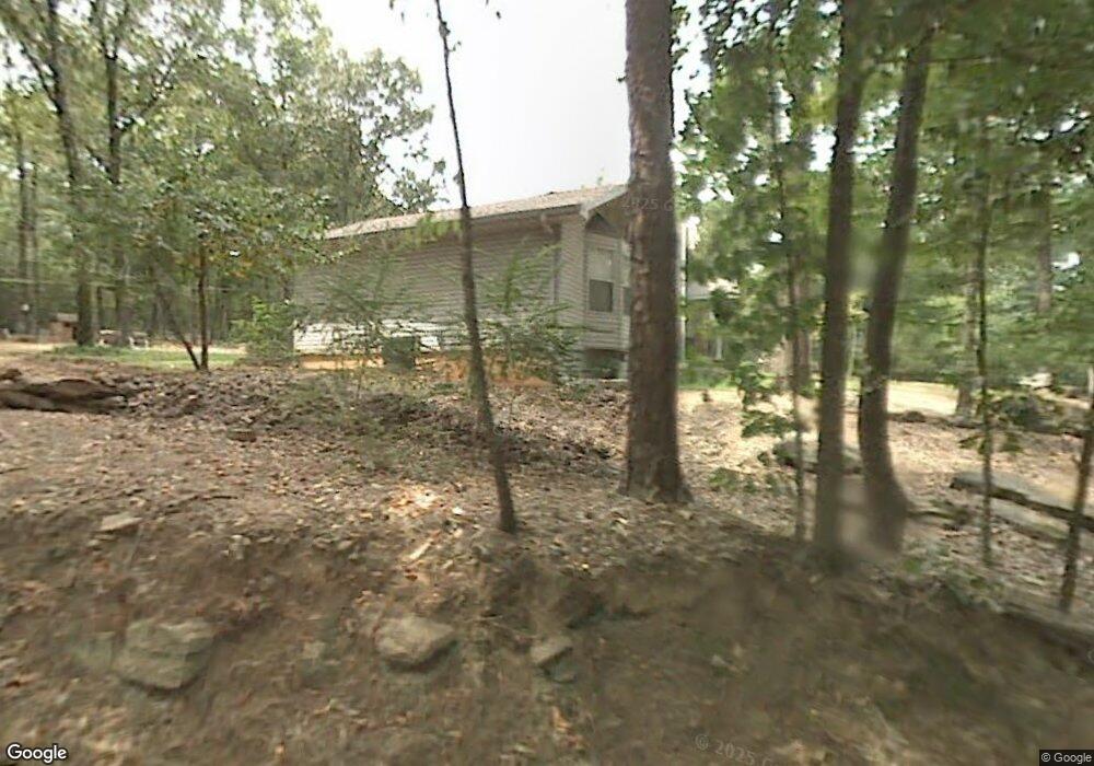
13704 Barth Rd Alexander, AR 72002
Estimated Value: $354,000 - $540,000
About This Home
This home is located at 13704 Barth Rd, Alexander, AR 72002 and is currently estimated at $442,562, approximately $152 per square foot. 13704 Barth Rd is a home located in Saline County with nearby schools including Robert L. Davis Elementary School.
Ownership History
We collect this data history from publicly available records. To have your information removed, we recommend requesting removal directly through your county’s website.
Purchase Details
Purchase Details
Home Financials for this Owner
Home Financials are based on the most recent Mortgage that was taken out on this home.Purchase Details
Purchase Details
Purchase Details
Purchase Details
Home Values in the Area
Average Home Value in this Area
Purchase History
We collect this data history from publicly available records. To have your information removed, we recommend requesting removal directly through your county’s website.
| Date | Buyer | Sale Price | Title Company |
|---|---|---|---|
| -- | None Listed On Document | ||
| -- | None Listed On Document | ||
| $220,000 | First National Title Co | ||
| -- | -- | ||
| $92,000 | -- | ||
| -- | -- | ||
| $82,000 | -- |
Mortgage History
We collect this data history from publicly available records. To have your information removed, we recommend requesting removal directly through your county’s website.
| Date | Status | Borrower | Loan Amount |
|---|---|---|---|
| Previous Owner | $198,000 |
Tax History
We collect this data history from publicly available records. To have your information removed, we recommend requesting removal directly through your county’s website.
| Year | Tax Paid | Tax Assessment Tax Assessment Total Assessment is a certain percentage of the fair market value that is determined by local assessors to be the total taxable value of land and additions on the property. | Land | Improvement |
|---|---|---|---|---|
| 2025 | $2,366 | $77,247 | $6,785 | $70,462 |
| 2024 | $2,206 | $77,247 | $6,785 | $70,462 |
| 2023 | $2,056 | $77,247 | $6,785 | $70,462 |
| 2022 | $2,056 | $77,247 | $6,785 | $70,462 |
| 2021 | $2,066 | $50,890 | $9,220 | $41,670 |
| 2020 | $2,066 | $50,890 | $9,220 | $41,670 |
| 2019 | $2,066 | $50,890 | $9,220 | $41,670 |
| 2018 | $2,091 | $50,890 | $9,220 | $41,670 |
| 2017 | $1,784 | $44,820 | $9,220 | $35,600 |
| 2016 | $1,407 | $32,240 | $7,620 | $24,620 |
| 2015 | $1,407 | $32,240 | $7,620 | $24,620 |
| 2014 | $1,122 | $29,990 | $7,620 | $22,370 |
Map
- 1007 Clinton Ct
- 00 Petit Jean Dr
- 00 Petit Jean Dr
- 3994 Mountain Crest Cir
- 14616 Woodside Place Loop
- 00 Boulder Point Dr
- 4505 Hollow Bend Dr
- 14025 Cottontail Ln
- 13032 Skyridge Cove
- 13825 Ridgecrest Dr
- 13612 Carrington Place Dr
- 13228 Hummingbird Ln
- 13815 Rockinghorse Ln
- 7024 Pearl Valley Cove
- 14908 E Azalea
- 1009 Katy Ln
- 1 Nickel Cove
- Lot 153-159 E Azalea Dr
- 14914 E Azalea Dr
- 12601 County Line Rd
- 14617 Sweet Gum Dr
- 14701 Sweet Gum Dr
- 13615 Barth Rd
- 13626 Barth Rd
- 0 Woodsgate Cove Unit 21002407
- 0 Woodsgate Cove Unit 20039319
- 0 Woodsgate Cove Unit 20036146
- 0 Woodsgate Cove Unit 20035426
- 0 Woodsgate Cove Unit 20033271
- 0 Woodsgate Cove Unit 20033247
- 0 Woodsgate Cove Unit 20032142
- 0 Woodsgate Cove Unit 20030017
- 0 Woodstream Drives Unit 20029693
- 0 Woodsgate Cove Unit 20028163
- 0 Woodsgate Cove Unit 20022543
- 0 Woodsgate Cove Unit 20021956
- 0 Woodsgate Cove Unit 20019529
- 0 Woodsgate Cove Unit 20019518
- 0 Woodsgate Cove Unit 20019050
- 0 Woodsgate Cove Unit 20019038
Ask me questions while you tour the home.