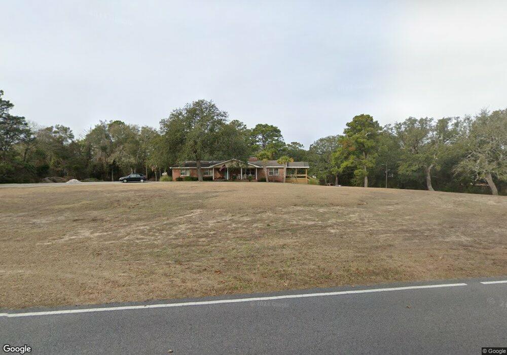
1379 E Moore St Southport, NC 28461
Estimated Value: $763,000 - $1,136,026
2
Beds
2
Baths
3,762
Sq Ft
$250/Sq Ft
Est. Value
About This Home
This home is located at 1379 E Moore St, Southport, NC 28461 and is currently estimated at $938,757, approximately $249 per square foot. 1379 E Moore St is a home located in Brunswick County with nearby schools including Southport Elementary School, South Brunswick Middle School, and South Brunswick High School.
Ownership History
Date
Name
Owned For
Owner Type
Purchase Details
Closed on
Dec 17, 2020
Sold by
Tomcho Ronald J and Dang Hanh M
Bought by
Rivenbark Jerry Edward and Rivenbark Deanna Lynn
Current Estimated Value
Home Financials for this Owner
Home Financials are based on the most recent Mortgage that was taken out on this home.
Original Mortgage
$382,500
Outstanding Balance
$268,542
Interest Rate
2.7%
Mortgage Type
Seller Take Back
Estimated Equity
$670,215
Purchase Details
Closed on
Jul 1, 1998
Bought by
Tomcho Ronald J Et Hanh
Create a Home Valuation Report for This Property
The Home Valuation Report is an in-depth analysis detailing your home's value as well as a comparison with similar homes in the area
Home Values in the Area
Average Home Value in this Area
Purchase History
| Date | Buyer | Sale Price | Title Company |
|---|---|---|---|
| Rivenbark Jerry Edward | $425,000 | None Available | |
| Tomcho Ronald J Et Hanh | -- | -- |
Source: Public Records
Mortgage History
| Date | Status | Borrower | Loan Amount |
|---|---|---|---|
| Open | Rivenbark Jerry Edward | $382,500 |
Source: Public Records
Tax History
| Year | Tax Paid | Tax Assessment Tax Assessment Total Assessment is a certain percentage of the fair market value that is determined by local assessors to be the total taxable value of land and additions on the property. | Land | Improvement |
|---|---|---|---|---|
| 2025 | $4,955 | $629,350 | $322,060 | $307,290 |
| 2024 | $47 | $629,350 | $322,060 | $307,290 |
| 2023 | $6,511 | $629,350 | $322,060 | $307,290 |
| 2022 | $6,511 | $642,120 | $316,610 | $325,510 |
| 2021 | $5,682 | $642,120 | $316,610 | $325,510 |
| 2020 | $5,312 | $642,120 | $316,610 | $325,510 |
| 2019 | $5,312 | $320,060 | $316,610 | $3,450 |
| 2018 | $4,617 | $327,270 | $323,820 | $3,450 |
| 2017 | $4,948 | $327,270 | $323,820 | $3,450 |
| 2016 | $4,595 | $327,270 | $323,820 | $3,450 |
| 2015 | $4,595 | $557,310 | $323,820 | $233,490 |
| 2014 | $3,899 | $494,253 | $323,820 | $170,433 |
Source: Public Records
Map
Nearby Homes
- 5207 White Ibis Ct
- 6108 Harbor Oaks Dr
- 5110 Hollow Tree Dr
- 5138 Fernwood Dr
- 5122 Prices Creek Dr
- 6122 River Sound Cir
- 5122 Fernwood Dr
- 109 Yaupon Dr Exd
- 6131 River Sound Cir
- 6158 River Sound Cir
- 6098 Turtlewood Dr
- 1.12 Ac Jabbertown Rd
- 136 Park Ave
- 5988 Gray Squirrel Path
- 5002 Canvasback Ct
- 1014 Softwind Way
- 1010 Softwind Way
- 2071 Rosin Dr
- 2071 Rosin Dr Unit 19
- 278 Sand Dollar Ln Unit 37
- 5205 White Ibis Ct
- 0 E Moore St
- 524 E Moore St
- 3 E Moore St
- 1203 E Moore St
- 6106 Harbor Oaks Dr
- 6104 Harbor Oaks Dr
- 5203 White Ibis Ct
- 6108 60 Harbor Oaks Dr
- 6102 Harbor Oaks Dr
- Lot 78 White Ibis Ct
- 0 White Ibis Ct
- 5201 White Ibis Ct
- 5110 Prices Creek Dr
- 6100 Harbor Oaks Dr
- 000 Jabbertown Rd
- 6098 Harbor Oaks Dr
- 5149 Fernwood Dr
- 5204 White Ibis Ct
- 1.08 Acres E Moore St
Your Personal Tour Guide
Ask me questions while you tour the home.