Estimated Value: $320,030 - $647,000
Studio
--
Bath
--
Sq Ft
6,273
Sq Ft Lot
About This Home
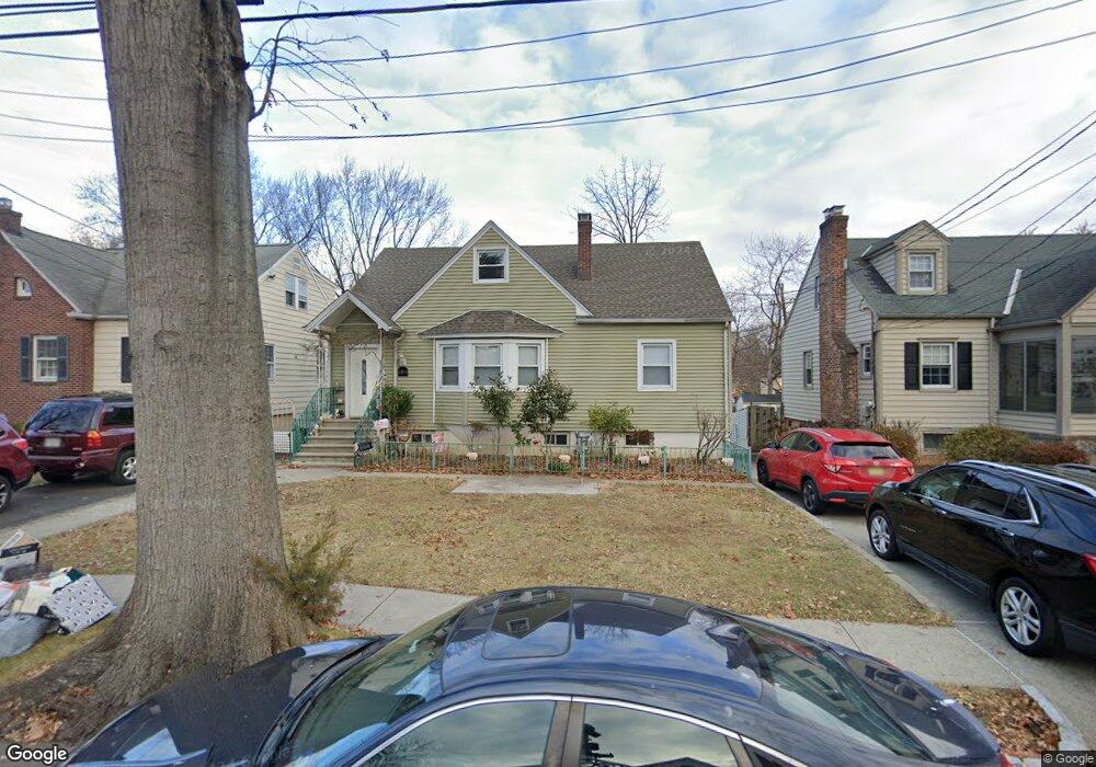
This home is located at 1381 Brookside Dr, Union, NJ 07083 and is currently estimated at $503,258. 1381 Brookside Dr is a home located in Union County with nearby schools including Livingston Elementary School and Union High School.
Ownership History
Date
Name
Owned For
Owner Type
Purchase Details
Closed on
May 30, 2001
Sold by
Willis John R and Willis Melissa J
Bought by
Deoliveira Christina
Current Estimated Value
Home Financials for this Owner
Home Financials are based on the most recent Mortgage that was taken out on this home.
Original Mortgage
$130,000
Outstanding Balance
$49,556
Interest Rate
7.15%
Estimated Equity
$453,702
Create a Home Valuation Report for This Property
The Home Valuation Report is an in-depth analysis detailing your home's value as well as a comparison with similar homes in the area
Home Values in the Area
Average Home Value in this Area
Purchase History
| Date | Buyer | Sale Price | Title Company |
|---|---|---|---|
| Deoliveira Christina | $182,000 | -- |
Source: Public Records
Mortgage History
| Date | Status | Borrower | Loan Amount |
|---|---|---|---|
| Open | Deoliveira Christina | $130,000 |
Source: Public Records
Tax History
| Year | Tax Paid | Tax Assessment Tax Assessment Total Assessment is a certain percentage of the fair market value that is determined by local assessors to be the total taxable value of land and additions on the property. | Land | Improvement |
|---|---|---|---|---|
| 2025 | $10,885 | $48,700 | $20,900 | $27,800 |
| 2024 | $10,553 | $48,700 | $20,900 | $27,800 |
| 2023 | $10,553 | $48,700 | $20,900 | $27,800 |
| 2022 | $10,186 | $48,700 | $20,900 | $27,800 |
| 2021 | $9,939 | $48,700 | $20,900 | $27,800 |
| 2020 | $9,741 | $48,700 | $20,900 | $27,800 |
| 2019 | $9,610 | $48,700 | $20,900 | $27,800 |
| 2018 | $9,446 | $48,700 | $20,900 | $27,800 |
| 2017 | $9,307 | $48,700 | $20,900 | $27,800 |
| 2016 | $9,080 | $48,700 | $20,900 | $27,800 |
| 2015 | $8,929 | $48,700 | $20,900 | $27,800 |
| 2014 | $8,729 | $48,700 | $20,900 | $27,800 |
Source: Public Records
Map
Nearby Homes
- 1393 Cornell Place
- 1090 Salem Rd
- 1453 Morris Ave
- 951 Liberty Ave
- 970 Lorraine Ave
- 980 Salem Rd
- 950 Carteret Ave
- 537 Us Highway 22
- 936 Arnet Ave
- 525 Us Highway 22
- 130 Valley View Rd
- 566 Chapman St
- 564 Chapman St
- 260 Millard Ave
- 359 Harvard Ave
- 875 Salem Rd
- 321 Sherwood Rd
- 192 Boston Ave
- 1207 S State St
- 575 Purce St
- 1385 Brookside Dr
- 1377 Brookside Dr
- 1387 Brookside Dr
- 1084 Sterling Rd
- 1084 Sterling Rd Unit 1
- 1393 Brookside Dr
- 1389 Vauxhall Rd
- 1385 Vauxhall Rd
- 1393 Vauxhall Rd
- 1388 Brookside Dr
- 1080 Sterling Rd
- 1397 Brookside Dr
- 1381 Vauxhall Rd
- 1375 Vauxhall Rd
- 1078 Sterling Rd
- 1401 Brookside Dr
- 1397 Brookfall Ave
- 1085 Sterling Rd
- 1075 Lorraine Ave
- 1371 Vauxhall Rd
Your Personal Tour Guide
Ask me questions while you tour the home.