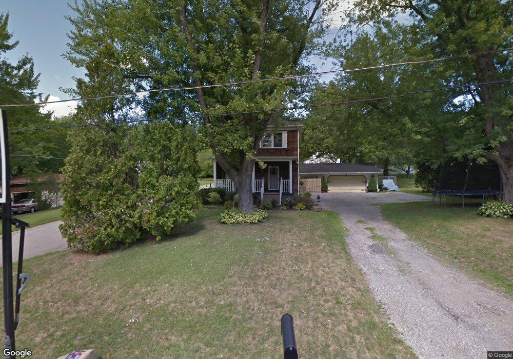
1382 Stevenson Rd Masury, OH 44438
Estimated Value: $77,000 - $162,000
2
Beds
1
Bath
1,508
Sq Ft
$75/Sq Ft
Est. Value
About This Home
This home is located at 1382 Stevenson Rd, Masury, OH 44438 and is currently estimated at $113,348, approximately $75 per square foot. 1382 Stevenson Rd is a home located in Trumbull County with nearby schools including Brookfield Elementary School, Brookfield Middle School, and Brookfield High School.
Ownership History
Date
Name
Owned For
Owner Type
Purchase Details
Closed on
Jul 18, 1996
Sold by
Boyd Bryan K
Bought by
Toro Darjo H and Toro Danielle L
Current Estimated Value
Home Financials for this Owner
Home Financials are based on the most recent Mortgage that was taken out on this home.
Original Mortgage
$57,900
Outstanding Balance
$1,294
Interest Rate
8.31%
Mortgage Type
New Conventional
Estimated Equity
$112,054
Purchase Details
Closed on
Jan 1, 1990
Bought by
Bryon Bryon K and Bryon S
Create a Home Valuation Report for This Property
The Home Valuation Report is an in-depth analysis detailing your home's value as well as a comparison with similar homes in the area
Purchase History
We collect this data history from publicly available records. To have your information removed, we recommend requesting removal directly through your county’s website.
| Date | Buyer | Sale Price | Title Company |
|---|---|---|---|
| Toro Darjo H | $62,500 | -- | |
| Bryon Bryon K | -- | -- |
Source: Public Records
Mortgage History
We collect this data history from publicly available records. To have your information removed, we recommend requesting removal directly through your county’s website.
| Date | Status | Borrower | Loan Amount |
|---|---|---|---|
| Open | Toro Darjo H | $57,900 |
Source: Public Records
Tax History
| Year | Tax Paid | Tax Assessment Tax Assessment Total Assessment is a certain percentage of the fair market value that is determined by local assessors to be the total taxable value of land and additions on the property. | Land | Improvement |
|---|---|---|---|---|
| 2025 | $1,254 | $27,170 | $1,580 | $25,590 |
| 2024 | $1,254 | $27,170 | $1,580 | $25,590 |
| 2023 | $1,252 | $27,170 | $1,580 | $25,590 |
| 2022 | $1,015 | $17,860 | $1,580 | $16,280 |
| 2021 | $951 | $17,860 | $1,580 | $16,280 |
| 2020 | $945 | $17,860 | $1,580 | $16,280 |
| 2019 | $962 | $16,950 | $1,580 | $15,370 |
| 2018 | $953 | $16,950 | $1,580 | $15,370 |
| 2017 | $952 | $16,950 | $1,580 | $15,370 |
| 2016 | $974 | $16,670 | $1,580 | $15,090 |
| 2015 | $975 | $16,670 | $1,580 | $15,090 |
| 2014 | $971 | $16,670 | $1,580 | $15,090 |
| 2013 | $1,017 | $17,790 | $1,580 | $16,210 |
Source: Public Records
Map
Nearby Homes
- 7623 Connelly Rd
- 1400 Thomas Hubbard Rd
- 7627 Catherine St
- 7839 Locust St
- 7766 Stewart Sharon Rd
- 7911 1st St
- 1017 Broadway St
- 7156 Chestnut Ridge Rd
- 6987 White Oak Dr
- 0 Addison Unit 5199691
- 6967 Tamarack Dr
- 7489 Van Ness Ave
- 0 Oakwood Dr Unit 5197641
- 1532 S Stateline Rd
- 7291 Oakwood Dr Unit B
- 711 State Route 7 SE
- 780 S Irvine Ave
- 727 S State Line Rd
- 689 S State Line Rd
- 750 S Irvine Ave
- 1372 Stevenson Rd
- 1392 Stevenson Rd
- 7542 Francis St
- 1400 Stevenson Rd
- 1379 Stevenson Rd
- 1364 Stevenson Rd
- 1397 Stevenson Rd
- 7538 Balint Ave
- 7538 Balint Ave
- 7537 Balint Ave
- 7536 Francis St
- 1367 Stevenson Rd
- 1404 Stevenson Rd
- 7526 Francis St
- 7578 Francis St
- 7545 Francis St
- 7539 Francis St
- 7539 Francis St
- 1346 Stevenson Rd
- 7586 Francis St
Your Personal Tour Guide
Ask me questions while you tour the home.