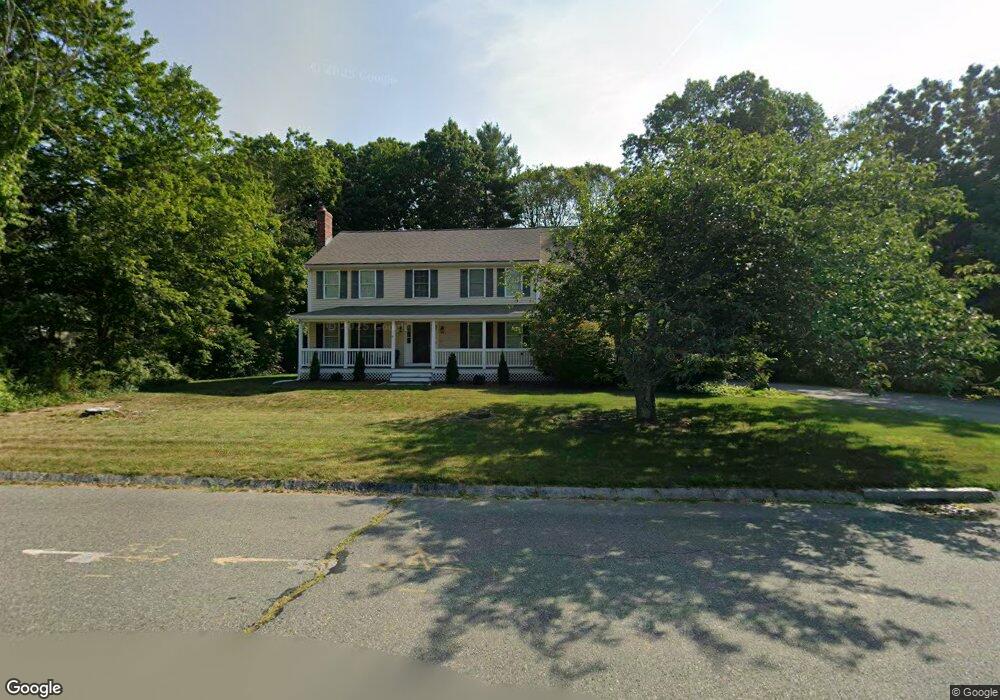
139 Pine Tree Ln Raynham, MA 02767
Estimated Value: $753,000 - $930,000
5
Beds
4
Baths
2,800
Sq Ft
$306/Sq Ft
Est. Value
About This Home
This home is located at 139 Pine Tree Ln, Raynham, MA 02767 and is currently estimated at $856,381, approximately $305 per square foot. 139 Pine Tree Ln is a home located in Bristol County with nearby schools including Merrill Elementary School, LaLiberte Elementary School, and Williams Intermediate School.
Ownership History
Date
Name
Owned For
Owner Type
Purchase Details
Closed on
Dec 7, 1998
Sold by
Ph Rt and Bumila George A
Bought by
Marasca Kenneth P and Marasca Linda M
Current Estimated Value
Home Financials for this Owner
Home Financials are based on the most recent Mortgage that was taken out on this home.
Original Mortgage
$189,000
Outstanding Balance
$42,561
Interest Rate
6.68%
Mortgage Type
Purchase Money Mortgage
Estimated Equity
$813,820
Create a Home Valuation Report for This Property
The Home Valuation Report is an in-depth analysis detailing your home's value as well as a comparison with similar homes in the area
Home Values in the Area
Average Home Value in this Area
Purchase History
| Date | Buyer | Sale Price | Title Company |
|---|---|---|---|
| Marasca Kenneth P | $85,000 | -- |
Source: Public Records
Mortgage History
| Date | Status | Borrower | Loan Amount |
|---|---|---|---|
| Open | Marasca Kenneth P | $32,000 | |
| Open | Marasca Kenneth P | $189,000 |
Source: Public Records
Tax History
| Year | Tax Paid | Tax Assessment Tax Assessment Total Assessment is a certain percentage of the fair market value that is determined by local assessors to be the total taxable value of land and additions on the property. | Land | Improvement |
|---|---|---|---|---|
| 2025 | $9,531 | $787,700 | $203,600 | $584,100 |
| 2024 | $9,335 | $751,600 | $195,800 | $555,800 |
| 2023 | $8,554 | $629,000 | $176,200 | $452,800 |
| 2022 | $8,111 | $546,900 | $156,600 | $390,300 |
| 2021 | $7,919 | $539,100 | $148,800 | $390,300 |
| 2020 | $7,768 | $539,100 | $148,800 | $390,300 |
| 2019 | $7,671 | $539,100 | $148,800 | $390,300 |
| 2018 | $7,516 | $504,400 | $148,800 | $355,600 |
| 2017 | $7,290 | $485,000 | $141,000 | $344,000 |
| 2016 | $7,217 | $481,800 | $137,800 | $344,000 |
| 2015 | $6,785 | $445,200 | $138,600 | $306,600 |
Source: Public Records
Map
Nearby Homes
- 51 Tucker Terrace
- 4 Emerald Place
- 55 Bally Dr
- 73 Raymond Ave
- 15 Carlton St
- 7 Anna St
- 532 Hill St
- 96 Old Colony Ave Unit 212
- 96 Old Colony Ave Unit 364
- 96 Old Colony Ave Unit 363
- 96 Old Colony Ave Unit 558
- 96 Old Colony Ave Unit 264
- 1 Campbell Ct
- 78 Gretchen Way
- 10 Liberty St
- 82-2-0 Middleboro Ave
- 125R Middleboro Ave
- 201 Buck Knoll Rd
- 0 Oxbow Rd Unit 20-3
- 0 Oxbow Rd Unit 39
- 123 Pine Tree Ln
- 109 Hill St
- 119 Hill St
- 105 Pine Tree Ln
- 105 Pine Tree Ln Unit 1
- 105 Pine Tree Ln Unit 2
- 120 Pine Tree Ln
- 131 Hill St
- 104 Hill St
- 81 Hill St
- 114 Hill St
- 124 Hill St
- 104 Pine Tree Ln
- 94 Hill St
- 134 Hill St
- 143 Hill St
- 93 Pine Tree Ln
- 82 Pine Tree Ln
- 48 Tucker Terrace
- 46 Tucker Terrace
Your Personal Tour Guide
Ask me questions while you tour the home.