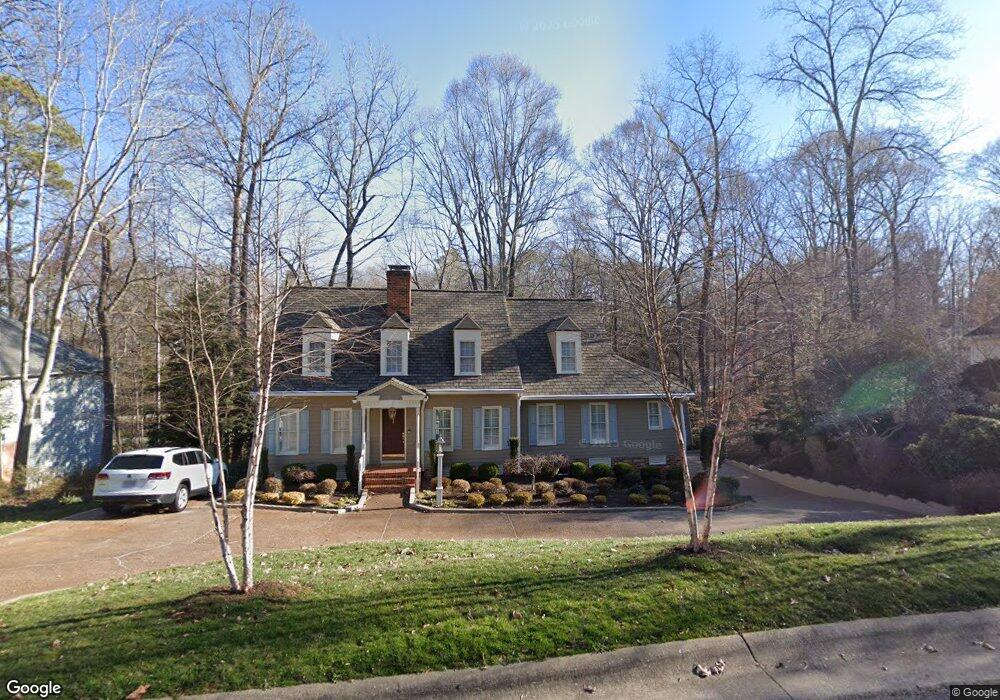
13910 N Point Rd Unit 2 Midlothian, VA 23112
Estimated Value: $494,170 - $601,000
4
Beds
2
Baths
2,978
Sq Ft
$184/Sq Ft
Est. Value
About This Home
This home is located at 13910 N Point Rd Unit 2, Midlothian, VA 23112 and is currently estimated at $546,543, approximately $183 per square foot. 13910 N Point Rd Unit 2 is a home located in Chesterfield County with nearby schools including Clover Hill Elementary School, Swift Creek Middle, and Clover Hill High.
Ownership History
Date
Name
Owned For
Owner Type
Purchase Details
Closed on
Aug 12, 2009
Sold by
Rodgers Edward F
Bought by
Ritchie John
Current Estimated Value
Home Financials for this Owner
Home Financials are based on the most recent Mortgage that was taken out on this home.
Original Mortgage
$328,932
Outstanding Balance
$216,101
Interest Rate
5.36%
Mortgage Type
FHA
Estimated Equity
$330,442
Create a Home Valuation Report for This Property
The Home Valuation Report is an in-depth analysis detailing your home's value as well as a comparison with similar homes in the area
Home Values in the Area
Average Home Value in this Area
Purchase History
| Date | Buyer | Sale Price | Title Company |
|---|---|---|---|
| Ritchie John | $335,000 | -- |
Source: Public Records
Mortgage History
| Date | Status | Borrower | Loan Amount |
|---|---|---|---|
| Open | Ritchie John | $328,932 |
Source: Public Records
Tax History
| Year | Tax Paid | Tax Assessment Tax Assessment Total Assessment is a certain percentage of the fair market value that is determined by local assessors to be the total taxable value of land and additions on the property. | Land | Improvement |
|---|---|---|---|---|
| 2025 | $4,457 | $485,000 | $79,000 | $406,000 |
| 2024 | $4,342 | $403,200 | $75,000 | $328,200 |
| 2023 | $3,514 | $386,200 | $73,000 | $313,200 |
| 2022 | $3,289 | $357,500 | $71,000 | $286,500 |
| 2021 | $3,248 | $339,300 | $69,000 | $270,300 |
| 2020 | $3,161 | $332,700 | $69,000 | $263,700 |
| 2019 | $3,209 | $337,800 | $69,000 | $268,800 |
| 2018 | $3,129 | $329,400 | $68,000 | $261,400 |
| 2017 | $3,098 | $322,700 | $68,000 | $254,700 |
| 2016 | $2,957 | $308,000 | $68,000 | $240,000 |
| 2015 | $2,794 | $288,400 | $68,000 | $220,400 |
| 2014 | $2,786 | $287,600 | $68,000 | $219,600 |
Source: Public Records
Map
Nearby Homes
- 5901 Eastbluff Ct
- 6024 Watch Harbour Rd
- 5900 Harbourwood Place
- 5601 Promontory Pointe Rd
- 5610 Long Cove Rd
- 24 Spinnaker Cove Dr
- 34 Spinnaker Cove Dr
- 14403 Shelter Cove Rd
- 14306 Trophy Buck Ct
- 14202 Branched Antler Place
- 14401 Woods Walk Ln
- 12201 Dutch Elm Cir
- 112 Water Pointe Ct
- 102 Water Pointe Ct
- 6106 Duck Cove Rd
- 7500 Flag Tail Dr
- 14309 Hancock Towns Dr
- 14423 Hancock Towns Dr
- 13805 Buck Rub Dr
- 14481 Hancock Towns Dr Unit F 2-2
- 13910 N Point Rd
- 13910 North Point Rd
- 13908 North Point Rd
- 13908 N Point Rd
- 13912 North Point Rd
- 13907 North Point Rd
- 13907 N Point Rd
- 5901 North Point Ct
- 13906 North Point Rd
- 5901 N Point Ct
- 13906 N Point Rd
- 13914 N Point Rd
- 13914 North Point Rd
- 5802 Rockport Landing Ct
- 13905 North Point Rd
- 5804 Rockport Landing Ct
- 13916 N Point Rd
- 13916 North Point Rd
- 5903 North Point Ct
- 13806 Watch Harbour Ct
Your Personal Tour Guide
Ask me questions while you tour the home.