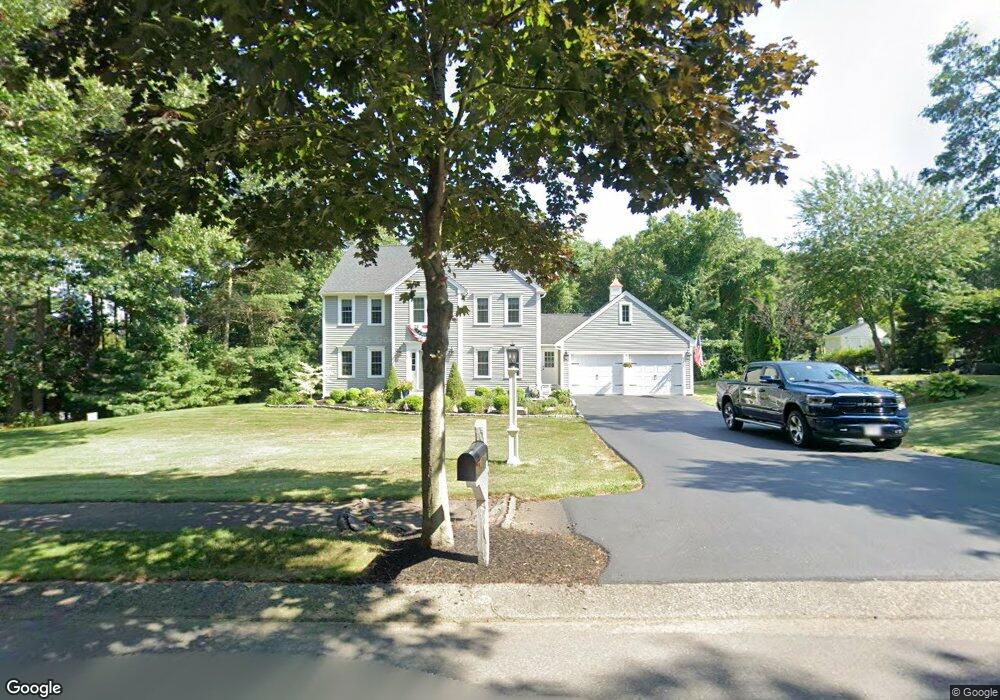
14 Appleton Waye Marshfield, MA 02050
Estimated Value: $838,000 - $1,070,000
4
Beds
3
Baths
2,300
Sq Ft
$414/Sq Ft
Est. Value
About This Home
This home is located at 14 Appleton Waye, Marshfield, MA 02050 and is currently estimated at $952,740, approximately $414 per square foot. 14 Appleton Waye is a home located in Plymouth County with nearby schools including Governor Edward Winslow School, Furnace Brook Middle School, and Marshfield High School.
Ownership History
Date
Name
Owned For
Owner Type
Purchase Details
Closed on
Jul 2, 2024
Sold by
Craig Joseph E and Craig Maryellen
Bought by
Craig
Current Estimated Value
Purchase Details
Closed on
May 31, 1996
Sold by
Steamboat Drive Rt and Gregory David T
Bought by
Craig Joseph E and Craig Maryellen
Create a Home Valuation Report for This Property
The Home Valuation Report is an in-depth analysis detailing your home's value as well as a comparison with similar homes in the area
Home Values in the Area
Average Home Value in this Area
Purchase History
| Date | Buyer | Sale Price | Title Company |
|---|---|---|---|
| Craig | -- | None Available | |
| Craig | -- | None Available | |
| Craig Joseph E | $241,500 | -- | |
| Craig Joseph E | $241,500 | -- |
Source: Public Records
Mortgage History
| Date | Status | Borrower | Loan Amount |
|---|---|---|---|
| Previous Owner | Craig Joseph E | $133,000 | |
| Previous Owner | Craig Joseph E | $14,000 |
Source: Public Records
Tax History
| Year | Tax Paid | Tax Assessment Tax Assessment Total Assessment is a certain percentage of the fair market value that is determined by local assessors to be the total taxable value of land and additions on the property. | Land | Improvement |
|---|---|---|---|---|
| 2025 | $8,188 | $827,100 | $330,700 | $496,400 |
| 2024 | $7,991 | $769,100 | $315,400 | $453,700 |
| 2023 | $7,784 | $688,700 | $292,700 | $396,000 |
| 2022 | $7,784 | $601,100 | $259,200 | $341,900 |
| 2021 | $7,491 | $567,900 | $259,200 | $308,700 |
| 2020 | $7,169 | $537,800 | $237,400 | $300,400 |
| 2019 | $6,924 | $517,500 | $237,400 | $280,100 |
| 2018 | $6,845 | $512,000 | $237,400 | $274,600 |
| 2017 | $6,768 | $493,300 | $237,400 | $255,900 |
| 2016 | $6,614 | $476,500 | $237,400 | $239,100 |
| 2015 | $6,257 | $470,800 | $237,400 | $233,400 |
| 2014 | $6,169 | $464,200 | $237,400 | $226,800 |
Source: Public Records
Map
Nearby Homes
- 116 Outlook Rd
- 95 Blackmount Dr
- 585 Careswell St
- 45 Red Gold Farm Rd
- 118 Enterprise St
- 555 Webster St
- 184 King Phillips Pathe
- 568 Webster St
- 238 Atwell Cir
- 412 Moraine St
- 66 Simmons Dr
- 431 Moraine St
- 11 Simmons Dr
- 4 Rachael's Ln
- 42 Carr Rd
- 315 Church St
- 74 Teakettle Ln
- Two Railroad Ave Unit 9
- Two Railroad Ave Unit 10
- Two Railroad Ave Unit 1
- 10 Appleton Waye
- 130 Aunt Lizzies Ln
- 138 Aunt Lizzies Ln
- 140 Steamboat Dr
- 128 Steamboat Dr
- 112 Aunt Lizzies Ln
- 47 Appleton Waye
- 120 Steamboat Dr
- 141 Aunt Lizzies Ln
- 127 Aunt Lizzies Ln
- 119 Aunt Lizzies Ln
- 90 Aunt Lizzies Ln
- 90 Aunt Lizzie's Ln
- 110 Steamboat Dr
- 142 Steamboat Dr
- 135 Steamboat Dr
- 109 Aunt Lizzies Ln
- 101 Steamboat Dr
- 76 Aunt Lizzies Ln
- 100 Steamboat Dr
Your Personal Tour Guide
Ask me questions while you tour the home.