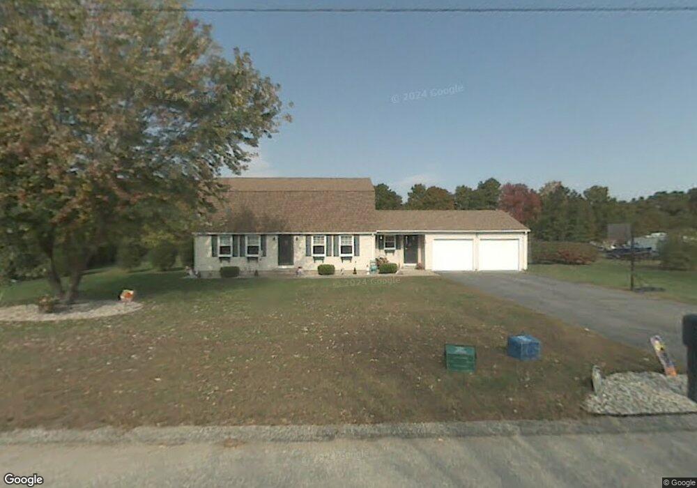
14 Deer Path Ln Westfield, MA 01085
Estimated Value: $524,595 - $586,000
4
Beds
2
Baths
2,216
Sq Ft
$248/Sq Ft
Est. Value
About This Home
This home is located at 14 Deer Path Ln, Westfield, MA 01085 and is currently estimated at $550,649, approximately $248 per square foot. 14 Deer Path Ln is a home located in Hampden County with nearby schools including Westfield High School, White Oak School, and Westfield Christian Academy.
Ownership History
Date
Name
Owned For
Owner Type
Purchase Details
Closed on
Dec 17, 2001
Sold by
Radle Clement J and Radle Judith M
Bought by
Pami Gary and Pami Marietta
Current Estimated Value
Home Financials for this Owner
Home Financials are based on the most recent Mortgage that was taken out on this home.
Original Mortgage
$150,000
Outstanding Balance
$58,744
Interest Rate
6.6%
Mortgage Type
Purchase Money Mortgage
Estimated Equity
$491,905
Purchase Details
Closed on
Sep 27, 1995
Sold by
Richardson David M and Richardson Karen M
Bought by
Radle Clement J and Radle Judith M
Home Financials for this Owner
Home Financials are based on the most recent Mortgage that was taken out on this home.
Original Mortgage
$132,300
Interest Rate
7.89%
Mortgage Type
Purchase Money Mortgage
Purchase Details
Closed on
Aug 31, 1988
Sold by
Phelon John W
Bought by
Richardson David M
Create a Home Valuation Report for This Property
The Home Valuation Report is an in-depth analysis detailing your home's value as well as a comparison with similar homes in the area
Home Values in the Area
Average Home Value in this Area
Purchase History
| Date | Buyer | Sale Price | Title Company |
|---|---|---|---|
| Pami Gary | $196,000 | -- | |
| Radle Clement J | $147,000 | -- | |
| Richardson David M | $185,000 | -- |
Source: Public Records
Mortgage History
| Date | Status | Borrower | Loan Amount |
|---|---|---|---|
| Open | Richardson David M | $150,000 | |
| Previous Owner | Richardson David M | $132,300 | |
| Previous Owner | Richardson David M | $15,000 |
Source: Public Records
Tax History
| Year | Tax Paid | Tax Assessment Tax Assessment Total Assessment is a certain percentage of the fair market value that is determined by local assessors to be the total taxable value of land and additions on the property. | Land | Improvement |
|---|---|---|---|---|
| 2025 | $6,427 | $423,400 | $151,900 | $271,500 |
| 2024 | $6,426 | $402,400 | $138,300 | $264,100 |
| 2023 | $6,100 | $373,400 | $131,800 | $241,600 |
| 2022 | $6,100 | $329,900 | $117,400 | $212,500 |
| 2021 | $5,913 | $313,200 | $110,900 | $202,300 |
| 2020 | $5,871 | $305,000 | $110,900 | $194,100 |
| 2019 | $5,742 | $291,900 | $105,700 | $186,200 |
| 2018 | $5,651 | $291,900 | $105,700 | $186,200 |
| 2017 | $5,496 | $283,000 | $107,000 | $176,000 |
| 2016 | $5,502 | $283,000 | $107,000 | $176,000 |
| 2015 | $5,128 | $276,600 | $107,000 | $169,600 |
| 2014 | $3,838 | $276,600 | $107,000 | $169,600 |
Source: Public Records
Map
Nearby Homes
- 336 Russellville Rd
- 134 Russellville Rd
- 68 Warfield Dr
- 132 North Rd
- 458 Montgomery Rd
- 52 & 53 Bayberry Ln
- 24 Jaeger Dr
- 45 Jaeger Dr
- Lot 5 Brickyard Rd
- 202 Brickyard Rd
- 182 Lockhouse Rd
- 0 Char Dr
- 0 Lockhouse Rd Unit 73496193
- 19 Arch Rd
- 19 Cottage Ave
- 57 White Loaf Rd
- 288 Buck Pond Rd
- 238 Prospect Street Extension
- 274 Prospect Street Extension
- Lot 5 Gil Farm Rd
- 20 Deer Path Ln
- 17 Deer Path Ln
- 11 Deer Path Ln
- 25 Deer Path Ln
- 26 Deer Path Ln
- 283 Russellville Rd
- 297 Russellville Rd
- 32 Deer Path Ln
- 222 & 246 Russellville Rd
- 301 Russellville Rd
- 31 Deer Path Ln
- 284 Russellville Rd
- 277 Russellville Rd
- 38 Deer Path Ln
- 37 Deer Path Ln
- 263 Russellville Rd
- 308 Russellville Rd
- 44 Deer Path Ln
- 288 Russellville Rd
- 43 Deer Path Ln
Your Personal Tour Guide
Ask me questions while you tour the home.