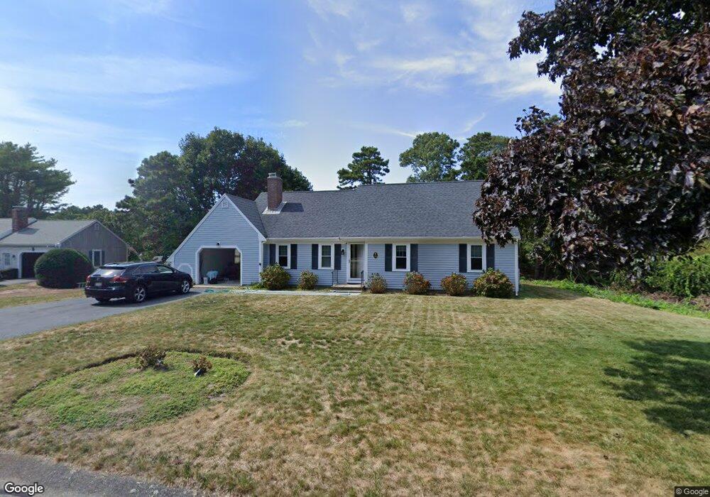
14 Parsons Path Harwich, MA 02645
Harwich Port NeighborhoodEstimated Value: $637,504 - $838,000
3
Beds
2
Baths
1,192
Sq Ft
$640/Sq Ft
Est. Value
About This Home
This home is located at 14 Parsons Path, Harwich, MA 02645 and is currently estimated at $762,876, approximately $639 per square foot. 14 Parsons Path is a home located in Barnstable County with nearby schools including Harwich Elementary School, Chatham Elementary School, and Monomoy Regional Middle School.
Ownership History
Date
Name
Owned For
Owner Type
Purchase Details
Closed on
Nov 2, 2022
Sold by
Baniukiewicz Robert M and Baniukiewicz Mary J
Bought by
Baniukiewicz Irt
Current Estimated Value
Purchase Details
Closed on
Jul 31, 2009
Sold by
Hayner Thomas B and Hayner Mary Constance
Bought by
Baniukiewicz Robert M and Baniukiewicz Mary Jo
Home Financials for this Owner
Home Financials are based on the most recent Mortgage that was taken out on this home.
Original Mortgage
$100,000
Interest Rate
5.43%
Mortgage Type
Purchase Money Mortgage
Create a Home Valuation Report for This Property
The Home Valuation Report is an in-depth analysis detailing your home's value as well as a comparison with similar homes in the area
Home Values in the Area
Average Home Value in this Area
Purchase History
We collect this data history from publicly available records. To have your information removed, we recommend requesting removal directly through your county’s website.
| Date | Buyer | Sale Price | Title Company |
|---|---|---|---|
| Baniukiewicz Irt | -- | None Available | |
| Baniukiewicz Robert M | $334,000 | -- |
Source: Public Records
Mortgage History
We collect this data history from publicly available records. To have your information removed, we recommend requesting removal directly through your county’s website.
| Date | Status | Borrower | Loan Amount |
|---|---|---|---|
| Previous Owner | Baniukiewicz Robert M | $100,000 |
Source: Public Records
Tax History
| Year | Tax Paid | Tax Assessment Tax Assessment Total Assessment is a certain percentage of the fair market value that is determined by local assessors to be the total taxable value of land and additions on the property. | Land | Improvement |
|---|---|---|---|---|
| 2025 | $3,477 | $588,300 | $212,700 | $375,600 |
| 2024 | $3,347 | $555,100 | $200,600 | $354,500 |
| 2023 | $3,210 | $483,400 | $182,400 | $301,000 |
| 2022 | $3,167 | $390,500 | $158,600 | $231,900 |
| 2021 | $2,971 | $345,500 | $144,200 | $201,300 |
| 2020 | $2,927 | $335,300 | $141,200 | $194,100 |
| 2019 | $2,761 | $318,500 | $135,700 | $182,800 |
| 2018 | $2,787 | $307,500 | $123,300 | $184,200 |
| 2017 | $2,551 | $284,400 | $112,400 | $172,000 |
| 2016 | $2,512 | $277,000 | $112,400 | $164,600 |
| 2015 | $2,423 | $270,100 | $110,200 | $159,900 |
| 2014 | $2,299 | $262,200 | $106,900 | $155,300 |
Source: Public Records
Map
Nearby Homes
- 252 Chatham Rd
- 58 Marthas Ln
- 106 Chatham Rd
- 7 Howard Rd
- 23 Dundee Cir
- 68 Gorham Rd
- 50 Long Rd
- 724 Route 28 Unit 2D
- 724 Route 28 Unit 2D
- 1025 Orleans-Harwich Rd
- 25 Robert Rd
- 14 Lovers Ln
- 10 Middle Rd
- 4 Skipper Shea Ln
- 9 Jason Ln
- 68 Levis Path
- 16 Turtle Run
- 1157 Orleans-Harwich Rd
- 2653 Main St
- 33 Old Colony Rd
- 8 Parsons Path
- 207 Chatham Rd
- 212 Chatham Rd
- 0 Parsons Path
- 2 Joshua Jethro Rd
- 2 Parsons Path
- 227 Chatham Rd
- 231 Chatham Rd
- 3 Joshua Jethro Rd
- 1 Parsons Point
- 228 Chatham Rd
- 8 Joshua Jethro Rd
- 235 Chatham Rd
- 161 Long Rd
- 2 Echo Woods Rd
- 3 Parsons Path
- 18 Wood Lilly Rd
- 12 Joshua Jethro Rd
- 196 Chatham Rd
- 187 Chatham Rd
Your Personal Tour Guide
Ask me questions while you tour the home.