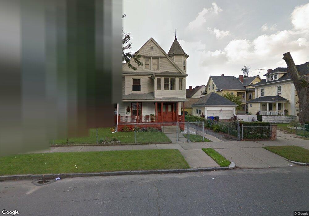
14 Westford Ave Springfield, MA 01109
Upper Hill NeighborhoodEstimated Value: $289,000 - $404,000
5
Beds
2
Baths
2,892
Sq Ft
$113/Sq Ft
Est. Value
About This Home
This home is located at 14 Westford Ave, Springfield, MA 01109 and is currently estimated at $328,195, approximately $113 per square foot. 14 Westford Ave is a home located in Hampden County with nearby schools including Mary M. Walsh Elementary School, M Marcus Kiley Middle, and Springfield High School of Science and Technology.
Ownership History
Date
Name
Owned For
Owner Type
Purchase Details
Closed on
Feb 12, 1996
Sold by
United Coop Bk
Bought by
Williams Marjorie
Current Estimated Value
Home Financials for this Owner
Home Financials are based on the most recent Mortgage that was taken out on this home.
Original Mortgage
$46,165
Outstanding Balance
$1,524
Interest Rate
7.1%
Mortgage Type
Purchase Money Mortgage
Estimated Equity
$326,671
Purchase Details
Closed on
Feb 24, 1995
Sold by
South Ronald
Bought by
United Coop Bk
Create a Home Valuation Report for This Property
The Home Valuation Report is an in-depth analysis detailing your home's value as well as a comparison with similar homes in the area
Home Values in the Area
Average Home Value in this Area
Purchase History
We collect this data history from publicly available records. To have your information removed, we recommend requesting removal directly through your county’s website.
| Date | Buyer | Sale Price | Title Company |
|---|---|---|---|
| Williams Marjorie | $45,000 | -- | |
| United Coop Bk | $50,000 | -- |
Source: Public Records
Mortgage History
We collect this data history from publicly available records. To have your information removed, we recommend requesting removal directly through your county’s website.
| Date | Status | Borrower | Loan Amount |
|---|---|---|---|
| Open | United Coop Bk | $46,165 | |
| Previous Owner | United Coop Bk | $10,000 |
Source: Public Records
Tax History
| Year | Tax Paid | Tax Assessment Tax Assessment Total Assessment is a certain percentage of the fair market value that is determined by local assessors to be the total taxable value of land and additions on the property. | Land | Improvement |
|---|---|---|---|---|
| 2025 | $3,827 | $244,100 | $31,300 | $212,800 |
| 2024 | $3,747 | $233,300 | $31,300 | $202,000 |
| 2023 | $3,337 | $195,700 | $28,500 | $167,200 |
| 2022 | $3,469 | $184,300 | $26,600 | $157,700 |
| 2021 | $3,338 | $176,600 | $18,900 | $157,700 |
| 2020 | $3,324 | $170,200 | $18,900 | $151,300 |
| 2019 | $3,237 | $164,500 | $16,100 | $148,400 |
| 2018 | $2,972 | $151,000 | $16,100 | $134,900 |
| 2017 | $2,790 | $141,900 | $15,100 | $126,800 |
| 2016 | $2,629 | $133,700 | $15,100 | $118,600 |
| 2015 | $2,675 | $136,000 | $15,100 | $120,900 |
Source: Public Records
Map
Nearby Homes
- 115-117 Northampton Ave
- 49 Andrew St
- 21 Westford Cir
- 31-33 Suffolk St
- 119-121 Middlesex St
- 62 Kenyon St
- 199 Eastern Ave
- 158 Bowles St
- 25 Dawes St
- 118 Quincy St
- 93 Thompson St
- 109 Pendleton Ave
- 88 Tyler St
- 485 Bay St
- 540-542 Union St
- 536-538 Union St
- 20 Conklin St
- 746-748 Alden St
- 148-150 Cedar St
- 20 Crosby St
- 20 Westford Ave
- 20 Westford Ave
- 121 Wilbraham Rd
- 121 Wilbraham Rd Unit 2
- 125 Wilbraham Rd
- 13 Northampton Ave
- 26 Westford Ave Unit 28
- 19 Northampton Ave
- 32 Westford Ave
- 15 Westford Ave
- 31 Northampton Ave
- 25 Westford Ave
- 38 Westford Ave
- 31 Westford Ave
- 18 Northampton Ave
- 37 Northampton Ave
- 14 Massachusetts Ave Unit 16
- 26 Northampton Ave
- 20 Massachusetts Ave
- 39 Westford Ave
Your Personal Tour Guide
Ask me questions while you tour the home.