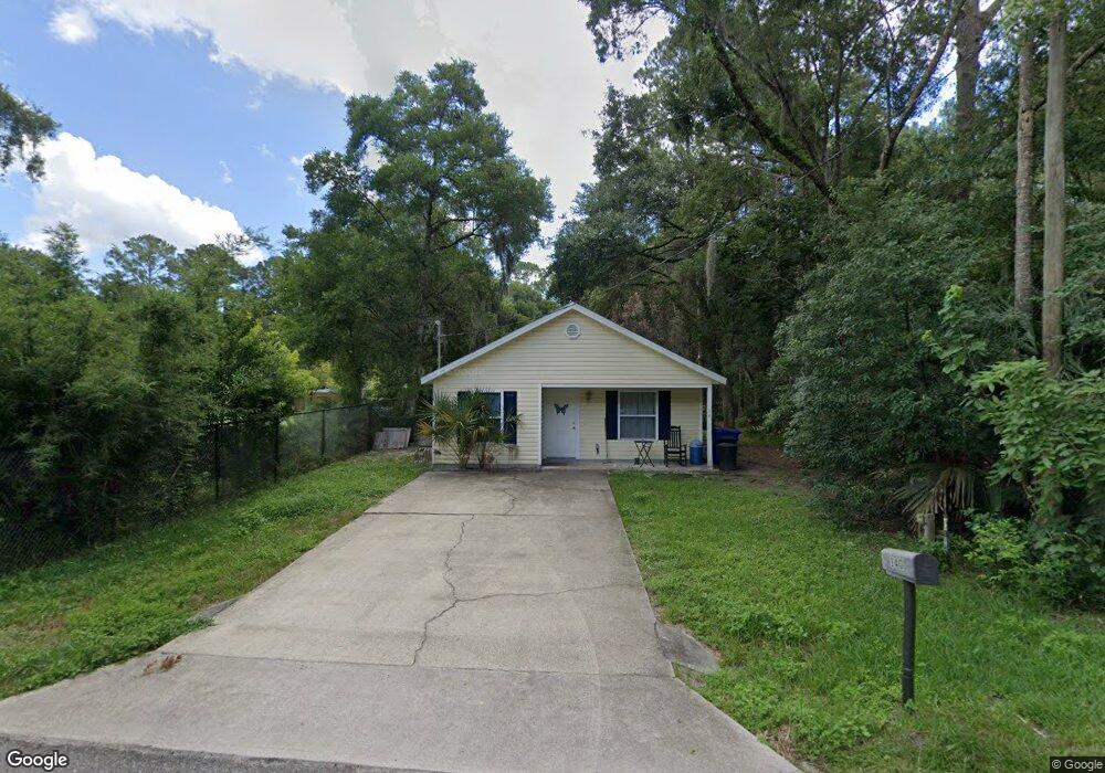
140 N Brevard St Saint Augustine, FL 32084
West Augustine NeighborhoodEstimated Value: $243,926 - $284,000
3
Beds
2
Baths
1,080
Sq Ft
$237/Sq Ft
Est. Value
About This Home
This home is located at 140 N Brevard St, Saint Augustine, FL 32084 and is currently estimated at $256,482, approximately $237 per square foot. 140 N Brevard St is a home located in St. Johns County with nearby schools including Webster Elementary School, R J Murray Middle School, and St. Augustine High School.
Ownership History
Date
Name
Owned For
Owner Type
Purchase Details
Closed on
Oct 31, 2005
Sold by
Covenant Homes Of St Augustine Inc
Bought by
Roberts Darryl Scott
Current Estimated Value
Home Financials for this Owner
Home Financials are based on the most recent Mortgage that was taken out on this home.
Original Mortgage
$70,000
Outstanding Balance
$37,884
Interest Rate
5.84%
Mortgage Type
Fannie Mae Freddie Mac
Estimated Equity
$218,598
Purchase Details
Closed on
Dec 31, 2002
Sold by
Macon James E
Bought by
St Johns County
Create a Home Valuation Report for This Property
The Home Valuation Report is an in-depth analysis detailing your home's value as well as a comparison with similar homes in the area
Home Values in the Area
Average Home Value in this Area
Purchase History
| Date | Buyer | Sale Price | Title Company |
|---|---|---|---|
| Roberts Darryl Scott | $87,500 | Land Title Of America Group | |
| St Johns County | $500,000 | Land Title Of America Group |
Source: Public Records
Mortgage History
| Date | Status | Borrower | Loan Amount |
|---|---|---|---|
| Open | Roberts Darryl Scott | $70,000 |
Source: Public Records
Tax History
| Year | Tax Paid | Tax Assessment Tax Assessment Total Assessment is a certain percentage of the fair market value that is determined by local assessors to be the total taxable value of land and additions on the property. | Land | Improvement |
|---|---|---|---|---|
| 2025 | $670 | $72,109 | -- | -- |
| 2024 | $670 | $70,077 | -- | -- |
| 2023 | $670 | $68,036 | $0 | $0 |
| 2022 | $645 | $66,054 | $0 | $0 |
| 2021 | $643 | $64,130 | $0 | $0 |
| 2020 | $643 | $63,245 | $0 | $0 |
| 2019 | $653 | $61,823 | $0 | $0 |
| 2018 | $644 | $60,670 | $0 | $0 |
| 2017 | $645 | $59,422 | $0 | $0 |
| 2016 | $648 | $59,946 | $0 | $0 |
| 2015 | $657 | $59,529 | $0 | $0 |
| 2014 | $659 | $58,534 | $0 | $0 |
Source: Public Records
Map
Nearby Homes
- 933 John St
- 281 N Volusia St
- 141 Webb St
- 0 W 2nd St
- 340 N Clay St
- 340 & 370 N Clay St
- 370 N Clay St
- 0 N Clay St Unit 260651
- 1120 W King Street St
- 900 Helen St
- 1129 W King Street Extension
- 890 Helen St
- 882 Helen St
- 749 John St
- 97 McDonald Ave
- 900 W 3rd St
- 875 W 3rd St
- 1148 Tocoi Rd
- 1155 Butler Ave
- 1167 W King St
- 938 W King St
- 0 Chapin - Lot 20
- 0 Chapin - Lot 23
- 0 Chapin - Lot 22
- 0 Chapin - Lot 21
- 936 W King St
- 964 W King St
- 948 Chapin St
- 200 N Brevard St
- 922 W King St
- 970 W King St
- 918 W King St
- 943 W King St
- 937 W King St
- 925 W King St
- 930 Butler Ave
- 910 W King St
- 937 Butler Ave
- 987 W King St
- 1008 W King St
Your Personal Tour Guide
Ask me questions while you tour the home.