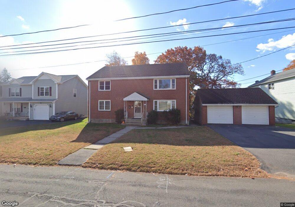
140 Pinehurst Ave New Britain, CT 06053
Estimated Value: $341,367 - $468,000
4
Beds
2
Baths
2,688
Sq Ft
$159/Sq Ft
Est. Value
About This Home
This home is located at 140 Pinehurst Ave, New Britain, CT 06053 and is currently estimated at $427,342, approximately $158 per square foot. 140 Pinehurst Ave is a home located in Hartford County with nearby schools including Gaffney School, Slade Middle School, and Mountain Laurel Sudbury School.
Ownership History
Date
Name
Owned For
Owner Type
Purchase Details
Closed on
Dec 15, 2025
Sold by
C R
Bought by
Koops Michelle A and Koops Herbert J
Current Estimated Value
Purchase Details
Closed on
Jul 19, 2024
Sold by
Ronzello Richard C
Bought by
Richard C Ronzello T C and Richard Ronzello
Purchase Details
Closed on
Apr 21, 2023
Sold by
Lombardo Rosario
Bought by
Ronzello Richard C
Purchase Details
Closed on
Apr 22, 2021
Sold by
Lombardo Rosario
Bought by
Baroni Bruno C
Create a Home Valuation Report for This Property
The Home Valuation Report is an in-depth analysis detailing your home's value as well as a comparison with similar homes in the area
Home Values in the Area
Average Home Value in this Area
Purchase History
| Date | Buyer | Sale Price | Title Company |
|---|---|---|---|
| Koops Michelle A | -- | -- | |
| Richard C Ronzello T C | -- | None Available | |
| Richard C Ronzello T C | -- | None Available | |
| Ronzello Richard C | -- | None Available | |
| Ronzello Richard C | -- | None Available | |
| Baroni Bruno C | $33,500 | None Available | |
| Baroni Bruno C | $33,500 | None Available |
Source: Public Records
Tax History
| Year | Tax Paid | Tax Assessment Tax Assessment Total Assessment is a certain percentage of the fair market value that is determined by local assessors to be the total taxable value of land and additions on the property. | Land | Improvement |
|---|---|---|---|---|
| 2025 | $7,729 | $197,260 | $65,520 | $131,740 |
| 2024 | $7,810 | $197,260 | $65,520 | $131,740 |
| 2023 | $7,551 | $197,260 | $65,520 | $131,740 |
| 2022 | $6,272 | $126,700 | $30,170 | $96,530 |
| 2021 | $7,620 | $153,930 | $57,400 | $96,530 |
| 2020 | $7,773 | $153,930 | $57,400 | $96,530 |
| 2019 | $7,773 | $153,930 | $57,400 | $96,530 |
| 2018 | $7,773 | $153,930 | $57,400 | $96,530 |
| 2017 | $7,328 | $145,110 | $47,810 | $97,300 |
| 2016 | $7,328 | $145,110 | $47,810 | $97,300 |
| 2015 | $7,110 | $145,110 | $47,810 | $97,300 |
| 2014 | $7,110 | $145,110 | $47,810 | $97,300 |
Source: Public Records
Map
Nearby Homes
- 61 Sterling St
- 240 Hillhurst Ave
- 157 Skinner Dr
- 54 Fairlane Dr
- 19 Maplehurst Ave
- 338 Hillhurst Ave
- 37 Richard St
- 7 Ledyard Rd
- 25 Clinton St
- 272 Burritt St
- 36 N Mountain Rd Unit D
- 527 Burritt St
- 54 N Mountain Rd Unit 204
- 19 Wakefield Ct
- 127 Booth St
- 900 Slater Rd
- 234 Pierremount Ave
- 18 Woodruff Ct
- 77 Booth St
- 179 Broad St
- 132 Pinehurst Ave
- 146 Pinehurst Ave
- 146 Pershing Ave
- 158 Pershing Ave
- 131 Sterling St
- 135 Sterling St
- 152 Pinehurst Ave
- 127 Sterling St
- 139 Sterling St
- 121 Sterling St
- 145 Sterling St
- 133 Pinehurst Ave
- 139 Pinehurst Ave
- 127 Pinehurst Ave
- 145 Pinehurst Ave
- 121 Pinehurst Ave
- 121 Pinehurst Ave Unit Second Floor
- 121 Pinehurst Ave Unit 2nd flr
- 111 Sterling St
- 151 Pinehurst Ave
Your Personal Tour Guide
Ask me questions while you tour the home.