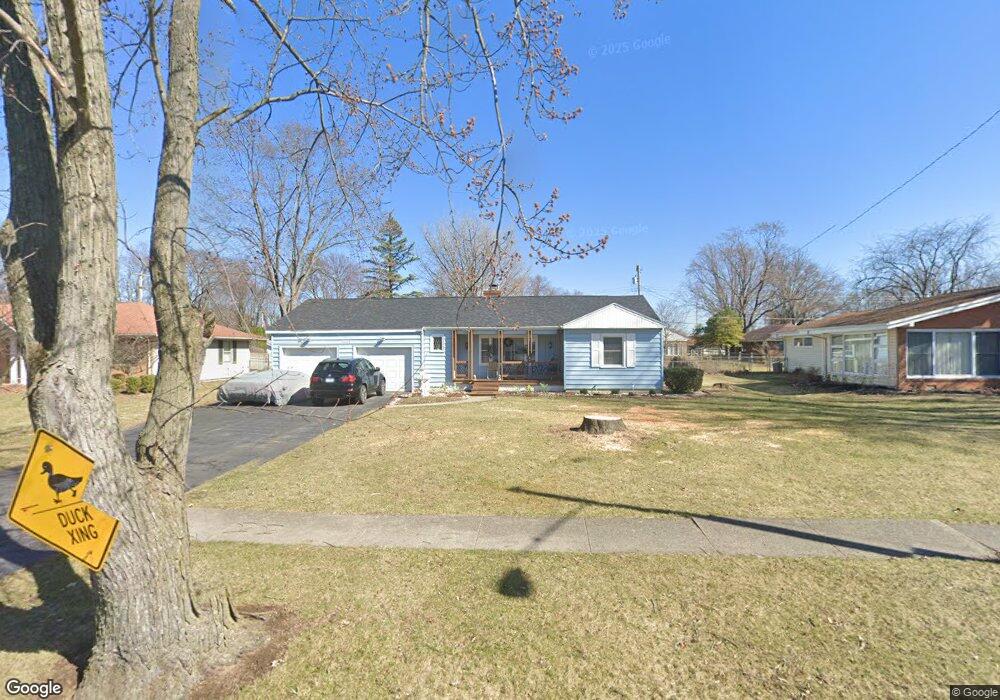
1401 Brookside Dr Findlay, OH 45840
Estimated Value: $203,000 - $218,000
3
Beds
3
Baths
1,786
Sq Ft
$118/Sq Ft
Est. Value
About This Home
This home is located at 1401 Brookside Dr, Findlay, OH 45840 and is currently estimated at $211,404, approximately $118 per square foot. 1401 Brookside Dr is a home located in Hancock County with nearby schools including Whittier Elementary School, Wilson Vance Elementary School, and Donnell Middle School.
Ownership History
Date
Name
Owned For
Owner Type
Purchase Details
Closed on
Jul 26, 2024
Sold by
Samuels Marlene
Bought by
Samuels Michael
Current Estimated Value
Purchase Details
Closed on
Jan 28, 2013
Sold by
Seel Kathy
Bought by
Odunkesenier Sefk
Purchase Details
Closed on
Mar 7, 2008
Sold by
Odunkesenler Sefik
Bought by
Seel Kathy
Purchase Details
Closed on
Jun 23, 2003
Sold by
Dukes Jasper H
Bought by
Odunkesenler Sefik
Create a Home Valuation Report for This Property
The Home Valuation Report is an in-depth analysis detailing your home's value as well as a comparison with similar homes in the area
Home Values in the Area
Average Home Value in this Area
Purchase History
| Date | Buyer | Sale Price | Title Company |
|---|---|---|---|
| Samuels Michael | -- | None Listed On Document | |
| Odunkesenier Sefk | -- | None Available | |
| Seel Kathy | $51,000 | Attorney | |
| Odunkesenler Sefik | $100,000 | -- |
Source: Public Records
Tax History
| Year | Tax Paid | Tax Assessment Tax Assessment Total Assessment is a certain percentage of the fair market value that is determined by local assessors to be the total taxable value of land and additions on the property. | Land | Improvement |
|---|---|---|---|---|
| 2024 | $1,842 | $51,860 | $10,280 | $41,580 |
| 2023 | $1,519 | $51,860 | $10,280 | $41,580 |
| 2022 | $1,839 | $51,860 | $10,280 | $41,580 |
| 2021 | $1,311 | $40,960 | $10,290 | $30,670 |
| 2020 | $1,311 | $40,960 | $10,290 | $30,670 |
| 2019 | $1,284 | $40,960 | $10,290 | $30,670 |
| 2018 | $1,170 | $35,620 | $8,950 | $26,670 |
| 2017 | $1,168 | $35,620 | $8,950 | $26,670 |
| 2016 | $1,160 | $35,620 | $8,950 | $26,670 |
| 2015 | $1,372 | $40,120 | $8,950 | $31,170 |
| 2014 | $1,372 | $40,120 | $8,950 | $31,170 |
| 2012 | $1,356 | $39,490 | $8,950 | $30,540 |
Source: Public Records
Map
Nearby Homes
- 1100 Stall Dr
- 1638 Westview Dr
- 1215 S Blanchard St
- 0 Blanchard Ave
- 525 3rd St
- 1105 1st St
- 400 E Pearl St
- 1730 Park St
- 1809 Park St
- 825 Morse St
- 15586 Canadian Way
- 313 2nd St
- 206 Greenlawn Ave
- 1209 S Main St
- 1463 Misty Oaks Dr
- 1041 S Main St
- 10657 Cherokee Dr
- 829 Maple Ave
- 1206 S Main St
- 10692 Cherokee Dr
- 1407 Brookside Dr
- 1331 Brookside Dr
- 1400 Westview Dr
- 1000 Eastview Dr
- 1415 Brookside Dr
- 1408 Westview Dr
- 1327 Brookside Dr
- 943 Stall Dr
- 1416 Westview Dr
- 1421 Brookside Dr
- 1001 Stall Dr
- 1411 Westview Dr
- 1426 Westview Dr
- 1427 Brookside Dr
- 1016 Eastview Dr
- 1321 Brookside Dr
- 1011 Stall Dr
- 1011 Eastview Dr
- 1425 Westview Dr
- 942 Stall Dr
Your Personal Tour Guide
Ask me questions while you tour the home.