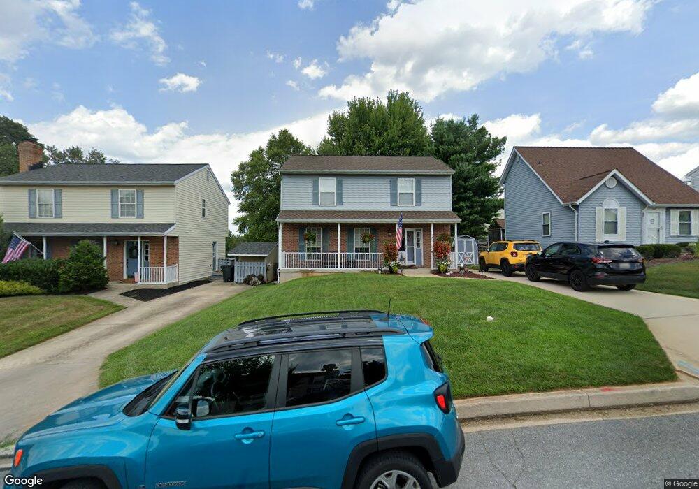
1407 Burnside Dr Hampstead, MD 21074
Estimated Value: $398,000 - $479,000
Studio
3
Baths
1,590
Sq Ft
$268/Sq Ft
Est. Value
About This Home
This home is located at 1407 Burnside Dr, Hampstead, MD 21074 and is currently estimated at $426,583, approximately $268 per square foot. 1407 Burnside Dr is a home located in Carroll County with nearby schools including Spring Garden Elementary School, Shiloh Middle School, and Manchester Valley High School.
Ownership History
Date
Name
Owned For
Owner Type
Purchase Details
Closed on
Jul 31, 2002
Sold by
Sapp Kevin M
Bought by
Devan Kevin S and Devan Marjory
Current Estimated Value
Purchase Details
Closed on
Dec 28, 1993
Sold by
Bruno Anthony P
Bought by
Sapp Kevin M
Home Financials for this Owner
Home Financials are based on the most recent Mortgage that was taken out on this home.
Original Mortgage
$129,050
Interest Rate
7%
Purchase Details
Closed on
Nov 1, 1990
Sold by
Woodhaven Building And
Bought by
Bruno Anthony P
Create a Home Valuation Report for This Property
The Home Valuation Report is an in-depth analysis detailing your home's value as well as a comparison with similar homes in the area
Home Values in the Area
Average Home Value in this Area
Purchase History
We collect this data history from publicly available records. To have your information removed, we recommend requesting removal directly through your county’s website.
| Date | Buyer | Sale Price | Title Company |
|---|---|---|---|
| Devan Kevin S | $173,500 | -- | |
| Sapp Kevin M | $129,900 | -- | |
| Bruno Anthony P | $116,300 | -- |
Source: Public Records
Mortgage History
We collect this data history from publicly available records. To have your information removed, we recommend requesting removal directly through your county’s website.
| Date | Status | Borrower | Loan Amount |
|---|---|---|---|
| Previous Owner | Sapp Kevin M | $129,050 |
Source: Public Records
Tax History
| Year | Tax Paid | Tax Assessment Tax Assessment Total Assessment is a certain percentage of the fair market value that is determined by local assessors to be the total taxable value of land and additions on the property. | Land | Improvement |
|---|---|---|---|---|
| 2025 | $4,138 | $321,600 | $90,000 | $231,600 |
| 2024 | $3,925 | $300,900 | $0 | $0 |
| 2023 | $3,721 | $280,200 | $0 | $0 |
| 2022 | $3,527 | $259,500 | $83,000 | $176,500 |
| 2021 | $6,923 | $249,667 | $0 | $0 |
| 2020 | $3,283 | $239,833 | $0 | $0 |
| 2019 | $3,151 | $230,000 | $83,000 | $147,000 |
| 2018 | $3,076 | $226,167 | $0 | $0 |
| 2017 | $3,024 | $222,333 | $0 | $0 |
| 2016 | -- | $218,500 | $0 | $0 |
| 2015 | -- | $215,100 | $0 | $0 |
| 2014 | -- | $211,700 | $0 | $0 |
Source: Public Records
Map
Nearby Homes
- 1402 Burnside Dr
- 4222R Upper Beckleysville Rd
- 0 Hanover Pike Unit MDCR2024542
- 1421 N Main St
- TBD Sommerfield Dr
- TBD Sommerfield Dr Unit (5 ACRES)
- 4211 S Hunter Rd
- 1609 Fairmount Rd
- 3939 Brittany Ln
- 4156 Black Rock Rd
- 4160 Black Rock Rd
- 4210 Mead Dr
- 3810 Sunnyfield Ct Unit 1B
- 1645 Saint Paul St
- 3845 Dakota Rd
- 4233 Tumbrell Dr
- 3832 Dakota Rd
- 1030 S Main St
- 1151 Caton Rd
- 4023 Sickle Dr
- 1403 Burnside Dr
- 1409 Burnside Dr
- 4200 Upper Beckleysville Rd
- 4202 Upper Beckleysville Rd
- 1421 Burnside Dr
- 4204 Upper Beckleysville Rd
- 1404 Burnside Dr
- 1408 Burnside Dr
- 1425 Burnside Dr
- 1422 Burnside Dr
- 4190 Upper Beckleysville Rd
- 4191 Chaille Long Dr
- 1429 Burnside Dr
- 4203 Upper Beckleysville Rd
- 1426 Burnside Dr
- 4198 Chaille Long Dr
- 4170 Upper Beckleysville Rd
- 4201 Upper Beckleysville Rd
- 4187 Chaille Long Dr
- 1428 Burnside Dr
Your Personal Tour Guide
Ask me questions while you tour the home.