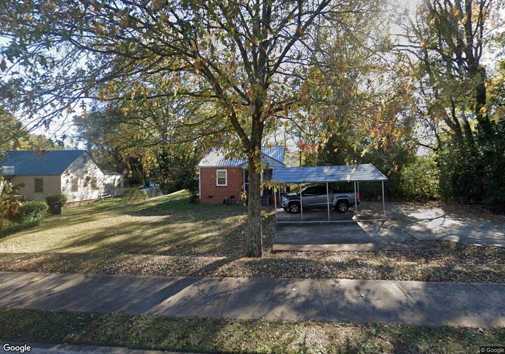
1408 E 10th St West Point, GA 31833
Estimated Value: $69,000 - $118,000
2
Beds
1
Bath
807
Sq Ft
$109/Sq Ft
Est. Value
About This Home
This home is located at 1408 E 10th St, West Point, GA 31833 and is currently estimated at $88,131, approximately $109 per square foot. 1408 E 10th St is a home located in Troup County with nearby schools including West Point Elementary School, Long Cane Elementary School, and Whitesville Road Elementary School.
Ownership History
Date
Name
Owned For
Owner Type
Purchase Details
Closed on
Feb 22, 1999
Sold by
Greyfield Res
Bought by
Stafford Vonetta
Current Estimated Value
Purchase Details
Closed on
Oct 9, 1996
Sold by
Roy Edwards
Bought by
Greyfield Res
Purchase Details
Closed on
Nov 9, 1995
Sold by
Blizzard T E
Bought by
Roy Edwards
Purchase Details
Closed on
Oct 3, 1995
Sold by
Roy Lee Edwards By Tc
Bought by
Blizzard T E
Purchase Details
Closed on
Aug 30, 1994
Sold by
Drm Inc
Bought by
Roy Lee Edwards By Tc
Purchase Details
Closed on
Sep 22, 1993
Sold by
Edwards
Bought by
Drm Inc
Purchase Details
Closed on
Aug 1, 1987
Bought by
Edwards
Purchase Details
Closed on
May 31, 1985
Purchase Details
Closed on
Jan 1, 1958
Create a Home Valuation Report for This Property
The Home Valuation Report is an in-depth analysis detailing your home's value as well as a comparison with similar homes in the area
Home Values in the Area
Average Home Value in this Area
Purchase History
| Date | Buyer | Sale Price | Title Company |
|---|---|---|---|
| Stafford Vonetta | $35,000 | -- | |
| Greyfield Res | -- | -- | |
| Roy Edwards | -- | -- | |
| Blizzard T E | $400 | -- | |
| Roy Lee Edwards By Tc | -- | -- | |
| Drm Inc | -- | -- | |
| Edwards | -- | -- | |
| -- | -- | -- | |
| -- | -- | -- |
Source: Public Records
Tax History
| Year | Tax Paid | Tax Assessment Tax Assessment Total Assessment is a certain percentage of the fair market value that is determined by local assessors to be the total taxable value of land and additions on the property. | Land | Improvement |
|---|---|---|---|---|
| 2025 | $1,237 | $35,440 | $10,040 | $25,400 |
| 2024 | $865 | $24,460 | $10,040 | $14,420 |
| 2023 | $655 | $24,020 | $10,040 | $13,980 |
| 2022 | $651 | $23,340 | $10,040 | $13,300 |
| 2021 | $698 | $23,144 | $10,040 | $13,104 |
| 2020 | $348 | $11,544 | $1,640 | $9,904 |
| 2019 | $342 | $11,348 | $1,640 | $9,708 |
| 2018 | $323 | $10,720 | $1,500 | $9,220 |
| 2017 | $323 | $10,720 | $1,500 | $9,220 |
| 2016 | $321 | $10,643 | $1,500 | $9,143 |
| 2015 | $327 | $10,818 | $1,675 | $9,143 |
| 2014 | $313 | $10,337 | $1,675 | $8,662 |
| 2013 | -- | $11,150 | $1,996 | $9,154 |
Source: Public Records
Map
Nearby Homes
- 1418 E 10th St
- 0 Sunset Dr Unit 10451831
- 0 Arrowhead Dr Unit 10451860
- 1104 E 8th St
- 900 E 9th St
- 509 Cleveland St
- 1202 E 9th St
- 707 E 7th St
- 506 E 6th St
- 4517 Georgia 18
- 4509 Georgia 18
- 4523 Georgia 18
- 4527 Georgia 18
- 508 Pine St
- 1800 Malco Dr
- 112 Hillcrest Rd
- 1903 Ridgewood Dr
- 128 Highland Dr
- 1007 4th Ave
- 712 4th Ave
- 1410 E 10th St
- 901 Higgins St
- 903 Higgins St
- 1412 E 10th St
- 1407 Higgins St
- 1409 Higgins St
- 1401 Higgins St
- 1403 Higgins St
- 1411 Higgins St
- 10th Street
- 1413 Higgins St
- 1409 E 10th St
- 1415 Higgins St
- 1416 E 10th St
- 1417 Higgins St
- 1406 Higgins St
- 1408 Higgins St
- 1402 Higgins St
- 1404 Higgins St
- 1410 Higgins St
Your Personal Tour Guide
Ask me questions while you tour the home.