Estimated Value: $225,000 - $249,000
4
Beds
2
Baths
1,528
Sq Ft
$157/Sq Ft
Est. Value
About This Home
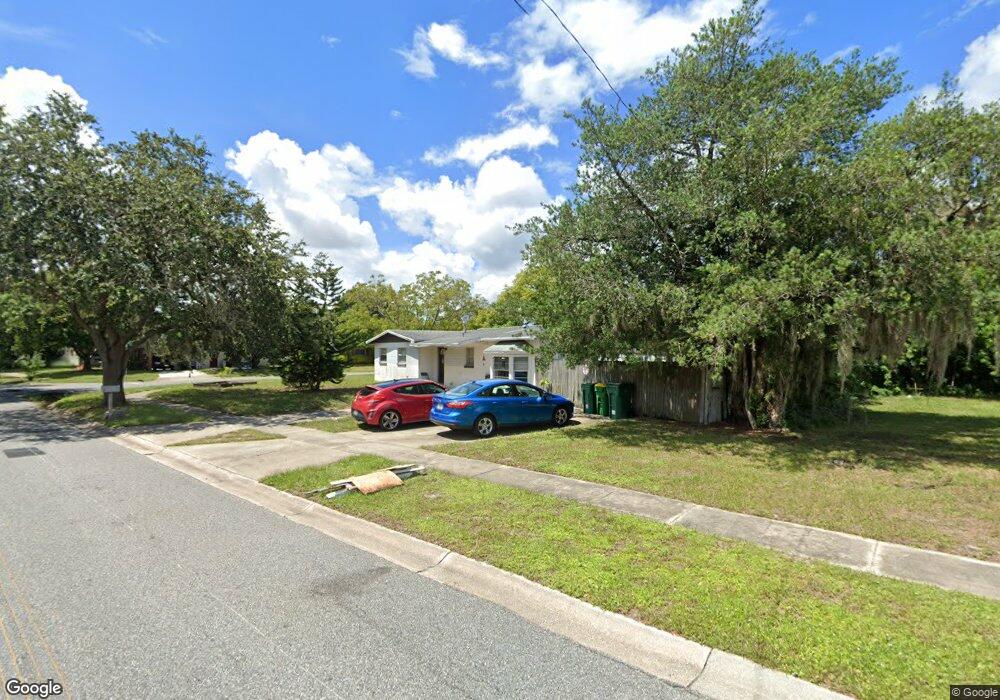
This home is located at 1409 College Ave, Cocoa, FL 32922 and is currently estimated at $239,526, approximately $156 per square foot. 1409 College Ave is a home located in Brevard County with nearby schools including Cambridge Elementary Magnet School, Cocoa High School, and Space Coast Christian Academy.
Ownership History
Date
Name
Owned For
Owner Type
Purchase Details
Closed on
Dec 2, 2016
Sold by
Land Trust Mangemtn Serving Inc
Bought by
Egil Llc
Current Estimated Value
Purchase Details
Closed on
Sep 16, 2013
Sold by
Moses Esq Alison J
Bought by
Land Trust Management Services Inc and The College Land Trust
Purchase Details
Closed on
Feb 29, 2008
Sold by
Johnson Wayne E and Johnson Victoria L
Bought by
Moses Alison and The Hooley Life Estate Land Trust
Purchase Details
Closed on
Feb 21, 2006
Sold by
Piper Richard D and Piper Raye Yvonne
Bought by
Johnson Wayne E and Johnson Victoria L
Home Financials for this Owner
Home Financials are based on the most recent Mortgage that was taken out on this home.
Original Mortgage
$63,500
Interest Rate
10.62%
Mortgage Type
Purchase Money Mortgage
Purchase Details
Closed on
May 20, 1996
Sold by
Clanton Bobby C and Clanton Dorothy Jean
Bought by
Piper Richard L and Piper Raye Yvonne
Home Financials for this Owner
Home Financials are based on the most recent Mortgage that was taken out on this home.
Original Mortgage
$64,928
Interest Rate
8.02%
Mortgage Type
FHA
Create a Home Valuation Report for This Property
The Home Valuation Report is an in-depth analysis detailing your home's value as well as a comparison with similar homes in the area
Home Values in the Area
Average Home Value in this Area
Purchase History
We collect this data history from publicly available records. To have your information removed, we recommend requesting removal directly through your county’s website.
| Date | Buyer | Sale Price | Title Company |
|---|---|---|---|
| Egil Llc | $79,000 | Fidelity National Title Of F | |
| Land Trust Management Services Inc | -- | Fidelity Natl Title Of Flori | |
| Land Trust Management Services Inc | -- | None Available | |
| Moses Alison | $86,000 | Fidelity Natl Title Ins Co | |
| Johnson Wayne E | $138,500 | Attorney | |
| Piper Richard L | $65,000 | -- |
Source: Public Records
Mortgage History
We collect this data history from publicly available records. To have your information removed, we recommend requesting removal directly through your county’s website.
| Date | Status | Borrower | Loan Amount |
|---|---|---|---|
| Previous Owner | Johnson Wayne E | $63,500 | |
| Previous Owner | Piper Richard L | $64,928 | |
| Closed | Egil Llc | $0 |
Source: Public Records
Tax History
| Year | Tax Paid | Tax Assessment Tax Assessment Total Assessment is a certain percentage of the fair market value that is determined by local assessors to be the total taxable value of land and additions on the property. | Land | Improvement |
|---|---|---|---|---|
| 2025 | $3,094 | $193,590 | -- | -- |
| 2024 | $2,909 | $188,850 | -- | -- |
| 2023 | $2,909 | $176,900 | $0 | $0 |
| 2022 | $2,483 | $155,880 | $0 | $0 |
| 2021 | $2,114 | $97,910 | $36,000 | $61,910 |
| 2020 | $1,986 | $98,500 | $36,000 | $62,500 |
| 2019 | $1,909 | $98,180 | $36,000 | $62,180 |
| 2018 | $1,660 | $84,810 | $25,000 | $59,810 |
| 2017 | $1,498 | $66,690 | $17,000 | $49,690 |
| 2016 | $1,160 | $48,860 | $9,000 | $39,860 |
| 2015 | $1,080 | $42,380 | $9,000 | $33,380 |
| 2014 | $999 | $40,440 | $10,000 | $30,440 |
Source: Public Records
Map
Nearby Homes
- 2016 Cooper Dr
- 1750 Rosa St
- 1417 Walter St
- 1354 S Stetson Dr
- 1711 Dixon Blvd Unit 179
- 1711 Dixon Blvd Unit 198
- 1727 Ruth Ave
- 1676 Ackley Rd
- 0 University Ln
- 1523 Clearlake Ct
- 1531 Paradise Ln
- 1644 Ruth St
- 1523 Furnari St
- 840 Morning Side Dr
- 833 Morning Side Dr
- Xxx Rosetine St
- 1515 Furnari St
- 1713 Shady Ln
- 0000 Null Unknown
- 914 Clearlake Rd Unit 102B
- 1906 Furman Ct
- 1423 College Ave
- 1970 Furman Ct
- 1412 College Ave
- 1416 College Ave
- 1910 Furman Ct
- 1405 College Ave
- 1408 College Ave
- 1905 Furman Ct
- 1420 College Ave
- 1966 Furman Ct
- 1914 Furman Ct
- 1909 Furman Ct
- 1404 College Ave
- 1962 Furman Ct
- 1424 College Ave
- 1975 Furman Ct
- 1913 Furman Ct
- 1906 Ivy Dr
- 1971 Furman Ct
Your Personal Tour Guide
Ask me questions while you tour the home.