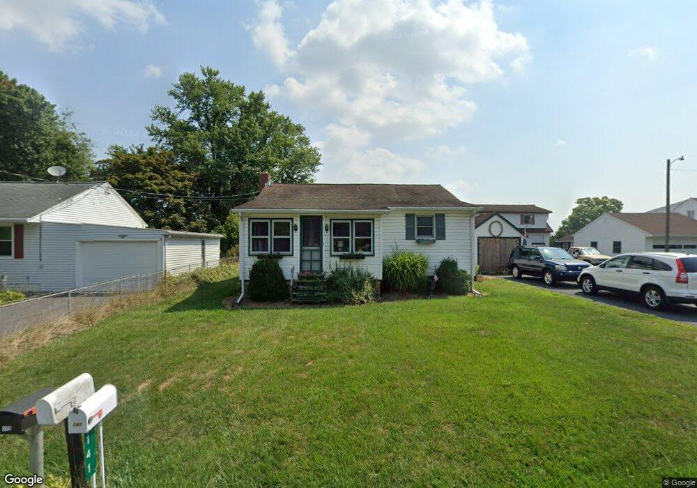
141 Crest Ave Lancaster, PA 17602
Bridgeport NeighborhoodEstimated Value: $263,893 - $293,000
2
Beds
2
Baths
1,112
Sq Ft
$251/Sq Ft
Est. Value
About This Home
This home is located at 141 Crest Ave, Lancaster, PA 17602 and is currently estimated at $279,223, approximately $251 per square foot. 141 Crest Ave is a home located in Lancaster County with nearby schools including Smoketown Elementary School, Gerald G. Huesken Middle School, and Conestoga Valley High School.
Ownership History
Date
Name
Owned For
Owner Type
Purchase Details
Closed on
Nov 3, 2021
Sold by
Bair Robert D and Bair Joan R
Bought by
Hallman Paul E
Current Estimated Value
Home Financials for this Owner
Home Financials are based on the most recent Mortgage that was taken out on this home.
Original Mortgage
$130,000
Outstanding Balance
$118,939
Interest Rate
2.88%
Mortgage Type
New Conventional
Estimated Equity
$160,284
Purchase Details
Closed on
Jan 15, 2019
Sold by
Bair Robert D and Bair Joan R
Bought by
Bair Robert D and Bair Joan R
Create a Home Valuation Report for This Property
The Home Valuation Report is an in-depth analysis detailing your home's value as well as a comparison with similar homes in the area
Home Values in the Area
Average Home Value in this Area
Purchase History
| Date | Buyer | Sale Price | Title Company |
|---|---|---|---|
| Hallman Paul E | $210,000 | One Abstract Llc | |
| Bair Robert D | -- | None Available |
Source: Public Records
Mortgage History
| Date | Status | Borrower | Loan Amount |
|---|---|---|---|
| Open | Hallman Paul E | $130,000 |
Source: Public Records
Tax History
| Year | Tax Paid | Tax Assessment Tax Assessment Total Assessment is a certain percentage of the fair market value that is determined by local assessors to be the total taxable value of land and additions on the property. | Land | Improvement |
|---|---|---|---|---|
| 2025 | $2,527 | $128,700 | $44,200 | $84,500 |
| 2024 | $2,527 | $124,800 | $44,200 | $80,600 |
| 2023 | $2,468 | $124,800 | $44,200 | $80,600 |
| 2022 | $2,407 | $124,800 | $44,200 | $80,600 |
| 2021 | $2,322 | $124,800 | $44,200 | $80,600 |
| 2020 | $2,322 | $124,800 | $44,200 | $80,600 |
| 2019 | $2,272 | $124,800 | $44,200 | $80,600 |
| 2018 | $3,343 | $124,800 | $44,200 | $80,600 |
| 2017 | $1,864 | $86,100 | $43,700 | $42,400 |
| 2016 | $1,842 | $86,100 | $43,700 | $42,400 |
| 2015 | $471 | $86,100 | $43,700 | $42,400 |
| 2014 | $1,277 | $86,100 | $43,700 | $42,400 |
Source: Public Records
Map
Nearby Homes
- 157 Jimanna Rd
- 1829 Krystle Dr
- 142 Hostetter Ln
- 32 Greenfield Rd
- 257 Longfellow Dr
- 89 Greenfield Rd
- 319 Dahlia Rd
- 77 Highland Dr
- 83 Highland Dr
- 314 Dahlia Rd
- 315 Lampeter Rd
- 26 Midway Farms Ln
- 225 Black Oak Dr
- 6 Thicket Ln
- 38 Conestoga Dr
- 305 Greenland Dr Unit 385
- 315 Conestoga Blvd
- 352 Dohner Dr Unit 69
- 2009 Millstream Rd
- 47 Riverside Ave
Your Personal Tour Guide
Ask me questions while you tour the home.