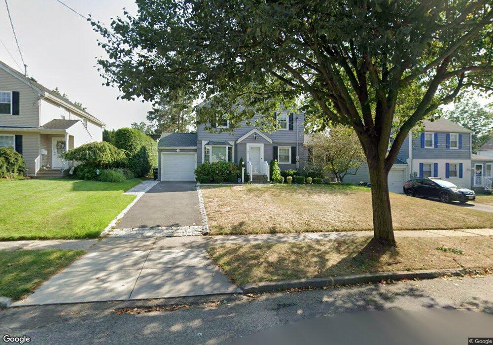
141 Manning Ave River Edge, NJ 07661
Estimated Value: $757,000 - $934,401
3
Beds
2
Baths
1,450
Sq Ft
$585/Sq Ft
Est. Value
About This Home
This home is located at 141 Manning Ave, River Edge, NJ 07661 and is currently estimated at $848,600, approximately $585 per square foot. 141 Manning Ave is a home located in Bergen County with nearby schools including Cherry Hill School, River Dell Middle School, and River Dell Regional High School.
Ownership History
Date
Name
Owned For
Owner Type
Purchase Details
Closed on
Mar 28, 2025
Sold by
Brehmer Lynne M
Bought by
Lomski Kevin and Valderrama Paola
Current Estimated Value
Home Financials for this Owner
Home Financials are based on the most recent Mortgage that was taken out on this home.
Original Mortgage
$574,240
Outstanding Balance
$569,618
Interest Rate
6.67%
Mortgage Type
New Conventional
Estimated Equity
$278,982
Purchase Details
Closed on
Sep 24, 2019
Sold by
Wilson Lawrence A and Wilson Tinti
Bought by
Brehmer Lynn M
Home Financials for this Owner
Home Financials are based on the most recent Mortgage that was taken out on this home.
Original Mortgage
$428,450
Interest Rate
3.5%
Mortgage Type
Purchase Money Mortgage
Purchase Details
Closed on
Dec 20, 1999
Sold by
Goracy Stanislaw and Goracy Alicja H
Bought by
Wilson Lawrence A and Tinti Wilson Barbara Maria
Home Financials for this Owner
Home Financials are based on the most recent Mortgage that was taken out on this home.
Original Mortgage
$223,200
Interest Rate
7.71%
Mortgage Type
Stand Alone First
Create a Home Valuation Report for This Property
The Home Valuation Report is an in-depth analysis detailing your home's value as well as a comparison with similar homes in the area
Home Values in the Area
Average Home Value in this Area
Purchase History
We collect this data history from publicly available records. To have your information removed, we recommend requesting removal directly through your county’s website.
| Date | Buyer | Sale Price | Title Company |
|---|---|---|---|
| Lomski Kevin | $717,800 | First Jersey Title | |
| Lomski Kevin | $717,800 | First Jersey Title | |
| Brehmer Lynn M | $451,000 | Westcore Title | |
| Wilson Lawrence A | $284,000 | -- |
Source: Public Records
Mortgage History
We collect this data history from publicly available records. To have your information removed, we recommend requesting removal directly through your county’s website.
| Date | Status | Borrower | Loan Amount |
|---|---|---|---|
| Open | Lomski Kevin | $574,240 | |
| Closed | Lomski Kevin | $574,240 | |
| Previous Owner | Brehmer Lynn M | $428,450 | |
| Previous Owner | Wilson Lawrence A | $223,200 |
Source: Public Records
Tax History
| Year | Tax Paid | Tax Assessment Tax Assessment Total Assessment is a certain percentage of the fair market value that is determined by local assessors to be the total taxable value of land and additions on the property. | Land | Improvement |
|---|---|---|---|---|
| 2025 | $13,893 | $574,800 | $345,000 | $229,800 |
| 2024 | $13,546 | $350,400 | $198,800 | $151,600 |
| 2023 | $12,965 | $350,400 | $198,800 | $151,600 |
| 2022 | $12,965 | $350,400 | $198,800 | $151,600 |
| 2021 | $12,709 | $350,400 | $198,800 | $151,600 |
| 2020 | $12,509 | $350,400 | $198,800 | $151,600 |
| 2019 | $12,152 | $350,400 | $198,800 | $151,600 |
| 2018 | $11,896 | $350,400 | $198,800 | $151,600 |
| 2017 | $11,780 | $350,400 | $198,800 | $151,600 |
| 2016 | $11,514 | $350,400 | $198,800 | $151,600 |
| 2015 | $11,272 | $350,400 | $198,800 | $151,600 |
| 2014 | $11,293 | $350,400 | $198,800 | $151,600 |
Source: Public Records
Map
Nearby Homes
- 172 Concord Dr
- 163 Monroe Ave
- 582 Center Ave
- 212 Monroe Ave
- 440 Bogert Rd
- 440 Kinderkamack Rd
- 276 Concord Dr
- 406 Kinderkamack Rd
- 255 Jefferson Ave
- 392 Mercer Ave
- 3 Elm Place
- 557 Monroe Ct
- 150 Howland Ave
- 678 Millbrook Rd
- 405 Valley Rd
- 12 Gainesborough Terrace Unit 1B
- 160 Lozier Terrace
- 65 Clover Ct
- 302 Howland Ave
- 293 Bogert Rd
- 143 Manning Ave
- 139 Manning Ave
- 137 Manning Ave
- 145 Manning Ave
- 140 Voorhis Ave
- 138 Voorhis Ave
- 142 Voorhis Ave
- 136 Voorhis Ave
- 135 Manning Ave
- 147 Manning Ave
- 144 Voorhis Ave
- 140 Manning Ave
- 138 Manning Ave
- 142 Manning Ave
- 134 Voorhis Ave
- 136 Manning Ave
- 144 Manning Ave
- 146 Voorhis Ave
- 149 Manning Ave
- 555 Bogert Rd
Your Personal Tour Guide
Ask me questions while you tour the home.