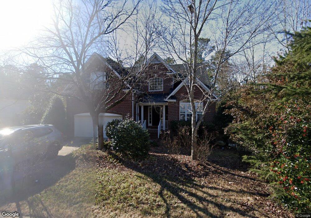
1410 Carrickfergus Ct Durham, NC 27713
South Durham NeighborhoodEstimated Value: $670,438 - $758,000
About This Home
This home is located at 1410 Carrickfergus Ct, Durham, NC 27713 and is currently estimated at $710,110, approximately $221 per square foot. 1410 Carrickfergus Ct is a home located in Durham County with nearby schools including Lowe's Grove Middle, Hillside High School, and Kestrel Heights School.
Ownership History
We collect this data history from publicly available records. To have your information removed, we recommend requesting removal directly through your county’s website.
Purchase Details
Home Financials for this Owner
Home Financials are based on the most recent Mortgage that was taken out on this home.Home Values in the Area
Average Home Value in this Area
Purchase History
We collect this data history from publicly available records. To have your information removed, we recommend requesting removal directly through your county’s website.
| Date | Buyer | Sale Price | Title Company |
|---|---|---|---|
| $310,500 | Bb&T |
Mortgage History
We collect this data history from publicly available records. To have your information removed, we recommend requesting removal directly through your county’s website.
| Date | Status | Borrower | Loan Amount |
|---|---|---|---|
| Open | $248,032 | ||
| Closed | $62,008 |
Tax History
We collect this data history from publicly available records. To have your information removed, we recommend requesting removal directly through your county’s website.
| Year | Tax Paid | Tax Assessment Tax Assessment Total Assessment is a certain percentage of the fair market value that is determined by local assessors to be the total taxable value of land and additions on the property. | Land | Improvement |
|---|---|---|---|---|
| 2025 | $5,974 | $602,665 | $147,375 | $455,290 |
| 2024 | $4,960 | $355,568 | $81,812 | $273,756 |
| 2023 | $4,658 | $355,568 | $81,812 | $273,756 |
| 2022 | $4,551 | $355,568 | $81,812 | $273,756 |
| 2021 | $4,530 | $355,568 | $81,812 | $273,756 |
| 2020 | $4,423 | $355,568 | $81,812 | $273,756 |
| 2019 | $4,423 | $355,568 | $81,812 | $273,756 |
| 2018 | $4,863 | $358,512 | $70,000 | $288,512 |
| 2017 | $4,827 | $358,512 | $70,000 | $288,512 |
| 2016 | $4,665 | $358,512 | $70,000 | $288,512 |
| 2015 | $4,662 | $336,748 | $63,200 | $273,548 |
| 2014 | $4,662 | $336,748 | $63,200 | $273,548 |
Map
- 808 Adeline Ct
- 714 Adeline Ct
- 707 Martry Rd
- 7409 Chesley Ln
- 7 Monteith Ct
- 7 Bobcat Ct
- 605 Swift Creek Crossing
- 4916 Wineberry Dr
- 4517 Grandale Dr
- 102 Settlers Mill Ln
- 6716 Somerknoll Dr
- 84 Candytuff Ln
- 7 Guilder Cove
- 6 Beaufort Ct
- 4403 Grandale Dr
- 5320 Mccormick Rd
- 115 Baccalaureate Blvd
- 933 S Bend Dr
- 6519 Caverstone Dr
- 1613 Bellenden Dr
- 1409 Carrickfergus Ct
- 1411 Carrickfergus Ct
- 1405 Carrickfergus Ct
- 1510 Bally Castle Dr
- 1403 Carrickfergus Ct
- 1504 Bally Castle Dr
- 1512 Bally Castle Dr
- 1502 Bally Castle Dr
- 1412 Carrickfergus Ct
- 1514 Bally Castle Dr
- 1415 Carrickfergus Ct
- 905 Adeline Ct
- 102 Castlebar Ln
- 907 Adeline Ct
- 806 Adeline Ct
- 810 Adeline Ct
- 723 Adeline Ct
- 902 Adeline Ct
- 804 Adeline Ct
- 1516 Bally Castle Dr
Ask me questions while you tour the home.