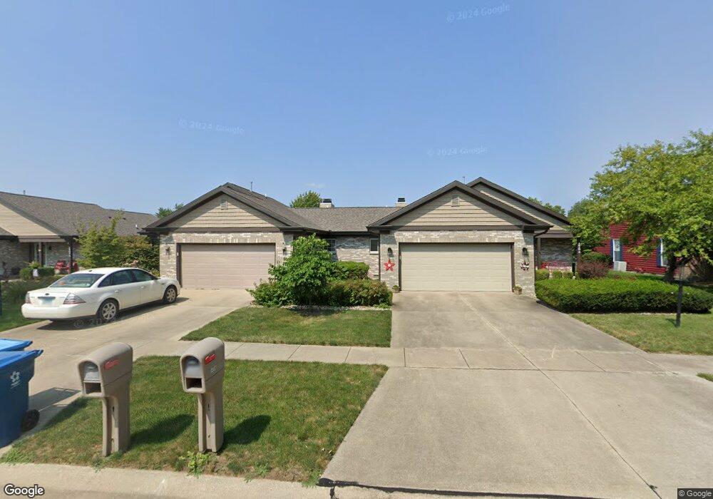
1410 Theodore Dr Unit B Champaign, IL 61821
Bolten Field NeighborhoodEstimated Value: $263,000 - $306,000
Studio
2
Baths
1,513
Sq Ft
$187/Sq Ft
Est. Value
About This Home
This home is located at 1410 Theodore Dr Unit B, Champaign, IL 61821 and is currently estimated at $283,125, approximately $187 per square foot. 1410 Theodore Dr Unit B is a home located in Champaign County with nearby schools including Central High School, Next Generation School, and Montessori Habitat School.
Ownership History
Date
Name
Owned For
Owner Type
Purchase Details
Closed on
Dec 21, 2022
Sold by
Olson Shirley
Bought by
Olson Shirley and Apperson-Skobel Katherine F
Current Estimated Value
Purchase Details
Closed on
Aug 27, 2021
Sold by
Olson Judith A
Bought by
Olson Judith A and Olson Shirley
Purchase Details
Closed on
Jun 28, 2018
Sold by
Seiler John H
Bought by
Olson Judith A
Home Financials for this Owner
Home Financials are based on the most recent Mortgage that was taken out on this home.
Original Mortgage
$106,150
Interest Rate
4.6%
Mortgage Type
New Conventional
Create a Home Valuation Report for This Property
The Home Valuation Report is an in-depth analysis detailing your home's value as well as a comparison with similar homes in the area
Home Values in the Area
Average Home Value in this Area
Purchase History
We collect this data history from publicly available records. To have your information removed, we recommend requesting removal directly through your county’s website.
| Date | Buyer | Sale Price | Title Company |
|---|---|---|---|
| Olson Shirley | -- | None Listed On Document | |
| Olson Shirley | -- | None Listed On Document | |
| Olson Shirley | -- | None Listed On Document | |
| Olson Judith A | -- | None Listed On Document | |
| Olson Judith A | -- | None Listed On Document | |
| Olson Judith A | -- | None Listed On Document | |
| Olson Judith A | $185,000 | Attorney | |
| Olson Judith A | $185,000 | Attorney | |
| Olson Judith A | $185,000 | Attorney |
Source: Public Records
Mortgage History
We collect this data history from publicly available records. To have your information removed, we recommend requesting removal directly through your county’s website.
| Date | Status | Borrower | Loan Amount |
|---|---|---|---|
| Previous Owner | Olson Judith A | $106,150 |
Source: Public Records
Tax History
| Year | Tax Paid | Tax Assessment Tax Assessment Total Assessment is a certain percentage of the fair market value that is determined by local assessors to be the total taxable value of land and additions on the property. | Land | Improvement |
|---|---|---|---|---|
| 2025 | $6,308 | $87,900 | $22,890 | $65,010 |
| 2024 | $6,434 | $78,340 | $20,400 | $57,940 |
| 2023 | $6,434 | $71,350 | $18,580 | $52,770 |
| 2022 | $6,053 | $65,820 | $17,140 | $48,680 |
| 2021 | $5,358 | $64,530 | $16,800 | $47,730 |
| 2020 | $4,563 | $62,040 | $16,150 | $45,890 |
| 2019 | $4,962 | $60,770 | $15,820 | $44,950 |
| 2018 | $4,392 | $59,810 | $15,570 | $44,240 |
| 2017 | $4,203 | $57,510 | $14,970 | $42,540 |
| 2016 | $3,749 | $56,320 | $14,660 | $41,660 |
| 2015 | $3,761 | $55,320 | $14,400 | $40,920 |
| 2014 | $3,728 | $55,320 | $14,400 | $40,920 |
| 2013 | $3,695 | $55,320 | $14,400 | $40,920 |
Source: Public Records
Map
Nearby Homes
- 1502 Theodore Dr Unit B
- 1506 Sandpiper Ln
- 1613 Broadmoor Dr Unit 1613
- 2159 Harbortown Cir Unit 2159
- 2144 Harbortown Cir Unit 2144
- 2108 Sunview Dr
- 2001 S Mattis Ave Unit E
- 1809 Augusta Dr
- 2111 Sunview Dr
- 1205 Broadmoor Dr
- 1910 Augusta Dr
- 2014 Blackthorn Dr Unit 13
- 2207 O Donnell Dr
- 1816 Southwood Dr
- 1937 Blackthorn Dr Unit 43
- 2208 O Donnell Dr
- 1705 Salem Rd
- 1911 Branch Rd
- 2007 Branch Rd
- 1423 Rose Dr
- 1502 Theodore Dr Unit A
- 1502B Theodore Dr
- 1410 Theodore Dr
- 1410 Theodore Dr Unit B
- 1410 Theodore Dr
- 1410 Theodore Dr Unit A
- 1411 Weathervane Dr Unit A
- 1411 Weathervane Dr Unit B
- 1409 Weathervane Dr Unit A
- 1409 Weathervane Dr Unit B
- 1504 Theodore Dr Unit A
- 1504 Theodore Dr Unit B
- 1413 Weathervane Dr Unit B
- 1413 Weathervane Dr Unit A
- 1413 Weathervane Dr
- 1411 Theodore Dr Unit B
- 1411 Theodore Dr Unit A
- 1408 Theodore Dr
- 1501 Theodore Dr Unit A
- 1501 Theodore Dr Unit B
Your Personal Tour Guide
Ask me questions while you tour the home.