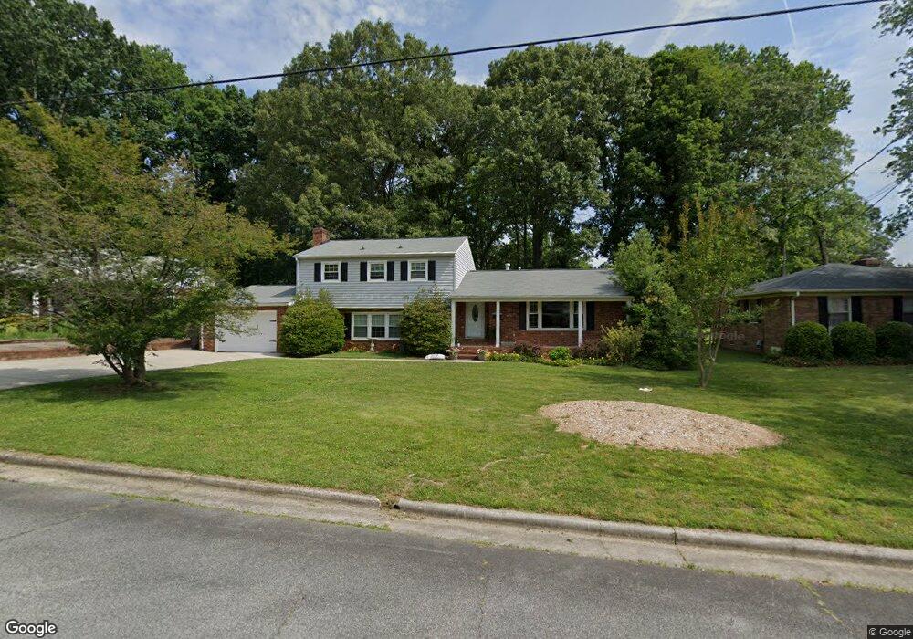
1411 Grantham Dr High Point, NC 27265
Oak View NeighborhoodEstimated Value: $266,000 - $356,000
4
Beds
3
Baths
2,556
Sq Ft
$118/Sq Ft
Est. Value
About This Home
This home is located at 1411 Grantham Dr, High Point, NC 27265 and is currently estimated at $301,407, approximately $117 per square foot. 1411 Grantham Dr is a home located in Guilford County with nearby schools including Montlieu Academy of Technology, Welborn Academy of Science & Technology, and T.W. Andrews High School.
Ownership History
Date
Name
Owned For
Owner Type
Purchase Details
Closed on
Nov 29, 2001
Sold by
Johnston William C and Johnston Myrline H
Bought by
Vierling Carl W and Vierling Lisa B
Current Estimated Value
Home Financials for this Owner
Home Financials are based on the most recent Mortgage that was taken out on this home.
Original Mortgage
$135,375
Outstanding Balance
$52,977
Interest Rate
6.59%
Estimated Equity
$248,430
Create a Home Valuation Report for This Property
The Home Valuation Report is an in-depth analysis detailing your home's value as well as a comparison with similar homes in the area
Home Values in the Area
Average Home Value in this Area
Purchase History
| Date | Buyer | Sale Price | Title Company |
|---|---|---|---|
| Vierling Carl W | $142,500 | -- |
Source: Public Records
Mortgage History
| Date | Status | Borrower | Loan Amount |
|---|---|---|---|
| Open | Vierling Carl W | $135,375 |
Source: Public Records
Tax History
| Year | Tax Paid | Tax Assessment Tax Assessment Total Assessment is a certain percentage of the fair market value that is determined by local assessors to be the total taxable value of land and additions on the property. | Land | Improvement |
|---|---|---|---|---|
| 2025 | $2,562 | $185,900 | $35,000 | $150,900 |
| 2024 | $2,562 | $185,900 | $35,000 | $150,900 |
| 2023 | $2,562 | $185,900 | $35,000 | $150,900 |
| 2022 | $2,506 | $185,900 | $35,000 | $150,900 |
| 2021 | $1,977 | $143,500 | $25,000 | $118,500 |
| 2020 | $1,977 | $143,500 | $25,000 | $118,500 |
| 2019 | $1,977 | $143,500 | $0 | $0 |
| 2018 | $1,968 | $143,500 | $0 | $0 |
| 2017 | $1,977 | $143,500 | $0 | $0 |
| 2016 | $1,885 | $134,400 | $0 | $0 |
| 2015 | $1,895 | $134,400 | $0 | $0 |
| 2014 | $1,927 | $134,400 | $0 | $0 |
Source: Public Records
Map
Nearby Homes
- 1526 Ann Arbor Ct
- 1808 Guyer St
- 1818 Guyer St Unit C
- 1604 E Lexington Ave
- 2005 Carlisle Way
- 1110 Forrest St
- 1108 Forrest St
- 1519 Mcguinn Dr
- 1415 Wiltshire St
- 1509 & 1511 Wiltshire St
- 1717 Carolina St
- 1719 Carolina St
- 1445 Bailey Cir
- 613 Woodridge Ln
- 1907 Boulding Ave
- 801 E Lexington Ave
- 2507 Suffolk Ave
- 1120 Carolina St
- 420 Chester Woods Ct
- 916 Forrest St
- 1409 Grantham Dr
- 1415 Grantham Dr
- 1542 Ann Arbor Ct
- 1544 Ann Arbor Ct
- 1417 Grantham Dr
- 1407 Grantham Dr
- 1540 Ann Arbor Ct
- 1414 Grantham Dr
- 1412 Grantham Dr
- 1546 Ann Arbor Ct
- 1416 Grantham Dr
- 1538 Ann Arbor Ct
- 1408 Grantham Dr
- 1419 Grantham Dr
- 1418 Grantham Dr
- 1403 Grantham Dr
- 1548 Ann Arbor Ct
- 1406 Grantham Dr
- 1536 Ann Arbor Ct
- 1420 Grantham Dr
Your Personal Tour Guide
Ask me questions while you tour the home.