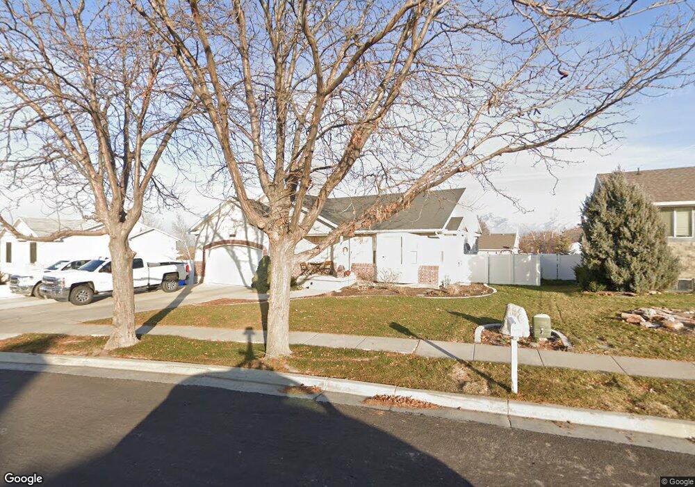
14111 Ensign Peak Cir Riverton, UT 84096
Estimated Value: $542,000 - $613,915
About This Home
This home is located at 14111 Ensign Peak Cir, Riverton, UT 84096 and is currently estimated at $583,229, approximately $205 per square foot. 14111 Ensign Peak Cir is a home located in Salt Lake County with nearby schools including Foothills School, South Hills Middle School, and Mountain Ridge High School.
Ownership History
We collect this data history from publicly available records. To have your information removed, we recommend requesting removal directly through your county’s website.
Purchase Details
Home Financials for this Owner
Home Financials are based on the most recent Mortgage that was taken out on this home.Purchase Details
Home Financials for this Owner
Home Financials are based on the most recent Mortgage that was taken out on this home.Purchase Details
Purchase Details
Purchase Details
Purchase Details
Home Financials for this Owner
Home Financials are based on the most recent Mortgage that was taken out on this home.Home Values in the Area
Average Home Value in this Area
Purchase History
We collect this data history from publicly available records. To have your information removed, we recommend requesting removal directly through your county’s website.
| Date | Buyer | Sale Price | Title Company |
|---|---|---|---|
| -- | Steed Title Insurance Agency | ||
| -- | Backman Title Services | ||
| -- | Founders Title | ||
| -- | 1St Natl Title Ins Agency | ||
| $175,613 | -- | ||
| -- | Merrill Title |
Mortgage History
We collect this data history from publicly available records. To have your information removed, we recommend requesting removal directly through your county’s website.
| Date | Status | Borrower | Loan Amount |
|---|---|---|---|
| Open | $236,500 | ||
| Closed | $246,762 | ||
| Previous Owner | $135,000 | ||
| Closed | $11,725 |
Tax History
We collect this data history from publicly available records. To have your information removed, we recommend requesting removal directly through your county’s website.
| Year | Tax Paid | Tax Assessment Tax Assessment Total Assessment is a certain percentage of the fair market value that is determined by local assessors to be the total taxable value of land and additions on the property. | Land | Improvement |
|---|---|---|---|---|
| 2025 | $3,277 | $592,800 | $209,900 | $382,900 |
| 2024 | $3,028 | $524,100 | $192,800 | $331,300 |
| 2023 | $3,200 | $522,100 | $178,500 | $343,600 |
| 2022 | $3,299 | $528,100 | $175,000 | $353,100 |
| 2021 | $2,736 | $389,900 | $135,000 | $254,900 |
| 2020 | $2,670 | $354,800 | $105,000 | $249,800 |
| 2019 | $2,655 | $346,800 | $100,000 | $246,800 |
| 2018 | $2,537 | $326,300 | $92,400 | $233,900 |
| 2017 | $2,415 | $302,700 | $92,400 | $210,300 |
| 2016 | $2,302 | $276,900 | $92,400 | $184,500 |
| 2015 | $2,207 | $257,300 | $92,400 | $164,900 |
| 2014 | -- | $242,400 | $88,100 | $154,300 |
Map
- 5179 W Shaggy Peak Dr
- 14038 S van Cott Peak Cir
- 5244 W Shaggy Peak Dr
- 4977 W Cave Peak Dr
- 14137 Ben Lomond Peak Dr
- 13951 S Haystack Peak Cir
- 5106 W Amber Rose Ln
- 5036 W Cedar Point Peak Dr
- 5071 W Amber Rose Ln
- 4886 Boulder Meadow Dr
- 5184 W Windom Rd
- 5194 W Windom Rd
- 13981 Barneys Peak Cir
- 14443 S Chrome Rd
- 5212 W Courtly Ln
- 14464 S Chrome Rd
- 4927 W Yellow Topaz Dr
- 14503 S Ryegate Dr
- 5203 W Courtly Ln
- 5209 W Courtly Ln
- 14111 S Ensign Peak Cir
- 14121 Ensign Peak Cir
- 14121 Ensign Peak Cir Unit 242
- 14097 S Lowe Peak Dr
- 14112 Elk Horn Peak Dr
- 14112 S Elk Horn Peak Dr
- 14124 Elk Horn Peak Dr
- 14124 S Elk Horn Peak Dr
- 14098 Elk Horn Peak Dr
- 14098 S Elk Horn Peak Dr
- 14122 S Ensign Peak Cir
- 14089 Lowe Peak Dr
- 14089 S Lowe Peak Dr
- 14133 Ensign Peak Cir
- 14136 Elk Horn Peak Dr
- 14092 Elk Horn Peak Dr
- 5162 W Lowe Peak Dr
- 5162 Lowe Peak Dr
- 14143 Ensign Peak Cir
- 14077 S Lowe Peak Dr
Ask me questions while you tour the home.