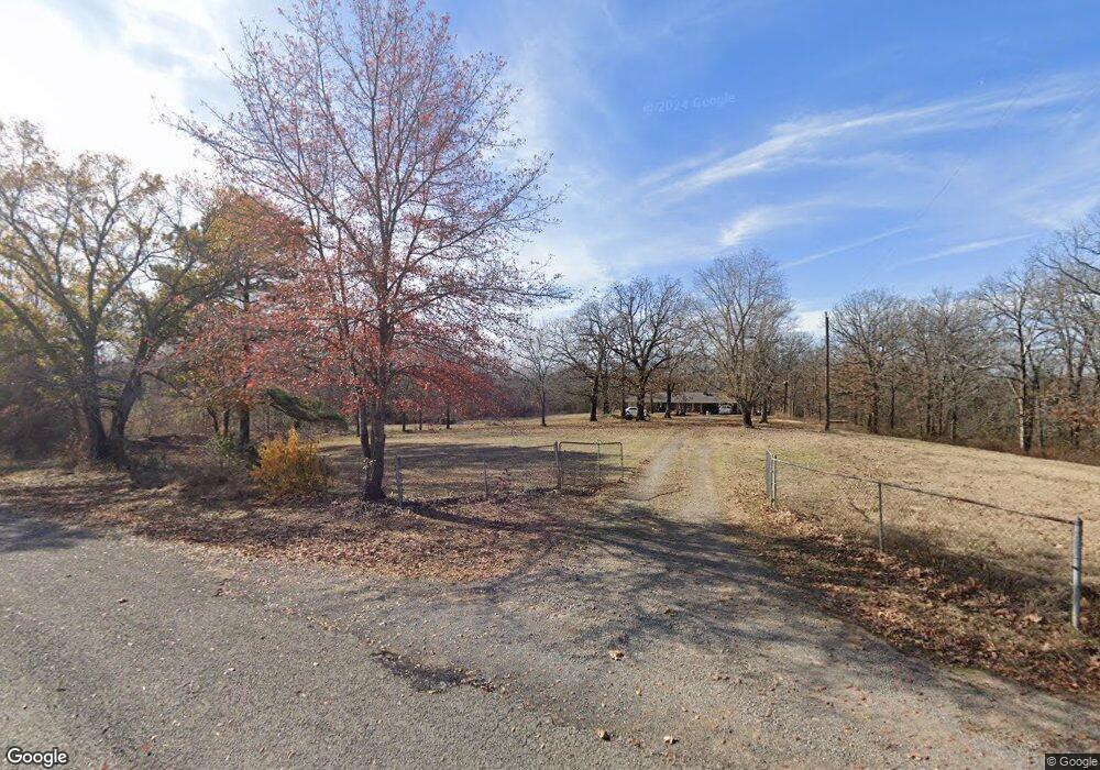
14132 Edwards Loop Cameron, OK 74932
Estimated Value: $209,000 - $339,000
3
Beds
2
Baths
1,536
Sq Ft
$181/Sq Ft
Est. Value
About This Home
This home is located at 14132 Edwards Loop, Cameron, OK 74932 and is currently estimated at $278,484, approximately $181 per square foot. 14132 Edwards Loop is a home located in Le Flore County with nearby schools including Cameron Elementary School and Cameron High School.
Ownership History
Date
Name
Owned For
Owner Type
Purchase Details
Closed on
Apr 1, 2025
Sold by
Robertson Christa and Robertson John
Bought by
Wise-Bibee Stephanie Delane
Current Estimated Value
Purchase Details
Closed on
Feb 7, 2025
Sold by
Robertson Christa and Robertson John Darrell
Bought by
Mcclary Bryson Blade and Mcclary Chloe Brook
Purchase Details
Closed on
Oct 2, 2024
Sold by
Robertson Christa and Robertson John
Bought by
Tarkington Thomas E
Create a Home Valuation Report for This Property
The Home Valuation Report is an in-depth analysis detailing your home's value as well as a comparison with similar homes in the area
Purchase History
| Date | Buyer | Sale Price | Title Company |
|---|---|---|---|
| Wise-Bibee Stephanie Delane | $18,000 | Adams Abstract | |
| Wise-Bibee Stephanie Delane | $18,000 | Adams Abstract | |
| Mcclary Bryson Blade | $63,000 | Old Republic National Title | |
| Mcclary Bryson Blade | $63,000 | Old Republic National Title | |
| Tarkington Thomas E | $18,000 | Old Republic National Title In |
Source: Public Records
Tax History
| Year | Tax Paid | Tax Assessment Tax Assessment Total Assessment is a certain percentage of the fair market value that is determined by local assessors to be the total taxable value of land and additions on the property. | Land | Improvement |
|---|---|---|---|---|
| 2025 | $796 | $10,146 | $2,654 | $7,492 |
| 2024 | $774 | $9,859 | $2,579 | $7,280 |
| 2023 | $774 | $9,871 | $2,591 | $7,280 |
| 2022 | $658 | $8,382 | $2,200 | $6,182 |
| 2021 | $560 | $8,137 | $2,136 | $6,001 |
| 2020 | $542 | $7,901 | $2,074 | $5,827 |
| 2019 | $524 | $7,670 | $1,904 | $5,766 |
| 2018 | $506 | $7,447 | $1,888 | $5,559 |
| 2017 | $489 | $7,230 | $1,773 | $5,457 |
| 2016 | $473 | $7,020 | $1,694 | $5,326 |
| 2015 | $458 | $6,815 | $1,778 | $5,037 |
| 2014 | $444 | $6,616 | $1,700 | $4,916 |
Source: Public Records
Map
Nearby Homes
- 14630 Edwards Loop
- 24506 Green Rd
- 107 Briarwood
- 3204 W George Ave
- 1205 W George Ave
- 1005 W George Ave
- 103 E George Ave
- 205 E George Ave
- 23694 Old Highway 112
- 26354 Ross Rd
- TBD Oklahoma 112
- Tract 6 Knot Hole Rd
- 300 Park Ln
- 305 Martindale Ln
- 16729 Quays Rd
- 11238 Liberty Hill Rd
- 602 Martindale Ln
- 15965 Mckeown Rd
- 106 Cowan Ln
- Tract 17 and 18 Poker Bend Rd
- 14283 Edwards Loop
- 14283 Edwards Loop
- 14137 Edwards Loop
- 23132 Old Highway 112
- 10594 Rock Island Rd
- 14513 Edwards Loop
- 14512 Edwards Loop
- 23896 State Highway 112
- 23507 Old Highway 112
- 23507 Old Highway 112
- 23736 Oklahoma 112
- 23123 Oklahoma 112
- 23602 State Highway 112
- 14655 Edwards Loop
- 23513 Old Highway 112
- 14728 Edwards Loop
- 23623 Old Highway 112
- 14812 Edwards Loop
- 14809 Edwards Loop
- 13397 Morris Loop
Your Personal Tour Guide
Ask me questions while you tour the home.