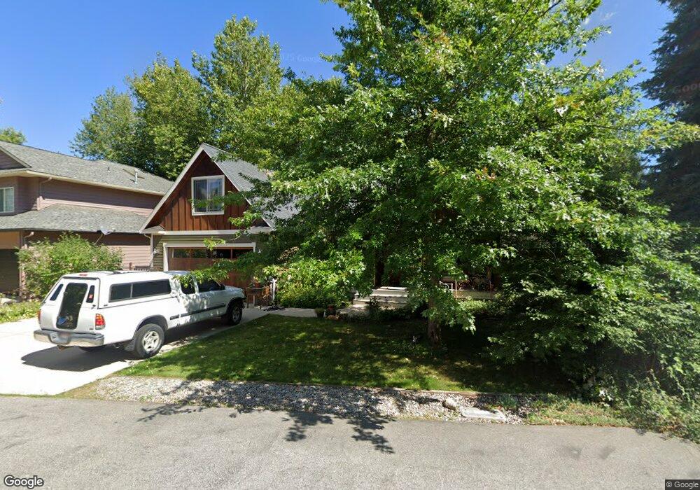
1415 Mathison Dr Sandpoint, ID 83864
Estimated Value: $784,747 - $1,060,000
About This Home
This home is located at 1415 Mathison Dr, Sandpoint, ID 83864 and is currently estimated at $890,937, approximately $343 per square foot. 1415 Mathison Dr is a home located in Bonner County with nearby schools including Washington Elementary School, Sandpoint Middle School, and Sandpoint High School.
Ownership History
We collect this data history from publicly available records. To have your information removed, we recommend requesting removal directly through your county’s website.
Purchase Details
Purchase Details
Home Financials for this Owner
Home Financials are based on the most recent Mortgage that was taken out on this home.Home Values in the Area
Average Home Value in this Area
Purchase History
We collect this data history from publicly available records. To have your information removed, we recommend requesting removal directly through your county’s website.
| Date | Buyer | Sale Price | Title Company |
|---|---|---|---|
| $318,000 | None Available | ||
| -- | -- |
Mortgage History
We collect this data history from publicly available records. To have your information removed, we recommend requesting removal directly through your county’s website.
| Date | Status | Borrower | Loan Amount |
|---|---|---|---|
| Previous Owner | $344,000 |
Tax History
We collect this data history from publicly available records. To have your information removed, we recommend requesting removal directly through your county’s website.
| Year | Tax Paid | Tax Assessment Tax Assessment Total Assessment is a certain percentage of the fair market value that is determined by local assessors to be the total taxable value of land and additions on the property. | Land | Improvement |
|---|---|---|---|---|
| 2025 | $3,584 | $735,159 | $298,339 | $436,820 |
| 2023 | $3,703 | $814,130 | $327,151 | $486,979 |
| 2022 | $4,887 | $794,512 | $351,996 | $442,516 |
| 2021 | $3,822 | $472,594 | $168,490 | $304,104 |
| 2020 | $3,585 | $432,010 | $132,281 | $299,729 |
| 2019 | $3,316 | $399,233 | $112,416 | $286,817 |
| 2018 | $3,240 | $367,615 | $112,416 | $255,199 |
| 2017 | $3,208 | $346,431 | $0 | $0 |
| 2016 | $2,630 | $286,375 | $0 | $0 |
| 2015 | $2,713 | $286,375 | $0 | $0 |
| 2014 | $2,670 | $280,217 | $0 | $0 |
Map
- 1407 Mathison Dr
- 1320 Mathison Dr
- 1309 Metaline Ln
- 1710 Westwood Dr
- 1309 Westwood Ln
- 207 Madera Dr
- 140 Madera Dr
- 212 Canoe Cove
- 1406 J r Ct
- 502 S Lincoln Ave
- 1104 Birch St
- 606 S Ella Ave
- 424 S Olive Ave Unit 302
- 424 S Olive Ave
- 424 S Olive Ave Unit 304
- 424 S Olive Ave Unit 101
- 123 Hanson Ct
- 290 Syringa Heights Rd
- 266 Syringa Heights Rd
- 403 S Olive Ave
- 1419 Mathison Dr
- 1401 Mathison Dr
- 1408 Mathison Dr
- 1418 Mathison Dr
- 1423 Mathison Dr
- 1319 Mathison Dr
- 2006 Carmen Ct
- 2001 Heather Ct
- 1510 Westwood Dr
- 1512 Westwood Dr
- 2005 Carmen Ct
- 1506 Westwood Dr
- 1504 Westwood Dr
- 1516 Westwood Dr
- 2015 Heather Ct
- 1602 Westwood Dr
- 1502 Mathison Dr
- 1315 Mathison Dr
- 1314 Mathison Dr
- 1314 Mathison Dr Unit Westwood area
Ask me questions while you tour the home.