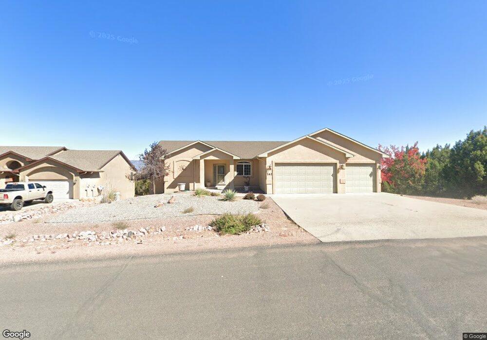
142 Eagle Crest Loop Canon City, CO 81212
Estimated Value: $558,930 - $683,000
3
Beds
3
Baths
3,864
Sq Ft
$163/Sq Ft
Est. Value
About This Home
This home is located at 142 Eagle Crest Loop, Canon City, CO 81212 and is currently estimated at $627,983, approximately $162 per square foot. 142 Eagle Crest Loop is a home with nearby schools including Lincoln School of Science & Technology, Canon City Middle School, and Canon City High School.
Create a Home Valuation Report for This Property
The Home Valuation Report is an in-depth analysis detailing your home's value as well as a comparison with similar homes in the area
Tax History
| Year | Tax Paid | Tax Assessment Tax Assessment Total Assessment is a certain percentage of the fair market value that is determined by local assessors to be the total taxable value of land and additions on the property. | Land | Improvement |
|---|---|---|---|---|
| 2025 | $2,051 | $29,769 | -- | -- |
| 2024 | $2,051 | $30,596 | $0 | $0 |
| 2023 | $1,770 | $26,576 | $0 | $0 |
| 2022 | $2,319 | $26,567 | $0 | $0 |
| 2021 | $2,325 | $27,331 | $0 | $0 |
| 2020 | $1,930 | $22,841 | $0 | $0 |
| 2019 | $1,906 | $22,841 | $0 | $0 |
| 2018 | $1,790 | $20,924 | $0 | $0 |
| 2017 | $1,542 | $20,924 | $0 | $0 |
| 2016 | $1,613 | $21,890 | $0 | $0 |
| 2015 | $1,610 | $21,890 | $0 | $0 |
| 2012 | $1,501 | $21,554 | $3,980 | $17,574 |
Source: Public Records
Map
Nearby Homes
- 68 Wild Rose Ct
- 156 S Osprey Ct
- 156 Osprey Ct
- 124 Eagle Crest Loop
- 140 N Osprey Ct
- 46 Fox Run Ct
- 304 Storm Ridge Dr
- 137 Wild Rose Dr
- 135 Wild Rose Dr
- 131 Wild Rose Dr
- 123 Wild Rose Dr
- 129 Mourning Dove Dr
- 333 Storm Ridge Dr
- 24 Pike View Dr
- 486 Greenhorn Dr
- 133 Blue Grouse Dr
- 507 Greenhorn Dr
- 29 Kyndra Ct
- TBD Wild Rose Dr
- 212 Wolf Cub Trail
- 139 Eagle Crest Loop
- 144 Eagle Crest Loop
- 65 Wild Rose Ct Unit 73
- 65 Wild Rose Ct
- 149 Eagle Crest Loop
- 85 Eagle Crest Loop
- 77 Eagle Crest Loop
- 59 Eagle Crest Loop
- 70 Eagle Crest Loop
- 99 Eagle Crest Loop
- 55 Eagle Crest Loop
- 842 Eagle Crest Loop
- 62 Eagle Crest Loop
- 62 Eagle Crest Loop Unit 810
- 0 Eagle Crest Loop
- 72 Wild Rose Ct Unit 71
- 72 Wild Rose Ct
- 135 Eagle Crest Loop
- 57 Tanner Pkwy
- 63 Wild Rose Ct
Your Personal Tour Guide
Ask me questions while you tour the home.