Estimated Value: $196,000 - $248,000
3
Beds
3
Baths
1,425
Sq Ft
$150/Sq Ft
Est. Value
About This Home
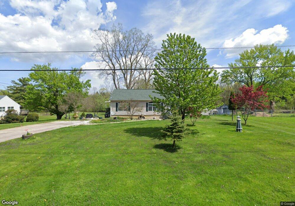
This home is located at 1425 Maxwell St, Flint, MI 48532 and is currently estimated at $213,852, approximately $150 per square foot. 1425 Maxwell St is a home located in Genesee County with nearby schools including Carman-Ainsworth High School, Genesee STEM Academy, and St. Paul Lutheran School.
Ownership History
Date
Name
Owned For
Owner Type
Purchase Details
Closed on
Aug 12, 2005
Sold by
Anderson Joel F
Bought by
Anderson Joel F and Brown Larry K
Current Estimated Value
Purchase Details
Closed on
May 6, 2004
Sold by
Brown Larry K
Bought by
Anderson Joel F
Home Financials for this Owner
Home Financials are based on the most recent Mortgage that was taken out on this home.
Original Mortgage
$144,500
Outstanding Balance
$61,752
Interest Rate
4.25%
Mortgage Type
Purchase Money Mortgage
Estimated Equity
$152,100
Purchase Details
Closed on
Dec 9, 2002
Sold by
Dorff Rodney Owen
Bought by
Rickman Darrell and Rickman Alysa
Purchase Details
Closed on
May 20, 2002
Sold by
Clark Christine R
Bought by
Anderson Joel F and Brown Larry K
Create a Home Valuation Report for This Property
The Home Valuation Report is an in-depth analysis detailing your home's value as well as a comparison with similar homes in the area
Home Values in the Area
Average Home Value in this Area
Purchase History
| Date | Buyer | Sale Price | Title Company |
|---|---|---|---|
| Anderson Joel F | -- | -- | |
| Anderson Joel F | -- | Metropolitan Title Company | |
| Rickman Darrell | $233,000 | Cislo Title Company | |
| Anderson Joel F | $20,000 | Cislo Title Company |
Source: Public Records
Mortgage History
| Date | Status | Borrower | Loan Amount |
|---|---|---|---|
| Open | Anderson Joel F | $144,500 |
Source: Public Records
Tax History
| Year | Tax Paid | Tax Assessment Tax Assessment Total Assessment is a certain percentage of the fair market value that is determined by local assessors to be the total taxable value of land and additions on the property. | Land | Improvement |
|---|---|---|---|---|
| 2025 | $2,160 | $96,700 | $0 | $0 |
| 2024 | $1,126 | $97,400 | $0 | $0 |
| 2023 | $1,074 | $78,100 | $0 | $0 |
| 2022 | $942 | $71,300 | $0 | $0 |
| 2021 | $1,912 | $67,900 | $0 | $0 |
| 2020 | $965 | $61,900 | $0 | $0 |
| 2019 | $951 | $53,400 | $0 | $0 |
| 2018 | $1,763 | $46,200 | $0 | $0 |
| 2017 | $1,711 | $46,200 | $0 | $0 |
| 2016 | $1,750 | $41,700 | $0 | $0 |
| 2015 | $1,598 | $41,600 | $0 | $0 |
| 2014 | $948 | $40,000 | $0 | $0 |
| 2012 | -- | $40,500 | $40,500 | $0 |
Source: Public Records
Map
Nearby Homes
- 1512 Crescent Lane Dr Lot#46
- 4199 Sheraton Dr
- 0 Charter Dr Unit 50153638
- 4474 Corunna Rd
- 4480 Corunna Rd
- 10 Acres T A Mansour Blvd
- 3.9 Acres W Court St
- 18.41 Taft Rd
- 4051 Red Wing Dr
- 2 Charter Dr
- 5037 W Court St
- 1184 Normandy Terrace Dr
- 1455 S Linden Rd
- 1034 Normandy Terrace Dr
- 000 Devenish Ln
- 1260 Gilbert St
- 2442 Valley Oaks Cir Unit 35
- 2525 White Oak Place Unit 3
- 5151 Brobeck St
- 2379 Hialeah Dr
- 1441 Maxwell St
- 1415 Maxwell St
- 1397 Maxwell St
- 1455 Maxwell St
- 1512 Ward Dr
- 4293 W Court St
- 4261 W Court St
- 4303 W Court St
- 4317 W Court St
- 1416 Maxwell St
- 1434 Maxwell St
- 4050-4233 W Court St
- 4381 W Court St
- 4403 Lenrose Ave
- 1374 Benard St
- 4411 Lenrose Ave
- 4208 Corunna Rd
- 1322 Krsul Dr
- 4185 W Court St
- 1423 Conway St
Your Personal Tour Guide
Ask me questions while you tour the home.